Refahiye
| Refahiye | |
|---|---|
 Refahiye | |
| Coordinates: 39°54′04″N 38°46′07″E / 39.90111°N 38.76861°ECoordinates: 39°54′04″N 38°46′07″E / 39.90111°N 38.76861°E | |
| Country | Turkey |
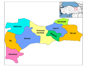
| Province | Erzincan |
| Government | |
| • Mayor | Cevdet Çınar (MHP) |
| • Kaymakam | Yusuf Karaloğlu |
| Area[1] | |
| • District | 1,681.98 km2 (649.42 sq mi) |
| Elevation | 1,589 m (5,213 ft) |
| Population (2012)[2] | |
| • Urban | 3,980 |
| • District | 10,504 |
| • District density | 6.2/km2 (16/sq mi) |
| Post code | 2553x |
| Website |
www |
Refahiye (Kurdish: Gercan, Armenian: Կերճանիս, Gerjanis) is a town and district of Erzincan Province in the Eastern Anatolia region of Turkey. It covers an area of 1,744 km², and the elevation is 1,589 m. The district has a total population of 10,569 where 3730 live in the town of Refahiye. The mayor is Cevdet Çınar (MHP).
It is on the Asian highway network. The province is known for its forests and mountains called Dumanlı Mountains. There are a lot of local honey producers in the villages in Refahiye. It was greatly affected by the earthquake of 1939, and much of its infrastructure had to be rebuilt from scratch.
References
- ↑ "Area of regions (including lakes), km²". Regional Statistics Database. Turkish Statistical Institute. 2002. Retrieved 2013-03-05.
- ↑ "Population of province/district centers and towns/villages by districts - 2012". Address Based Population Registration System (ABPRS) Database. Turkish Statistical Institute. Retrieved 2013-02-27.
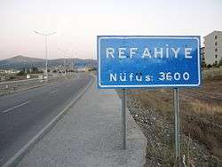
A view from the entrance of Refahiye.
External links
- Şahverdi, a beautiful village of Refahiye
- Information related to Şahverdi Köyü in Turkish
- District governor's official website (Turkish)
- District municipality's official website (Turkish)
This article is issued from Wikipedia - version of the 10/8/2016. The text is available under the Creative Commons Attribution/Share Alike but additional terms may apply for the media files.