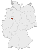
Ravensberg Basin
| Location | |
|---|---|
 | |
| Basic data | |
| Federal state: | North Rhine-Westphalia and Lower Saxony |
| Natural regions: | Central Uplands Lower Saxon Hills Lower Weser Uplands |
| Highest hills: | 256 m above sea level (NN): Steinegge 165 m above sea level (NN): Schweichler Berg |
| Lowest point: | 41 m above sea level (NN) (northern Weser valley) |
| Map | |
 | |
The Ravensberg Basin (German: Ravensberger Mulde) or Ravensberg Hills (Ravensberger Hügelland) is a natural region in the governorate of Detmold (Ostwestfalen-Lippe) in the northeastern part of the German state of North Rhine-Westphalia; small elements also fall within the neighbouring state of Lower Saxony. It is part of the lower Weser Uplands and includes the hilly basin country between the Wiehen Hills in the north, Lippe Uplands in the east, Teutoburg Forest in the south and Osnabrück Hills in the west. The heart of the Ravensberg Basin is almost coincident with the cultural region of the Ravensberg Land.
Sources
- Adolf Schüttler: Das Ravensberger Land. Aschendorff, Münster 1986.
- Emil Meynen (Hrsg.): Handbuch der naturräumlichen Gliederung Deutschlands. Selbstverlag der Bundesanstalt für Landeskunde, Remagen 1959-1962 (Teil 2, enthält Lieferung 6-9), ISBN B0000BJ19F
External links
- BfN landscape fact file, sparsely-settled outer areas of the Ravensberg Basin
- BfN landscape fact file, densely populated core (here with Bad Salzuflen)
- Ecological characteristics
See also
- County of Ravensberg
- Ravensberg Land
- Ravensberg Castle
- Minden-Ravensberg (old administrative unit)
Coordinates: 52°7′N 8°40′E / 52.117°N 8.667°E
This article is issued from Wikipedia - version of the 7/16/2016. The text is available under the Creative Commons Attribution/Share Alike but additional terms may apply for the media files.