Ravenel, South Carolina
| Ravenel, South Carolina | |
|---|---|
| Town | |
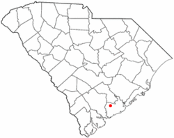 Location of Ravenel in South Carolina | |
| Coordinates: 32°45′52″N 80°14′24″W / 32.76444°N 80.24000°WCoordinates: 32°45′52″N 80°14′24″W / 32.76444°N 80.24000°W | |
| Country | United States |
| State | South Carolina |
| County | Charleston |
| Government | |
| • Mayor | Opal N. Baldwin |
| Area | |
| • Total | 12.6 sq mi (32.7 km2) |
| • Land | 12.6 sq mi (32.7 km2) |
| • Water | 0.0 sq mi (0.0 km2) |
| Elevation | 38 ft (12 m) |
| Population (2010) | |
| • Total | 2,465 |
| • Density | 195/sq mi (75.3/km2) |
| Time zone | EST (UTC-5) |
| • Summer (DST) | EDT (UTC-4) |
| ZIP code | 29470 |
| Area code(s) | 843 |
| FIPS code | 45-59020[1] |
| GNIS feature ID | 1225766[2] |
| Website |
www |
Ravenel is a town in Charleston County, South Carolina, United States. The population was 2,465 at the 2010 census.[3] Ravenel is part of the Charleston-North Charleston-Summerville metropolitan area.
Geography
Ravenel is located in western Charleston County at 32°46′41″N 80°13′16″W / 32.77806°N 80.22111°W (32.777930, -80.221112).[4] It is bordered to the south by the town of Hollywood. U.S. Route 17 passes through the town, leading 20 miles (32 km) east to Charleston and 13 miles (21 km) west to Jacksonboro.
According to the United States Census Bureau, Ravenel has a total area of 12.6 square miles (32.7 km2), all of it land.[3]
Demographics
| Historical population | |||
|---|---|---|---|
| Census | Pop. | %± | |
| 1950 | 337 | — | |
| 1960 | 527 | 56.4% | |
| 1970 | 931 | 76.7% | |
| 1980 | 1,655 | 77.8% | |
| 1990 | 2,165 | 30.8% | |
| 2000 | 2,214 | 2.3% | |
| 2010 | 2,465 | 11.3% | |
| Est. 2015 | 2,600 | [5] | 5.5% |
As of the census[1] of 2000, there were 2,214 people, 799 households, and 581 families residing in the town. The population density was 179.5 people per square mile (69.3/km²). There were 863 housing units at an average density of 70.0 per square mile (27.0/km²). The racial makeup of the town was 47.88% White, 49.95% African American, 0.05% Native American, 0.41% Asian, 1.13% from other races, and 0.59% from two or more races. Hispanic or Latino of any race were 2.66% of the population.
There were 799 households out of which 36.2% had children under the age of 18 living with them, 49.3% were married couples living together, 19.1% had a female householder with no husband present, and 27.2% were non-families. 21.0% of all households were made up of individuals and 7.3% had someone living alone who was 65 years of age or older. The average household size was 2.76 and the average family size was 3.25.
In the town the population was spread out with 30.4% under the age of 18, 7.4% from 18 to 24, 28.5% from 25 to 44, 24.4% from 45 to 64, and 9.3% who were 65 years of age or older. The median age was 35 years. For every 100 females there were 92.4 males. For every 100 females age 18 and over, there were 87.7 males.
The median income for a household in the town was $33,021, and the median income for a family was $36,477. Males had a median income of $33,009 versus $21,306 for females. The per capita income for the town was $15,495. About 15.9% of families and 18.3% of the population were below the poverty line, including 25.8% of those under age 18 and 11.9% of those age 65 or over.
Government
The city is run by an elected mayor–council government system.
Mayor
Opal N. Baldwin
Council members
Robert L. Cochran, Laura Parker, Curtis Inabinett, Jr., Annie Brown, Harold T. "Buck" Dukes, Jr., Wendell M. Maxwell
Climate
| Climate data for Ravenel, South Carolina (Airport), 1981–2010 normals | |||||||||||||
|---|---|---|---|---|---|---|---|---|---|---|---|---|---|
| Month | Jan | Feb | Mar | Apr | May | Jun | Jul | Aug | Sep | Oct | Nov | Dec | Year |
| Average high °F (°C) | 59.0 (15) |
62.8 (17.1) |
69.6 (20.9) |
76.5 (24.7) |
83.2 (28.4) |
88.4 (31.3) |
91.1 (32.8) |
89.6 (32) |
84.9 (29.4) |
77.1 (25.1) |
69.8 (21) |
61.6 (16.4) |
76.1 (24.5) |
| Average low °F (°C) | 38.1 (3.4) |
41.2 (5.1) |
47.2 (8.4) |
53.8 (12.1) |
62.4 (16.9) |
70.2 (21.2) |
73.6 (23.1) |
72.9 (22.7) |
67.8 (19.9) |
57.3 (14.1) |
48.1 (8.9) |
40.6 (4.8) |
56.1 (13.4) |
| Average precipitation inches (mm) | 3.70 (94) |
2.96 (75.2) |
3.71 (94.2) |
2.91 (73.9) |
3.02 (76.7) |
5.64 (143.3) |
6.52 (165.6) |
7.15 (181.6) |
6.10 (154.9) |
3.75 (95.3) |
2.43 (61.7) |
3.11 (79) |
50.99 (1,295.1) |
| Average snowfall inches (cm) | 0.1 (0.3) |
0.2 (0.5) |
0 (0) |
0 (0) |
0 (0) |
0 (0) |
0 (0) |
0 (0) |
0 (0) |
0 (0) |
0 (0) |
0.3 (0.8) |
0.6 (1.5) |
| Average precipitation days (≥ 0.01 in) | 9.5 | 8.6 | 7.9 | 7.7 | 7.8 | 11.9 | 13.0 | 13.2 | 10.0 | 7.3 | 7.0 | 8.7 | 112.6 |
| Average snowy days (≥ 0.1 in) | 0.1 | 0.1 | 0 | 0 | 0 | 0 | 0 | 0 | 0 | 0 | 0 | 0.2 | 0.4 |
| Mean monthly sunshine hours | 179.8 | 189.3 | 244.9 | 276.0 | 294.5 | 279.0 | 288.3 | 257.3 | 219.0 | 223.2 | 189.0 | 170.5 | 2,810.8 |
| Source: NOAA,[7] HKO (sun only, 1961–1990)[8] | |||||||||||||
References
- 1 2 "American FactFinder". United States Census Bureau. Retrieved 2008-01-31.
- ↑ "US Board on Geographic Names". United States Geological Survey. 2007-10-25. Retrieved 2008-01-31.
- 1 2 "Geographic Identifiers: 2010 Census Summary File 1 (G001): Ravenel town, South Carolina". U.S. Census Bureau, American Factfinder. Retrieved June 29, 2015.
- ↑ "US Gazetteer files: 2010, 2000, and 1990". United States Census Bureau. 2011-02-12. Retrieved 2011-04-23.
- ↑ "Annual Estimates of the Resident Population for Incorporated Places: April 1, 2010 to July 1, 2015". Retrieved July 2, 2016.
- ↑ "Census of Population and Housing". Census.gov. Retrieved June 4, 2015.
- ↑ "NowData – NOAA Online Weather Data". National Oceanic and Atmospheric Administration. Retrieved February 12, 2012.
- ↑ "Climatological Normals of Charleston, South Carolina". Hong Kong Observatory. Retrieved June 9, 2010.
External links
Municipalities and communities of Charleston County, South Carolina, United States | ||
|---|---|---|
| Cities |  | |
| Towns | ||
| CDP | ||
| Unincorporated communities | ||
| Footnotes | ‡This populated place also has portions in an adjacent county or counties | |