Rathedaung
| Rathedaung ရသေ့တောင်မြို့ | |
|---|---|
 Rathedaung Location in Myanmar (Burma) | |
| Coordinates: MM 20°29′00″N 92°45′00″E / 20.48333°N 92.75000°E | |
| Country |
|
| Division | Rakhine State |
| District | Sittwe District |
| Township | Rathedaung Township |
| Time zone | MMT (UTC+6.30) |
| Area code(s) | 42, 43 |
Rathedaung (Burmese: ရသေ့တောင်မြို့) is the administrative town of Rathedaung Township in the Rakhine State of westernmost part of Myanmar (Burma). It is 65 kilometers (40 miles) north of Sittwe.
There were at least 12 casualties in Rathedaung Township during communal clashes of June 2012.[1] Two were Muslims and ten were Buddhists.[2]
References
External links
Capital: Sittwe | ||
| Kyaukpyu District |  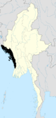 | |
| Maungdaw District | ||
| Sittwe District | ||
| Thandwe District |
| |
| Mrauk-U District | ||
| Main cities and towns | ||
Coordinates: 20°29′N 92°45′E / 20.483°N 92.750°E
This article is issued from Wikipedia - version of the 10/28/2016. The text is available under the Creative Commons Attribution/Share Alike but additional terms may apply for the media files.