Rajula
| Rajula રાજુલા | |
|---|---|
| city | |
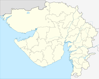
 Rajula Location in Gujarat, India | |
| Coordinates: 21°03′N 71°26′E / 21.05°N 71.43°ECoordinates: 21°03′N 71°26′E / 21.05°N 71.43°E | |
| Country |
|
| State | Gujarat |
| District | Amreli |
| Founded by | Raju Pastiwala |
| Elevation | 41 m (135 ft) |
| Population (2011)[1] | |
| • Total | 1,50,000 approx |
| Time zone | IST (UTC+5:30) |
Rajula is a city and municipality in Amreli district in the Indian state of Gujarat. Rajula has a big market yard facility. Dawoodi Bohra have contributed a lot in development activities. Originally Rajula spread between Dholio Dunger and Piriyo Dungar, but expanded beyond that area on all sides. A small lake appears on the western side of the town near Maruti Dham.
Demographics
As of the 2001 Indian census,[2] Rajula had a population of approximately 80,393. Females constituted 49% of the population. Rajula has an average literacy rate of 64%, higher than the national average of 59.5%, with male literacy at 72% and female, 55%. In Rajula, 15% of the population is under 6 years of age.
Temples
Kumbhnath Sukhnath temple is situated near Rajula. It is an old temple of Shiva. The statue of Shiva was made by Bhima and Yudhishthira. Fairs are generally organised on the festivals of Satam atham and Janmashthami. The temple is situated at the bank of Ghano river, a tributary of Dhaterwadi. Other temples include Bhidbhanjan, Ram Mandir, Goverdhannathji Ni Haveli, Samudrimataji Mandir, Sanyas Ashram, Gayatrijinu Mandir, Holia Hanumanji Nu Mandir, Ambama Nu Mandir, Sankheshwarimataji Mandir and Satnam Pan Hous.
The temple of Lord Shiva, 3 miles away from Rajula, is very beautiful. In legend, it was established by Bhim (one of the characters from Mahabharata). The temple is on the bank of Dhaterwadi river.
Education
St. Thomas High School is managed by Christian catholic group. It is located at Chataddiya Road. Shree Swaminarayan Gurukul is a well known school and it is a first private school in City located at Chataddiya road, providing education service since 1996.Calorax Delhi Public School (CBSE) is also available at Bherai Road.
The village hosts primary schools and bal mandirs. Gandhi mandir is managed by Shri Rajula Seva Mandal. The high school is Shree Jivanlal Anandaji Sanghavi & Shree T.J.B.S. Girls' School is located here. Rajula Education Trust's Smt. Hiralaxmi Bhaidas Sanghavi Mahila Arts & Commerce College is also one of colleges here. Separate schools, colleges and hostels for girls are available along with coeducational schools.
Calorx Public School is managed by Calorx Education and Research Foundation. It is located at Chataddiya Road.
Future career Academy. 1st competitive exam class It is located at Chhatadiya road Rajula.
Transport
The city is well connected with rest of the country by railways, bus transport and sea transport to other major cities of Gujarat such as Vadodara, Ahmedabad, Rajkot, Jamnagar, Surat and Bhavnagar.Night sleeper coach private buses running from Una or Diu to major cities like Ahmedabad, Baroda,Surat and Mumbai pass through Rajula providing a pleasure journey from Rajula to these cities. Rajula is situated on national highway No. 8 E. This highway connects Bhavnagar with Somnath. If you want to travel within the city or near the city the transports available are Autorikshaw and Chakada.
Economy
The city has substantial rock quarries that export around the country. Its economy mainly depends on industries and agriculture. Crops such as groundnut, cotton, and onion are popular.
Port Pipavav is a busy and growing seaport. Pipavav Shipyard Limited now Reliance defence engineering limited is one of the India's largest shipbuilding and heavy industry companies.
Kovaya village known for Limestone mine reserves has some of the largest cement manufacturing plants.
Hotels and Restaurant
There are many Hotels available in Rajula to stay. To eat there are many good restaurants where one can find continental food and Gujarati food.
References
- ↑ "Census of India Search details". censusindia.gov.in. Retrieved 10 May 2015.
- ↑ "Census of India 2001: Data from the 2001 Census, including cities, villages and towns (Provisional)". Census Commission of India. Archived from the original on 2004-06-16. Retrieved 2008-11-01.