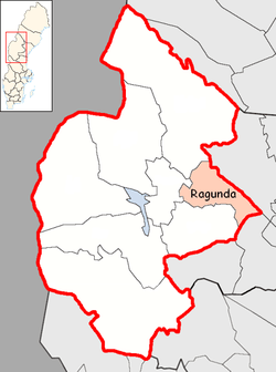
Ragunda Municipality
| Ragunda Municipality Ragunda kommun | ||
|---|---|---|
| Municipality | ||
| ||
 | ||
| Country | Sweden | |
| County | Jämtland County | |
| Seat | Hammarstrand | |
| Area[1] | ||
| • Total | 2,633.11 km2 (1,016.65 sq mi) | |
| • Land | 2,511.14 km2 (969.56 sq mi) | |
| • Water | 121.97 km2 (47.09 sq mi) | |
| Area as of January 1, 2014. | ||
| Population (June 30, 2016)[2] | ||
| • Total | 5,431 | |
| • Density | 2.1/km2 (5.3/sq mi) | |
| Time zone | CET (UTC+1) | |
| • Summer (DST) | CEST (UTC+2) | |
| ISO 3166 code | SE | |
| Province | Jämtland | |
| Municipal code | 2303 | |
| Website | www.ragunda.se | |

Ragunda Municipality (Swedish: Ragunda kommun) is a municipality in Jämtland County in northern Sweden. Its seat is in Hammarstrand.
The present municipality was formed in 1974, when "old" Ragunda Municipality was amalgamated with the municipalities of Fors and Stugun. Further amalgamations have been discussed due to declining population, but have not been carried out.
Ragunda Municipality is known for being the site of the King Chulalongkorn Memorial Building, which is located by the village Utanede. Designed as a Thai royal pavilion, the only one of its kind outside Thailand, it was raised in 1997 in commemoration of King Chulalongkorn's visit there a century earlier.
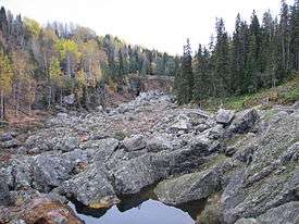
Döda Fallet (The dead waterfall) is an extinct whitewater rapid in a nature reserve and one of the major tourist attractions of the municipality.
Localities
There are four localities (or urban areas) in Ragunda Municipality:[3]
| # | Locality | Population |
|---|---|---|
| 1 | Hammarstrand | 1,061 |
| 2 | Stugun | 627 |
| 3 | Västra Bispgården | 523 |
| 4 | Östra Bispgården | 294 |
The municipal seat in bold
Twin cities
Photo gallery
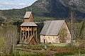 Ragunda old church
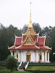
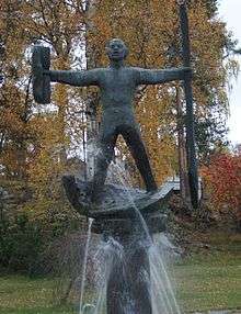 Statue of vildhussen in Hammarstrand
See also
- Borgvattnet - The Haunted Vicarage
References
- ↑ "Statistiska centralbyrån, Kommunarealer den 1 januari 2014" (Microsoft Excel) (in Swedish). Statistics Sweden. Retrieved 2014-04-18.
- ↑ "Folkmängd i riket, län och kommuner 30 juni 2016" (in Swedish). Statistics Sweden. August 17, 2016. Retrieved August 17, 2016.
- ↑ Statistics Sweden as of December 31, 2005
- ↑ "Kolme vuosikymmentä pohjoismaisia ystäväkuntasuhteita Karstulassa" (PDF) (in Finnish). Karstulan Pohjola-Norden ry. Retrieved 7 May 2012.
External links
| Wikimedia Commons has media related to Ragunda Municipality. |
- Ragunda Municipality - Official site
Municipalities and seats of Jämtland County | ||
|---|---|---|
| Municipalities | ||
| Municipal seats | ||
Coordinates: 63°06′N 16°21′E / 63.100°N 16.350°E