Rafah, Egypt
| Rafah "Rapia" in the Egyptian Language | |
|---|---|
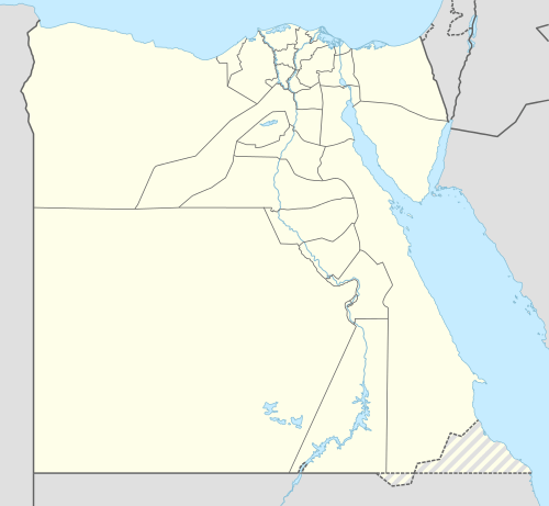 Rafah Location in Egypt | |
| Coordinates: EG 31°17′19″N 34°14′28″E / 31.28861°N 34.24111°E | |
| Country |
|
| Governorate | North Sinai |
| Population | |
| • Ethnicities | Bedouin Arabs and Egyptians |
| Time zone | EST (UTC+2) |
Rafah (Egyptian Arabic: رفح, IPA: [ˈɾɑfɑħ]) or Egyptian Rafah is an important city in North Sinai and Egypt's eastern border with the Gaza strip. It is the capital of Rafah center in North Sinai Governorate, and is situated on the eastern Mediterranean coast of Egypt. In the Egyptian language of Ancient Egypt, the city was known as Rapia.
The Egyptian government announced in early 2015 that it would raze the entire city and build a new settlement for its residents, in order to expand a security buffer between Egypt and Gaza. The Egyptian military reportedly began bulldozing sections of Rafah in late 2014.[1]
History
The city has always been a part of the Egyptian Empire since the Pharaohnic period. It was also a major location on the battle route towards Egyptian settlements in Anatolia and Levant.
During the 2011 Egyptian protests, anti-government rioters attacked and killed three police officers in the town.[2][3]
Obliteration
In October 2014, the Egyptian government announced plans to relocate the population and completely demolish the city in order to enlarge the buffer zone between Egypt and Gaza.[4] Between July 2013 and August 2015, Egyptian authorities demolished at least 3,255 residential, commercial, administrative, and community buildings along the border, forcibly evicting thousands of people.[5]
In June 2015 Egypt completed the digging of a ditch at the Rafah Crossing Point, 20 meters wide by 10 meters deep. It is located two kilometers from the border with Gaza outside of Rafah City and part of the enlarged buffer zone. Expansion of the trench along with watchtowers was planned.[6]
Agriculture
Due to rain, hail and sleet; the city has plentiful sources of water for agriculture. Mediterranean fruits and crops are dominant, such as: peaches, olives, apples, citrus fruits, dates, grapes, vegetables, strawberries and peppers.
Climate
Like east Mediterranean cities and Egypt's north coast but wetter, it is characterised by hot dry summers and mild rainy winters. The temperature during summer can be around 30 °C (86 °F) during daytime, and rarely exceeds 35 °C (95 °F) due to the influence of the sea. Winters range from mild to cool during the day and chilly during the night and temperatures dip below 6 °C (43 °F) very often. Rainfall is average with sometimes hail, sleet and rarely snow takes place.
Köppen-Geiger climate classification system classifies its climate as hot semi-arid (BSh).[7][8]
Rafah, Alexandria, Abu Qir, Rosetta, Baltim, Kafr el-Dawwar and Mersa Matruh are the wettest places in Egypt.
| Climate data for Rafah, North Sinai | |||||||||||||
|---|---|---|---|---|---|---|---|---|---|---|---|---|---|
| Month | Jan | Feb | Mar | Apr | May | Jun | Jul | Aug | Sep | Oct | Nov | Dec | Year |
| Average high °C (°F) | 17.2 (63) |
18 (64) |
20.3 (68.5) |
22.9 (73.2) |
25.8 (78.4) |
28.2 (82.8) |
29.6 (85.3) |
30.5 (86.9) |
29 (84) |
27.4 (81.3) |
23.7 (74.7) |
19.3 (66.7) |
24.33 (75.73) |
| Daily mean °C (°F) | 12.7 (54.9) |
13.5 (56.3) |
15.4 (59.7) |
18 (64) |
20.8 (69.4) |
23.5 (74.3) |
25.2 (77.4) |
25.9 (78.6) |
24.5 (76.1) |
22.4 (72.3) |
18.6 (65.5) |
14.7 (58.5) |
19.6 (67.25) |
| Average low °C (°F) | 8.2 (46.8) |
9 (48) |
10.6 (51.1) |
13.2 (55.8) |
15.9 (60.6) |
18.8 (65.8) |
20.8 (69.4) |
21.4 (70.5) |
20 (68) |
17.4 (63.3) |
13.5 (56.3) |
10.1 (50.2) |
14.91 (58.82) |
| Average precipitation mm (inches) | 49 (1.93) |
37 (1.46) |
28 (1.1) |
6 (0.24) |
4 (0.16) |
0 (0) |
0 (0) |
0 (0) |
0 (0) |
8 (0.31) |
39 (1.54) |
54 (2.13) |
225 (8.87) |
| Source: Climate-Data.org (altitude: 78m)[7] | |||||||||||||
| Climate data for Rafiah, Gaza Strip | |||||||||||||
|---|---|---|---|---|---|---|---|---|---|---|---|---|---|
| Month | Jan | Feb | Mar | Apr | May | Jun | Jul | Aug | Sep | Oct | Nov | Dec | Year |
| Average high °C (°F) | 17.4 (63.3) |
18.1 (64.6) |
20.5 (68.9) |
23 (73) |
25.8 (78.4) |
28.3 (82.9) |
29.6 (85.3) |
30.5 (86.9) |
29.1 (84.4) |
27.6 (81.7) |
23.8 (74.8) |
19.4 (66.9) |
24.42 (75.93) |
| Daily mean °C (°F) | 12.9 (55.2) |
13.6 (56.5) |
15.6 (60.1) |
18.1 (64.6) |
20.9 (69.6) |
23.6 (74.5) |
25.2 (77.4) |
26 (79) |
24.7 (76.5) |
22.6 (72.7) |
18.7 (65.7) |
14.8 (58.6) |
19.72 (67.53) |
| Average low °C (°F) | 8.4 (47.1) |
9.1 (48.4) |
10.8 (51.4) |
13.3 (55.9) |
16.1 (61) |
19 (66) |
20.9 (69.6) |
21.6 (70.9) |
20.3 (68.5) |
17.6 (63.7) |
13.7 (56.7) |
10.2 (50.4) |
15.08 (59.13) |
| Average precipitation mm (inches) | 48 (1.89) |
36 (1.42) |
27 (1.06) |
6 (0.24) |
4 (0.16) |
0 (0) |
0 (0) |
0 (0) |
0 (0) |
8 (0.31) |
39 (1.54) |
53 (2.09) |
221 (8.71) |
| Source: Climate-Data.org (altitude: 45m)[8] | |||||||||||||
See also
References
- ↑ "Egypt Moves to Eradicate Town Near Gaza Strip". The New York Times. 8 January 2015. Retrieved 8 January 2015.
- ↑ Parker, Nick (29 January 2011). "Troops Battle Rioters in Egypt". The Sun. Retrieved 3 February 2011.
- ↑ "Pyramids closed as deadly riots spread". Herald Sun. 30 January 2011. Retrieved 3 February 2011.
- ↑ Laura Dean (February 2, 2015). "An entire city is going to be wiped off the map in Egypt". GlobalPost.
- ↑ “Look for Another Homeland”. Human Rights Watch, September 2015
- ↑ Egypt builds trench along Gaza border to prevent smuggling. Ma'an News Agency, 22 June 2015
- 1 2 "Climate: Rafah - Climate graph, Temperature graph, Climate table". Climate-Data.org. Retrieved 2014-02-21.
- 1 2 "Climate: Rafiah - Climate graph, Temperature graph, Climate table". Climate-Data.org. Retrieved 2014-02-21.
Coordinates: 31°16′51″N 34°14′29″E / 31.28083°N 34.24139°E