Radovlja
| Radovlja | |
|---|---|
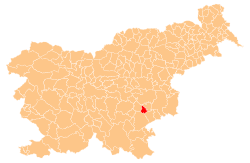
 Radovlja Location in Slovenia | |
| Coordinates: 45°53′40.75″N 15°14′11.7″E / 45.8946528°N 15.236583°ECoordinates: 45°53′40.75″N 15°14′11.7″E / 45.8946528°N 15.236583°E | |
| Country |
|
| Traditional region | Lower Carniola |
| Statistical region | Southeast Slovenia |
| Municipality | Šmarješke Toplice |
| Area | |
| • Total | 1.26 km2 (0.49 sq mi) |
| Elevation | 239.9 m (787.1 ft) |
| Population (2002) | |
| • Total | 152 |
| [1] | |
Radovlja (pronounced [ˈɾaːdɔu̯lja]) is a settlement northwest of Šmarjeta in the Municipality of Šmarješke Toplice in southeastern Slovenia. The area is part of the historical region of Lower Carniola and is now included in the Southeast Slovenia Statistical Region.[2]
References
External links
| Settlements | Administrative centre: Šmarješke Toplice
|  | ||||||
|---|---|---|---|---|---|---|---|---|
| Landmarks |
| |||||||
This article is issued from Wikipedia - version of the 7/11/2015. The text is available under the Creative Commons Attribution/Share Alike but additional terms may apply for the media files.