Radisson Heights, Calgary
| Albert Park/Radisson Heights | |
|---|---|
| Neighbourhood | |
|
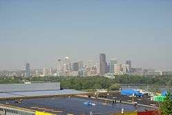
Downtown skyline view from Radisson Heights | |
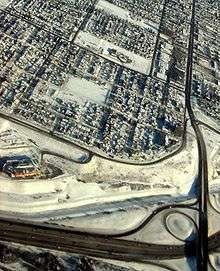
 Albert Park/Radisson Heights Location of Albert Park/Radisson Heights in Calgary | |
| Coordinates: 51°02′44″N 113°59′22″W / 51.04556°N 113.98944°WCoordinates: 51°02′44″N 113°59′22″W / 51.04556°N 113.98944°W | |
| Country |
|
| Province |
|
| City |
|
| Quadrant | SE |
| Ward | 10 |
| Established | 1910 |
| Government[1] | |
| • Mayor | Naheed Nenshi |
| • Administrative body | Calgary City Council |
| • Councillor | Andre Chabot |
| Area | |
| • Total | 1.7 km2 (0.7 sq mi) |
| Elevation | 1,085 m (3,560 ft) |
| Population (2006)[2] | |
| • Total | 6,098 |
| • Average Income | $38,019 |
| Website | Albert Park/Radisson Heights Community Association |
Albert Park/Radisson Heights is a residential neighbourhood in the south-east quadrant of Calgary, Alberta. It is bounded to the west by the Bow River and Deerfoot Trail, to the north by Memorial Drive and to the south by International Avenue. The community of Forest Lawn lies to the east.
This community, established in 1910, enjoys ample open space, is well provided with public and separate schools, has good access to shopping and city-wide transportation routes, and has views of the Bow River Valley, the Downtown and the Canadian Rockies.
However, like many communities in the inner city, it suffers from a number of problems such as shortcutting of nonlocal traffic, residential infill development that is insensitive to the block or the community at large. The community has an area redevelopment plan in place.[3]
It is represented in the Calgary City Council by the Ward 10 councillor.[1]
Demographics
In the City of Calgary's 2012 municipal census, Albert Park/Radisson Heights had a population of 6,234 living in 2,709 dwellings, a 0.3% increase from its 2011 population of 6,217.[4] With a land area of 2.5 km2 (0.97 sq mi), it had a population density of 2,490/km2 (6,460/sq mi) in 2012.[5][4]
Residents in this community had an median household income of $38,019 in 2000.[6] As of 2000, 25.9% of the residents were immigrants. A proportion of 40.2% of the buildings were condominiums or apartments, and 58% of the housing was used for renting.[2]
Attractions
Albert Park and Radisson Heights are close to Downtown Calgary. Inglewood, Fort Calgary Historic Park and the Calgary Zoo, are just moments away. The Max Bell Centre (ice hockey arena) is located immediately west of Radisson Heights.
In 2002, Radisson Heights was the first community in Calgary to have its own Wi-Fi internet service and was managed by WestNet Wireless.[7]
Education
This neighbourhood has one public elementary school: Radisson Park Elementary School (K-4) built in 2006. There were two other elementary schools that were closed and merged into Radisson Park Elementary School, angering some southwest residents who have no community elementary schools.
References
- 1 2 "Calgary Elections". City of Calgary. October 21, 2013. Retrieved October 22, 2013.
- 1 2 City of Calgary (2006). "Albert Park/Radisson Heights Community Statistics" (PDF). Retrieved 2007-05-09.
- ↑ "Albert Park/Radisson Heights Area Redevelopment Plan" (PDF). City of Calgary. 2005. Retrieved 2011-07-13.
- 1 2 "2012 Civic Census Results" (PDF). City of Calgary. 2012. Retrieved February 4, 2013.
- ↑ "Community Boundaries" (Esri shapefile). City of Calgary. Retrieved February 5, 2013.
- ↑ City of Calgary (2004). "Ward 10 Profile" (PDF). Retrieved 2007-05-05.
- ↑ WestNet Wireless (2002). "Albert Park/Radisson Heights Coverage Info on WestNet". Retrieved 2002-02-22.
External links
 |
Bridgeland/Riverside | Memorial Drive | Marlborough | |
| Inglewood | |
Forest Heights | ||
| ||||
| | ||||
| Bow River, Deerfoot Trail | International Avenue Southview |
Forest Lawn |