Rätikon
| Rätikon | |
|---|---|
 | |
| Highest point | |
| Peak | Schesaplana |
| Elevation | 2,964 m (9,724 ft) |
| Coordinates | 47°3′14″N 9°42′46″E / 47.05389°N 9.71278°E |
| Geography | |
 | |
| Countries | Austria, Switzerland and Liechtenstein |
| States | Vorarlberg and Graubünden |
| Range coordinates | 47°03′N 9°45′E / 47.05°N 9.75°ECoordinates: 47°03′N 9°45′E / 47.05°N 9.75°E |
| Parent range | Central Eastern Alps |
| Borders on | Silvretta, Verwall Alps, Plessur Range and Appenzell Alps |
| Topo map | Swiss Federal Office of Topography swisstopo |
The Rätikon is a mountain range of the Central Eastern Alps located at the border between Vorarlberg, Liechtenstein and Graubünden. It is the geological border between the Eastern and Western Alps and stretches from the Montafon as far as the Rhine. In the south, the Prättigau is its limit, in the north the Walgau. In the east, it borders the Silvretta groups.
Its chief peaks are:
- Schesaplana 2964 m (9725 ft)
- Schiltfluh 2890 m (9482 ft)
- Panüelerkopf 2859 m (9380 ft)
- Drusenfluh 2829 m (9282 ft)
- Madrisahorn 2830 m (9285 ft)
- Sulzfluh 2820 m (9252 ft)
- Wildberg 2788 m (9147 ft)
- Zimbaspitze 2643 m (8678 ft)
- Vorder Grauspitz 2599 m (8528 ft)
- Falknis 2566 m (8419 ft)
- Naafkopf 2571 m (8445 ft)
- Hornspitze 2537 m (8323 ft)
- Vilan 2376 m (7795 ft)
- Sassauna 2308 m (7572 ft)
For a list of passes see Passes of the Silvretta and Rätikon Ranges.
A multiday hike that follows a big portion of the Rätikon chain on its southern side is called "Prättigauer Höhenweg".[1]
See also
References
| Wikimedia Commons has media related to Rätikon. |

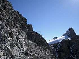
Drusenfluh

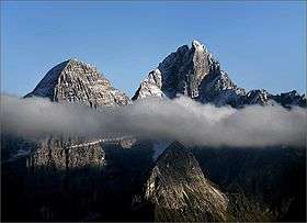
Drei Türme
This article is issued from Wikipedia - version of the 11/28/2016. The text is available under the Creative Commons Attribution/Share Alike but additional terms may apply for the media files.