Quoin Island (Persian Gulf)
 Oman | |
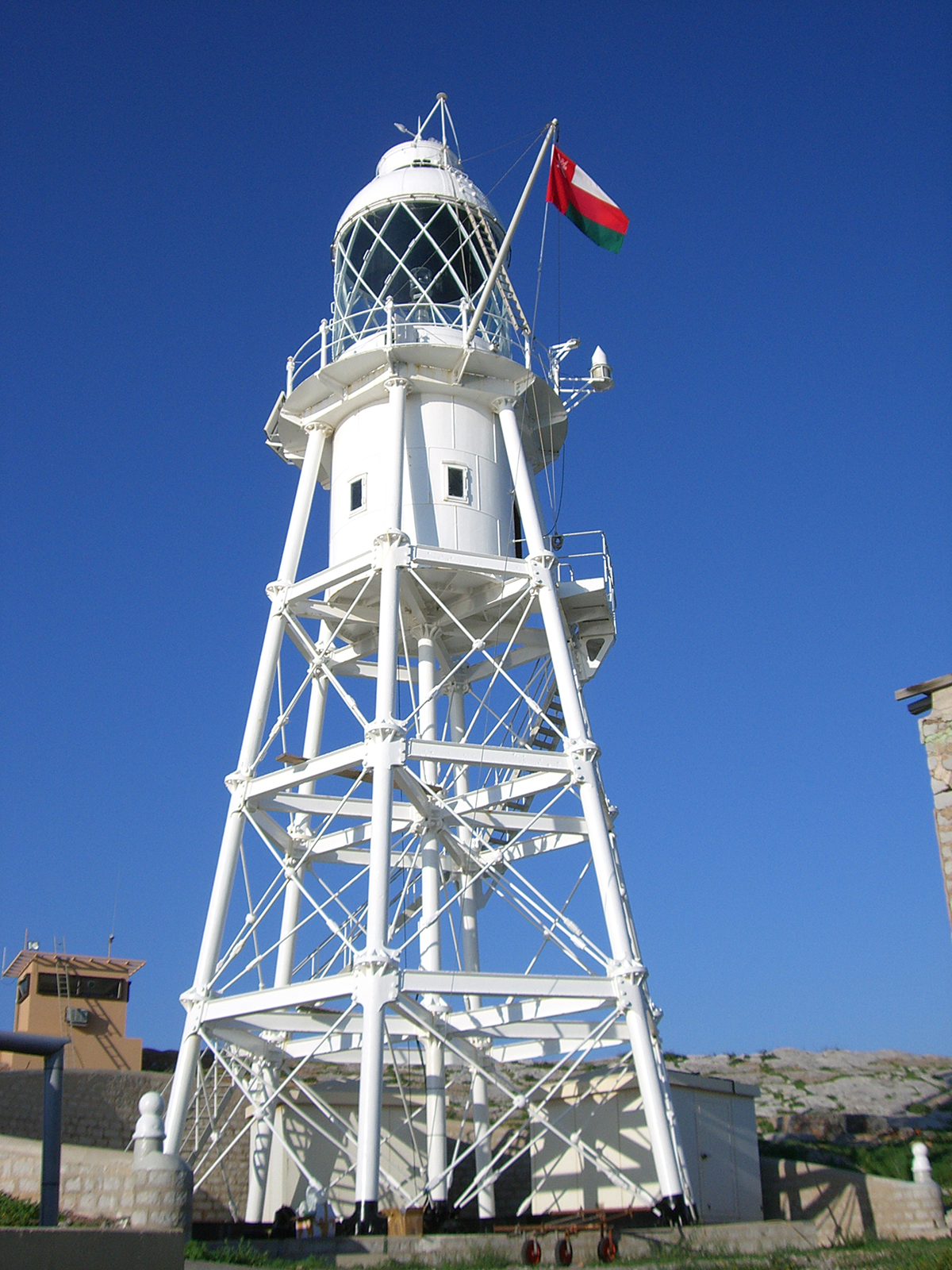
| Location |
Quoin Island Oman |
|---|---|
| Coordinates | 26°28′38.2″N 56°32′18.4″E / 26.477278°N 56.538444°E |
| Foundation | concrete basement |
| Construction | metal skeletal tower |
| Tower shape | square pyramidal skeletal tower |
| Markings / pattern | white tower |
| Height | 24 metres (79 ft) |
| Focal height | 60 metres (200 ft) |
| Light source | solar power |
| Range | 23 nautical miles (43 km; 26 mi) |
| Characteristic | Fl (2) W 10s. |
| Admiralty number | D7335 |
| NGA number | 28552 |
| ARLHS number | OMA-001[1] [2] |
Quoin Island (also known as As Salamah Island and Great Quoin Island) in Oman is the traditional "way point" used by ships to define the entrance or exit from the Persian Gulf. Once a ship is declaired a position of "Passed Quoin Inbound" the insurance rates for the ship will increase.
Quoin Island, Oman, is not to be confused with Quoin Island, Yemen, which is in the Red Sea and also has a lighthouse, or Quoin Island in the Torres Strait of Australia, neither of which are way points.
See also
References
- ↑ Oman The Lighthouse Directory. University of North Carolina at Chapel Hill. Retrieved 13 October 2016
- ↑ NGA List of Lights – Pub.112 Retrieved 13 October 2016
- Rowlett, Russ. "Lighthouses of Oman". The Lighthouse Directory. University of North Carolina at Chapel Hill.
External links
Coordinates: 26°30′13″N 56°30′42″E / 26.50361°N 56.51167°E
This article is issued from Wikipedia - version of the 10/13/2016. The text is available under the Creative Commons Attribution/Share Alike but additional terms may apply for the media files.