Quivicán
| Quivicán | |||
|---|---|---|---|
| Municipality | |||
|
The "Glorieta" bandstand | |||
| |||
.png) Quivicán municipality (red) within Mayabeque Province (yellow) and Cuba | |||
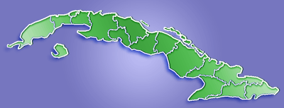 Location of Quivicán in Cuba | |||
| Coordinates: 22°49′29″N 82°21′21″W / 22.82472°N 82.35583°WCoordinates: 22°49′29″N 82°21′21″W / 22.82472°N 82.35583°W | |||
| Country |
| ||
| Province | Mayabeque | ||
| Founded | 1700[1] | ||
| Established | 1919 (Municipality) | ||
| Area[2] | |||
| • Total | 283 km2 (109 sq mi) | ||
| Elevation | 50 m (160 ft) | ||
| Population (2004)[3] | |||
| • Total | 29,253 | ||
| • Density | 103.4/km2 (268/sq mi) | ||
| Time zone | EST (UTC-5) | ||
| Area code(s) | +53-7 | ||


Quivicán is a town and municipality in Mayabeque Province of Cuba. It is located in the south west of the province, bordering the Gulf of Batabanó. The name is of Taino origin (spelled Quibicán).[4] It was founded in 1700.[1]
Geography
The municipality is divided into the barrios of Quivican Pueblo, La Salud, San Felipe, Pablo Noriega, San Agustín, Guiro Boñingal, Güiro Marrero, Santa Mónica, Aguacate and Fajardo.[1]
Demographics
In 2004, the municipality of Quivicán had a population of 29,253.[3] With a total area of 283 km2 (109 sq mi),[2] it has a population density of 103.4/km2 (268/sq mi).
Notable people
- Roldán González (b. 1971), musician
- Chucho Valdés (b. 1941), pianist
See also
References
- 1 2 3 Guije.com. "Quivicán" (in Spanish). Retrieved 2007-10-07.
- 1 2 Statoids (July 2003). "Municipios of Cuba". Retrieved 2007-10-07.
- 1 2 Atenas.cu (2004). "2004 Population trends, by Province and Municipality" (in Spanish). Archived from the original on 2007-09-27. Retrieved 2007-10-07.
- ↑ United Confederation of Taíno People. "Taíno Dictionary" (in Spanish). Archived from the original on 2007-10-16. Retrieved 2007-10-18.
External links
![]() Media related to Quivicán at Wikimedia Commons
Media related to Quivicán at Wikimedia Commons
This article is issued from Wikipedia - version of the 11/28/2016. The text is available under the Creative Commons Attribution/Share Alike but additional terms may apply for the media files.