Quinton, Birmingham
| Quinton | |
 Quinton |
|
| Population | 24,174 (2011 Ward)[1] |
|---|---|
| OS grid reference | SO990846 |
| Metropolitan borough | Birmingham |
| Metropolitan county | West Midlands |
| Region | West Midlands |
| Country | England |
| Sovereign state | United Kingdom |
| Post town | BIRMINGHAM |
| Postcode district | B32 |
| Dialling code | 0121 |
| Police | West Midlands |
| Fire | West Midlands |
| Ambulance | West Midlands |
| EU Parliament | West Midlands |
| UK Parliament | Birmingham Edgbaston |
|
|
Coordinates: 52°28′N 2°00′W / 52.46°N 2.00°W
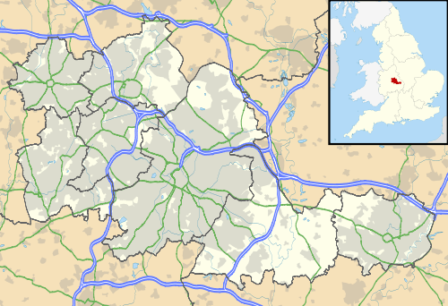
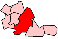
Quinton is a suburb on the western edge of Birmingham, England. It is a Birmingham City Council ward[2] within the Edgbaston formal district, and forms a part of the Birmingham Edgbaston parliamentary constituency.
Geography
Quinton borders the Birmingham suburbs of Harborne and Bartley Green and the Black Country area of Warley, and is separated by the M5 motorway from the Black Country town of Halesowen. It covers an area of 4.8 square kilometres (2 sq mi); its population was recorded in the 2001 UK census as 23,084, though its boundaries have since expanded slightly. The eastern parts of it were formerly known as "Ridgacre", with Quinton or "The Quinton" being the area now around the church.
The Old Quinton area, in the west of Quinton, contains the highest point in Birmingham at 224 metres above sea level, and the top of the spire of the (Church of England) Christ Church is the highest point of any building in Birmingham. The escarpment a little to the west also forms part of the national watershed, dividing the catchment areas of the River Severn and the River Trent.
The largest open space is Woodgate Valley Country Park, through which the Bourne Brook flows, dividing Quinton from Woodgate, South Woodgate and Bartley Green.
History
Before the Church was built, it was part of the ancient parish of Halesowen and was largely owned in medieval times by the wealthy abbey at Lapal near Halesowen. The parish was generally known as Ridgacre until 1901, and formed, with the most of rest of Halesowen parish, a detached part of Shropshire until moving to Worcestershire in 1844.[3] The area had developed along the Kidderminster and Birmingham Road, which had been turnpiked.
In the 1840s, it was mentioned, then called The Quinton, that there were two small coal mines in the area and that the inhabitants were employed in nail manufacturing. Christ Church was constructed in 1840 at a cost of £2,500.[4]
Though this area (including the Christ Church and its associated primary school) dates back to the Victorian era, and Quinton was formally removed from Worcestershire and incorporated into the county borough of Birmingham, in Warwickshire, on 9 November 1909; a tree was planted by Birmingham's Lord Mayor in Quinton Recreation Ground to commemorate the centenary. Quinton remained in character a village rather than a suburb until the large-scale private housing development of the 1930s.
Factory developments were not planned for the area as a result of objections by residents of Edgbaston to the possibility of fumes being blown over to their area by the wind.
The expanded Quinton of that time was fictionalised as "Tilton" by Francis Brett Young in his novel Mr & Mrs Pennington.
Quinton became, with the rest of Birmingham, part of the metropolitan county of the West Midlands on 1 April 1974, under the Local Government Act 1972.
Population and housing
The 2001 Population Census recorded that 23,084 people were living in Quinton. 14.5% (3,301) of the ward's population consisted of ethnic minorities compared with 29.6% for Birmingham. 71.7% of the population of Quinton stated Christianity as their religion.
Much of Quinton's housing on the Ridgacre estate consists of medium-sized private semi-detached houses from the 1930s and 1940s. Construction of the housing estate was halted during World War II. In the 1950s, council houses typical of the period were built in the remaining spaces. There is a concentration of low-rise council housing on the Woodgate Valley estate, and higher-rise blocks on the Welsh House Farm estate, though this was designated until 2004 as part of Harborne. The older part of Quinton, the original Quinton village in the area around the C of E church on Hagley Road known as The Quinton, is built largely of Victorian terraced houses and contains, on High Street, the Nailers Cottage which is the oldest building in the area. The area is almost entirely residential, though there are typical small local service businesses and an office park has recently been developed on the Quinton Meadows site adjacent to the motorway.
Politics
Quinton ward is currently represented by three Labour councillors on Birmingham City Council; Kate Booth, John Clancy and Matthew Gregson.
The ward of Quinton forms part of Birmingham Edgbaston (UK Parliament constituency) along with Bartley Green, Edgbaston and Harborne, which has been represented by Labour MP Gisela Stuart since 1997.
Public services
Quinton has one secondary school, Four Dwellings Academy and five primary schools; Quinton C of E, Worlds End Primary School, Woodhouse Primary School, Welsh House Farm Community School and Four Dwellings Primary Academy.
The area is served by Quinton Library.
Sport
Quinton is home to two amateur football teams, Quinton Magpies and Quinton Rangers, both play in the Warley and District Football League. A healthy local rivalry has been built up over several years.
Notable people
- Keith Law, songwriter for Velvett Fogg, lived in High Street.
- Adrian Chiles
- Bill Oddie
- Joleon Lescott grew up in Quinton and attended the Four Dwellings High School
- The Twang The popular indie band were formed in Quinton.
- Elliot Knight British actor best known for his role as Aiden Walker in How To Get Away With Murder.
References
- ↑ "Birmingham Ward population 2011". Retrieved 14 December 2015.
- ↑ "Quinton Ward". birmingham.gov.uk.
- ↑ Vision of Britain: Relationships/ unit history of Quinton Archived 1 October 2007 at the Wayback Machine.
- ↑ "Quadring - Quy". british-history.ac.uk.
External links
Birmingham council constituencies and wards | ||
| Edgbaston | 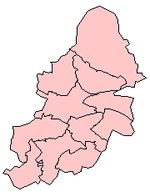 | |
| Erdington | ||
| Hall Green | ||
| Hodge Hill | ||
| Ladywood | ||
| Northfield | ||
| Perry Barr | ||
| Selly Oak | ||
| Sutton Coldfield | ||
| Yardley | ||