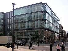
Queen Victoria Street, London
 Queen Victoria Street in 1989 | |
| Length | 0.7 mi (1.1 km) |
|---|---|
| Location | London, United Kingdom |
| West end | New Bridge Street/Victoria Embankment |
| East end | Mansion House Street/Bank junction |
Queen Victoria Street, named after the British monarch who reigned from 1837 to 1901, is a street in London which runs east by north from its junction with New Bridge Street and Victoria Embankment in the Castle Baynard ward of the City of London, along a section that divides the wards of Queenhithe and Bread Street, then lastly through the middle of Cordwainer ward, until it reaches Mansion House Street at Bank junction. Beyond Bank junction, the street continues north-east as Threadneedle Street which joins Bishopsgate.
The road was commissioned in 1861[1] to streamline the approach to the central business district, and was provided for through the Metropolitan Improvement Act.[2] Costing over £1,000,000, it remains a flagship street within the City.[3]
The nearest London Underground stations are Blackfriars (at its western junction with New Bridge Street), Mansion House (where it crosses Cannon Street), and Bank (near its eastern end).
Queen Victoria Street formed part of the marathon course of the 2012 Olympic and Paralympic Games.[4][5]
Notable buildings

The British and Foreign Bible Society was formerly located at No. 146 from 1868 and 1985. That address is now occupied by the Church of Scientology of London.
A blue plaque on the Faraday Building on the north side marks the previous site of the Doctors' Commons, demolished in 1867. Other notable sites on the north side of Queen Victoria Street include:
- the Bank of New Zealand's triangular building at No. 1 was their London office from 1889 to 1988. It is now the offices of the City of London Magistrates' Court Committee;
- the Bank of New York Mellon at No. 160, formerly the site of The Times newspaper offices;
- the church of St. Andrew-by-the-Wardrobe;
- the College of Arms' headquarters at No. 130;
- a Monetary Authority of Singapore branch at No. 128;
- The Salvation Army's global headquarters at No. 101; and
- the City of London School.
On the south side is St Benet Paul's Wharf church, at No. 135. Baynard House is also located on Queen Victoria Street.
Other streets linked to Queen Victoria Street include Puddle Dock, Cannon Street, Walbrook and Poultry.
References
| Wikimedia Commons has media related to Queen Victoria Street, London. |
- ↑ A Dictionary of London, Harben, H.A: London, Herbert Jenkins, 1922
- ↑ "The Housing of the Working Classes in London" Porritt,E in Political Science Quarterly, Vol. 10, No. 1 (Mar., 1895)
- ↑ The City of London-a history Borer,M.I.C. : New York,D.McKay Co, 1978 ISBN 0-09-461880-1
- ↑ http://www.london2012.com/athletics/event/men-marathon/coursemap/
- ↑ http://www.london2012.com/athletics/event/women-marathon/coursemap/
- Google Maps
Coordinates: 51°30′43″N 0°06′00″W / 51.512°N 0.09993°W