Quarryville, Pennsylvania
| Borough of Quarryville | |
| Settlement | |
 Library | |
| Country | United States |
|---|---|
| State | Pennsylvania |
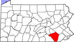
| County | Lancaster |
| Elevation | 545 ft (166.1 m) |
| Coordinates | 39°53′43″N 76°09′44″W / 39.89528°N 76.16222°WCoordinates: 39°53′43″N 76°09′44″W / 39.89528°N 76.16222°W |
| Area | 1.3 sq mi (3.4 km2) |
| - land | 1.3 sq mi (3 km2) |
| - water | 0.0 sq mi (0 km2), 0% |
| Population | 1,994 (2000) |
| Density | 1,520.9/sq mi (587.2/km2) |
| Timezone | EST (UTC-5) |
| - summer (DST) | EDT (UTC-4) |
| ZIP code | 17566 |
| Area code | 717 |
 Location of Quarryville in Lancaster County | |
 Location of Quarryville in Pennsylvania | |
 Location of Pennsylvania in the United States | |
Quarryville is a borough in Lancaster County, Pennsylvania, United States. The population was 1,994 at the 2000 census.
Geography
Quarryville is located at 39°53′43″N 76°9′44″W / 39.89528°N 76.16222°W (39.895402, -76.162175).[1]
According to the United States Census Bureau, the borough has a total area of 1.3 square miles (3.4 km2), all of it land.
Demographics
| Historical population | |||
|---|---|---|---|
| Census | Pop. | %± | |
| 1880 | 346 | — | |
| 1900 | 565 | — | |
| 1910 | 739 | 30.8% | |
| 1920 | 823 | 11.4% | |
| 1930 | 1,028 | 24.9% | |
| 1940 | 1,120 | 8.9% | |
| 1950 | 1,187 | 6.0% | |
| 1960 | 1,427 | 20.2% | |
| 1970 | 1,571 | 10.1% | |
| 1980 | 1,558 | −0.8% | |
| 1990 | 1,642 | 5.4% | |
| 2000 | 1,994 | 21.4% | |
| 2010 | 2,576 | 29.2% | |
| Est. 2015 | 2,736 | [2] | 6.2% |
| Sources:[3][4][5] | |||
As of the census[4] of 2000, there were 1,994 people, 838 households, and 578 families residing in the borough. The population density was 1,520.9 people per square mile (587.7/km²). There were 864 housing units at an average density of 659.0 per square mile (254.7/km²). The racial makeup of the borough was 96.69% White, 0.45% African American, 0.10% Native American, 0.25% Asian, 1.50% from other races, and 1.00% from two or more races. Hispanic or Latino of any race were 2.26% of the population.
There were 838 households, out of which 34.0% had children under the age of 18 living with them, 53.6% were married couples living together, 12.3% had a female householder with no husband present, and 31.0% were non-families. 28.4% of all households were made up of individuals, and 13.6% had someone living alone who was 65 years of age or older. The average household size was 2.38 and the average family size was 2.92.
In the borough the population was spread out, with 27.0% under the age of 18, 7.6% from 18 to 24, 27.4% from 25 to 44, 20.0% from 45 to 64, and 18.1% who were 65 years of age or older. The median age was 37 years. For every 100 females there were 90.4 males. For every 100 females age 18 and over, there were 82.2 males.
The median income for a household in the borough was $35,798, and the median income for a family was $44,000. Males had a median income of $38,550 versus $23,989 for females. The per capita income for the borough was $19,105. About 5.9% of families and 7.1% of the population were below the poverty line, including 10.6% of those under age 18 and 5.7% of those age 65 or over.
History
The land which became Quarryville Borough was originally located within New Providence Township and was the property of a John ("Swamp John") Groff. There was a stone quarry adjacent to the village where many of the workers lived. This village became larger as the work force grew, hence the town acquired the name Quarryville. Locals say that one day the men went to lunch and returned to find the quarry half-full of water. The quarry site remains, now full of water.
Etymology
Quarryville is named after the many quarries that are located in the region.
Education
Quarryville is part of the Solanco School District.
Quarryville Elementary School, Smith Middle School, and Solanco High School serve Quarryville.
Local services
The Quarryville Library is part of the Lancaster County Library System. The Quarryville Fire Company is a volunteer unit.
Notable people
- Edwin Duing Eshleman, former member of the United States House of Representatives.
- Robert Fulton, inventor and painter, was born outside of Quarryville.
- Johnny Weir, US Olympic figure skater, grew up in Quarryville.
- Don Wert, played baseball with the Detroit Tigers 1963-1970.
References
| Wikimedia Commons has media related to Quarryville, Pennsylvania. |
- ↑ "US Gazetteer files: 2010, 2000, and 1990". United States Census Bureau. 2011-02-12. Retrieved 2011-04-23.
- ↑ "Annual Estimates of the Resident Population for Incorporated Places: April 1, 2010 to July 1, 2015". Retrieved July 2, 2016.
- ↑ "Census of Population and Housing". U.S. Census Bureau. Archived from the original on May 11, 2015. Retrieved 11 December 2013.
- 1 2 "American FactFinder". United States Census Bureau. Archived from the original on September 11, 2013. Retrieved 2008-01-31.
- ↑ "Incorporated Places and Minor Civil Divisions Datasets: Subcounty Resident Population Estimates: April 1, 2010 to July 1, 2012". Population Estimates. U.S. Census Bureau. Archived from the original on June 17, 2013. Retrieved 11 December 2013.