Qualicum Beach
- "Qualicum" re-directs here. For the neighbourhood in Ottawa, see Qualicum, Ottawa
| Qualicum Beach | ||
|---|---|---|
| Town | ||
| Town of Qualicum Beach[1] | ||
 | ||
| ||
 Qualicum Beach Location of Qualicum Beach in British Columbia | ||
| Coordinates: 49°21′N 124°26′W / 49.350°N 124.433°WCoordinates: 49°21′N 124°26′W / 49.350°N 124.433°W | ||
| Country |
Canada | |
| Province |
British Columbia | |
| Regional District | Regional District of Nanaimo | |
| Established | As a village: 1943 | |
| As a town: 1983 | ||
| Government | ||
| • Mayor | Teunis Westbroek | |
| • Governing Body | Qualicum Beach Town Council | |
| Area | ||
| • Total | 17.98 km2 (6.94 sq mi) | |
| Elevation | 8 m (26 ft) | |
| Population (2011) | ||
| • Total | 8,687 | |
| • Density | 480/km2 (1,300/sq mi) | |
| Time zone | Pacific Standard (PST) (UTC-8) | |
| • Summer (DST) | PDT (UTC-7) | |
| Postal code | V9K 1S7 | |
| Area code(s) | 250 | |
| Website | Town of Qualicum Beach Website | |
Qualicum Beach is a town located on Vancouver Island British Columbia, Canada. At the 2011 census, it had a population of 8,687. It is situated at the foot of Mount Arrowsmith, along the Strait of Georgia on Vancouver Island's northeastern coast.
Qualicum's natural beauty, small-town charm, and proximity to Victoria and Vancouver have made it a popular tourist destination, with many rental cottages dotting its coast. It is also a popular retirement community, and has the oldest average population in Canada with a median age of 60.9 in 2006.[2]
Qualicum Beach is served by the coast-spanning Island Highway, an airport, and a nearby ferry to Lasqueti Island. It is informally considered a twin city with neighbouring Parksville.
History
The name "Qualicum" comes from a Pentlatch language term that means "Where the dog salmon (chum salmon) run."[3]
In May 1856, Hudson's Bay Company explorer Adam Grant Horne, with a group of aboriginal guides, found a land route across Vancouver Island from the Qualicum River to the Alberni Inlet.[4] He also discovered the Haida massacre of local Salish natives. Horne Lake is named after him.[5]
In 1864, the botanist and explorer Robert Brown led the Vancouver Island Exploring Expedition through the area. He found the area deserted as a result of the small pox epidemic of 1862.[6]:47 The first settlers arrived in the 1880s.[3] A road was built from Nanaimo to Parksville in 1886 and extended to Qualicum in 1894. The E and N Railway reached Parksville in 1910 and Qualicum in 1914. H.E. Beasley, a railway official, sponsored the creation of The Merchants Trust and Trading Company which organized the original layout of the town and built the golf links and a hotel in 1913.[7]
A private boys' residential school, the Qualicum College, was established in 1935 by Robert Ivan Knight. The school grew through the 1960s, but attendance diminished, and it closed in 1970. The structure remains, and though operated as a hotel for many years, it is vacant and proposed for re-development. Its playing fields have been turned into a housing subdivision.[8]
Doukhobor settlers established a communal colony in the adjoining Hilliers farming district from 1946 to 1952.
Qualicum Beach was officially incorporated as a village on May 5, 1942, and was changed to town status on January 7, 1983. The area is growing quickly with new housing subdivisions and a major new highway. It is a favoured retirement and golfing community.
HMS Qualicum was a ship in the Royal Navy named for the community.[9]
In 2002, the town's grocery store, Quality Foods, burned to the ground. The company quickly began rebuilding and set up a temporary store in a local warehouse until the new store was able to accept customers and product.
Politics and government
Municipal government of the Town of Qualicum Beach is structured like the U.S. American council-manager form of government. It is headed by a mayor (who also represents Qualicum Beach on the governing board of the Regional District of Nanaimo) and a four-member council. These positions are filled by at-large elections every three years, as provided by British Columbia law.[10] The current mayor, Teunis Westbroek was first elected in 1999, re-elected by acclamation in 2002, re-elected in a contested election in 2005 and again re-elected in 2008.[11] School board trustees, for representation on School District 69 Qualicum,[12] are also elected by residents of the town, the City of Parksville and the surrounding area. The town funds a volunteer fire department, which serves the town and nearby rural communities. The town has a local ambulance station. The nearest full hospital is Nanaimo Regional General Hospital in Nanaimo.[13]
Qualicum Beach is part of the Parksville-Qualicum provincial electoral district, represented by Michelle Stilwell of the BC Liberal Party in the Legislative Assembly of British Columbia. Federally, Qualicum Beach, in the Courtenay—Alberni riding, is represented in the Canadian House of Commons by NDP Member of Parliament Gord Johns, who was first elected in 2015.
Transportation

Highway 19A, known as the Oceanside route or the Old Island Highway, runs the length of the town along the shore line of the Strait of Georgia. The modern 4-lane Inland Island Highway, (Highway 19), is nearby. The Qualicum Beach exit is also its junction with Highway 4, which runs through Cathedral Grove to Port Alberni and to Tofino, Ucluelet, Bamfield and the Pacific Rim National Park Reserve on the south-west coast of the Island. KD Air offers daily flights to Vancouver and elsewhere from the Qualicum Beach Airport. Orca Airways also offers air service from Qualicum to Vancouver and other island destinations. Scenic, flight training and charter flights are offered by Qualicum Flight Center. The town has no marina or harbour but does offer a launching area for trailered boats. French Creek Harbour, is 5 kilometres (3 mi) south-east on Highway 19A.
Geography
The town has an area of 12.45 square kilometres (4.81 sq mi).
Qualicum Beach is on the Nanaimo lowlands, a narrow plain which lies between the Georgia Basin to the northeast and the Vancouver Island Ranges to the south-west. Landforms were significantly changed by the most recent advance of glacial ice about 18,000 to 19,000 years ago.
Marshall-Stevenson Wildlife Sanctuary, in the west end of Qualicum Beach, is a tidal wetlands at the mouth of the Little Qualicum River.
Wildlife include: black-tailed deer, Roosevelt elk, black bear, and cougar. With the presence of human population, deer, raccoons and rodents persist.
Soil types in the area, mostly classified as Orthic Dystric Brunisols and Duric Dystric Brunisols, vary from marginal to unsuitable for agriculture. They tend to be loamy sand or gravelly loamy sand. Their fertility is low and they are strongly acidic except in near-shore areas where Native American shell middens provide abundant calcium and organic matter. However, they are suitable for development.[14][15][16]
Climate
The area has cool, wet winters with 80 to 85% of the year's precipitation between October and April. The average annual precipitation is 131 centimetres (52 in). Mean daily temperature ranges from 1 to 3 °C (34 to 37 °F) in January, with cloud and rain from north Pacific air masses dominating the winter weather. High pressure ridges over the mainland can block easterly air flows, bringing snow and freezing temperatures during winter but do not persist, as moist westerly winds bring above-freezing temperatures. North Pacific high pressure cells influence summer weather, making it warm, dry and cloudless. July and August have mean precipitation of 17 millimetres (0.67 in) and mean maximum temperatures of 25 °C (77 °F). Although winter precipitation results in much moisture at the start of the growing season, summer, particularly July and August, are relatively dry.
With the longest freeze-free period in Canada, at 180 days per year, the Nanaimo lowlands area is favourable for agriculture. The area is within the small Coastal Douglas Fir bio-geographic zone, which is considered the mildest climate in Canada. The Vancouver Island Ranges, which includes nearby Mount Arrowsmith, shadows rainfall. This bio-geographic area can support Garry Oak and Arbutus, which do not exist elsewhere in Canada.
| Climate data for Little Qualicum Hatchery | |||||||||||||
|---|---|---|---|---|---|---|---|---|---|---|---|---|---|
| Month | Jan | Feb | Mar | Apr | May | Jun | Jul | Aug | Sep | Oct | Nov | Dec | Year |
| Record high °C (°F) | 15.5 (59.9) |
18.5 (65.3) |
22.5 (72.5) |
25.5 (77.9) |
31.5 (88.7) |
32.0 (89.6) |
34.5 (94.1) |
34.0 (93.2) |
33.0 (91.4) |
23.5 (74.3) |
18.5 (65.3) |
14.5 (58.1) |
34.5 (94.1) |
| Average high °C (°F) | 6.4 (43.5) |
7.8 (46) |
10.3 (50.5) |
13.3 (55.9) |
17.1 (62.8) |
19.9 (67.8) |
22.9 (73.2) |
22.9 (73.2) |
19.6 (67.3) |
13.6 (56.5) |
8.7 (47.7) |
5.9 (42.6) |
14.0 (57.2) |
| Average low °C (°F) | 0.0 (32) |
−0.4 (31.3) |
0.8 (33.4) |
2.6 (36.7) |
5.8 (42.4) |
8.5 (47.3) |
10.4 (50.7) |
9.7 (49.5) |
6.7 (44.1) |
4.0 (39.2) |
1.6 (34.9) |
0.0 (32) |
4.2 (39.6) |
| Record low °C (°F) | −14.0 (6.8) |
−17.5 (0.5) |
−9 (16) |
−3.5 (25.7) |
−2.0 (28.4) |
2.5 (36.5) |
4.0 (39.2) |
3.0 (37.4) |
−2.5 (27.5) |
−8.0 (17.6) |
−18.0 (−0.4) |
−17.5 (0.5) |
−18.0 (−0.4) |
| Average precipitation mm (inches) | 167.1 (6.579) |
114.0 (4.488) |
99.1 (3.902) |
64.2 (2.528) |
49.1 (1.933) |
42.4 (1.669) |
22.7 (0.894) |
31.8 (1.252) |
40.7 (1.602) |
113.4 (4.465) |
182.3 (7.177) |
156.2 (6.15) |
1,082.9 (42.634) |
| Average rainfall mm (inches) | 155.5 (6.122) |
106.8 (4.205) |
94.9 (3.736) |
64.2 (2.528) |
49.1 (1.933) |
42.4 (1.669) |
22.7 (0.894) |
31.8 (1.252) |
40.7 (1.602) |
112.9 (4.445) |
177.0 (6.969) |
149.7 (5.894) |
1,047.8 (41.252) |
| Average snowfall cm (inches) | 11.6 (4.57) |
7.1 (2.8) |
4.2 (1.65) |
0.0 (0) |
0.0 (0) |
0.0 (0) |
0.0 (0) |
0.0 (0) |
0.0 (0) |
0.5 (0.2) |
5.2 (2.05) |
6.5 (2.56) |
35.2 (13.86) |
| Average precipitation days (≥ 0.2 mm) | 20.5 | 16.1 | 18.3 | 16.1 | 13.8 | 12.1 | 7.2 | 7.1 | 8.8 | 16.6 | 21.1 | 19.1 | 176.6 |
| Average rainy days (≥ 0.2 mm) | 19.3 | 15.1 | 17.9 | 16.1 | 13.8 | 12.1 | 7.2 | 7.1 | 8.8 | 16.5 | 20.4 | 18.2 | 172.4 |
| Average snowy days (≥ 0.2 cm) | 2.3 | 1.7 | 0.96 | 0.0 | 0.0 | 0.0 | 0.0 | 0.0 | 0.0 | 0.08 | 1.4 | 1.5 | 7.9 |
| Source: Environment Canada[17] | |||||||||||||
Landmarks
| Site | Location | Remarks |
|---|---|---|
| Qualicum College | 49°21′27″N 124°25′37″W / 49.357494°N 124.426968°W | Built in 1935 |
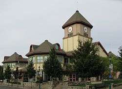
| Town Hall | 49°20′53″N 124°26′38″W / 49.347948°N 124.444027°W | |
| Qualicum Beach Museum | 49°21′01″N 124°26′53″W / 49.350356°N 124.44812°W | |
| Site of former Eaglecrest Lodge | 49°21′29″N 124°24′09″W / 49.357935°N 124.402506°W | Built by General MacRae |
| Heritage Forest | 49°21′07″N 124°25′55″W / 49.35205°N 124.432°W | Brown Property Preservation Society |
| Kwalikum Secondary School | 49°20′54″N 124°26′01″W / 49.348444°N 124.433641°W | |
| Qualicum Beach Airport | 49°20′14″N 124°23′38″W / 49.33722°N 124.39389°W | |
| E and N Railway station | 49°20′58″N 124°26′48″W / 49.349559°N 124.446784°W | |
Image gallery
 1992 History Monuments, 50th anniversary of Qualicum Beach
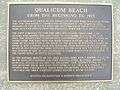 From the beginning to 1913
 From 1913 to 1930
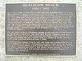 From 1930 to 1992
See also
- General A.D. McRae, who built Eaglecrest.
- Little Qualicum Falls Provincial Park.
- Horne Lake Caves Provincial Park.
- List of former mayors.
- Parksville, British Columbia.
- MacMillan Provincial Park Cathedral Grove
- Qualicum First Nation
- Eswyn Lyster - warbride author
- Englishman River Falls Provincial Park
- Noel Money
References
- ↑ "British Columbia Regional Districts, Municipalities, Corporate Name, Date of Incorporation and Postal Address" (XLS). British Columbia Ministry of Communities, Sport and Cultural Development. Retrieved November 2, 2014.
- ↑ "Selected trend data for Qualicum Beach". Statistics Canada. Retrieved 1 December 2011.
- 1 2 Francis (ed), Daniel (2000) [1999]. Francis, Daniel, ed. Encyclopedia of British Columbia. Harbour Publishing. p. 585. ISBN 1-55017-200-X.
- ↑ Francis (ed), Daniel (2000) [1999]. Francis, Daniel, ed. Encyclopedia of British Columbia. Harbour Publishing. p. 346. ISBN 1-55017-200-X.
- ↑ "Horne Lake". BC Geographical Names.
- ↑ Mackie, Richard Somerset (1995). The Wilderness Profound, Victorian Life on the Gulf of Georgia. Victoria, BC: Sono Nis Press. ISBN 1-55039-058-9.
- ↑ Town of Qualicum Beach web site, Early Days in Qualicum Retrieved October 11, 2006
- ↑ The Homeroom: Qualicum College Retrieved October 11, 2006
- ↑ http://www.archives.gov.on.ca/English/exhibits/d_day/big/big_16_minesweeper.htm Image of HMS Qualicum in Ontario Archives
- ↑ See the Local Government Act, RSBC 1996, chapter 323
- ↑ http://www.civicinfo.bc.ca/election2008/reports/electionresults2008.asp?localgovernmentid=108
- ↑ School District 69 (Qualicum) Board of School Trustees
- ↑ NRGH web site. Retrieved October 11, 2006.
- ↑ Environment Canada, Canadian Climate Normals 1971-2000, Qualicum River
- ↑ BC Ministry of Environment: Soils Of Southeast Vancouver Island Parksville, Qualicum Beach, Courtenay, And Port Alberni Areas, Jurgen, 1989 ISBN 0-7726-0907-1
- ↑ The Ecology of the Coastal Douglas Fir Zone Ministry of Forests, March 1999
- ↑ Environment Canada—Canadian Climate Normals 1981-2010 Station Data, accessed 7 November 2016
External links
| Wikivoyage has a travel guide for Parksville-Qualicum Beach. |
| Wikimedia Commons has media related to Qualicum Beach, British Columbia. |
- Town information and tourism Web Site
- Town of Qualicum Beach Web Site
- Qualicum Beach & Parksville Regional Tourism
- Qualicum Beach at DMOZ
- Image of HMS Qualicum at Archives of Ontario
| Subdivisions |  | |
|---|---|---|
| Communities | ||
| Metro areas and agglomerations | ||
| Towns | ||
| ||