Qir
| Qir قير | |
|---|---|
| city | |
 Qir | |
| Coordinates: 28°28′57″N 53°02′05″E / 28.48250°N 53.03472°ECoordinates: 28°28′57″N 53°02′05″E / 28.48250°N 53.03472°E | |
| Country |
|
| Province | Fars |
| County | Qir and Karzin |
| Bakhsh | Central |
| Elevation | 771 m (2,530 ft) |
| Population (2006) | |
| • Total | 16,839 |
| Time zone | IRST (UTC+3:30) |
| • Summer (DST) | IRDT (UTC+4:30) |
Qir (Persian: قير, also Romanized as Qīr)[1] is a city in and the capital of Qir and Karzin County, Fars Province, Iran. At the 2006 census, its population was 16,839, in 3,722 families.[2] It has an altitude of 771 metres (2,530 ft).[3]
On 10 April 1972, Qir was completely destroyed by a large earthquake, killing 3,399 people, two-thirds of the population at that time.[4]:128
References
- ↑ Qir can be found at GEOnet Names Server, at this link, by opening the Advanced Search box, entering "-3080296" in the "Unique Feature Id" form, and clicking on "Search Database".
- ↑ "Census of the Islamic Republic of Iran, 1385 (2006)". Islamic Republic of Iran. Archived from the original (Excel) on 2011-11-11.
- ↑ Location of Qir - Falling Rain Genomics
- ↑ Razani, R.; Lee K.L. (1973). The Engineering Aspects of the Qir Earthquake of 10 April 1972 in Southern Iran. National Academy of Sciences. p. 144. Retrieved 28 July 2012.
| Capital | 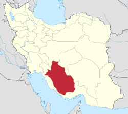 | ||||||||||||||||||||||||||||||||||||||||||||||||||||||||||||||
|---|---|---|---|---|---|---|---|---|---|---|---|---|---|---|---|---|---|---|---|---|---|---|---|---|---|---|---|---|---|---|---|---|---|---|---|---|---|---|---|---|---|---|---|---|---|---|---|---|---|---|---|---|---|---|---|---|---|---|---|---|---|---|---|
| Counties (A-K) and cities | |||||||||||||||||||||||||||||||||||||||||||||||||||||||||||||||
| Counties (L-Z) and cities | |||||||||||||||||||||||||||||||||||||||||||||||||||||||||||||||
| Landmarks |
| ||||||||||||||||||||||||||||||||||||||||||||||||||||||||||||||
| populated places | |||||||||||||||||||||||||||||||||||||||||||||||||||||||||||||||
This article is issued from Wikipedia - version of the 11/6/2016. The text is available under the Creative Commons Attribution/Share Alike but additional terms may apply for the media files.