Qena
| Qena قنا Kena | |
|---|---|
 | |
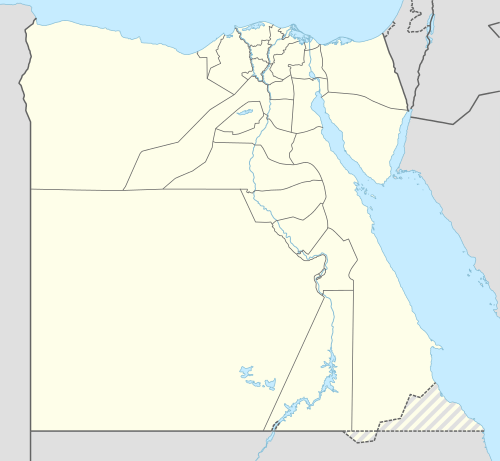 Qena Location in Egypt | |
| Coordinates: 26°10′12″N 32°43′38″E / 26.17000°N 32.72722°E | |
| Country | Egypt |
| Governorate | Qena |
| Elevation | 75 m (246 ft) |
| Population (2012) | |
| • Total | 230,392 |
| Time zone | EET (UTC+2) |
| Area code(s) | (+20) 96 |
Qena (Arabic: قنا Qinā , Egyptian Arabic: [ˈʔenæ], locally: [ˈɡena]) is a city in Upper Egypt, and the capital of the Qena Governorate. Situated on the east bank of the Nile, it was known in antiquity as Kaine (Greek Καινή, meaning "new (city)"; Latinized transliteration: Caene) and Maximianopolis.[1][2]
Overview

This provincial capital is located about 57 miles from El Balyana and 39 miles north of Luxor. It is most famous for its proximity to the ruins of Dendara. It owes its modern prosperity to the opening of the Wadi Qena towards the Red Sea, which is a major traffic route between Upper Egypt and the Red Sea. Tourists traveling between Luxor and the Red Sea will assuredly pass through this city since there is only one good road connection. Qena is noted for its pottery, in particular the porous water.
In addition to its Ancient Egyptian heritage as the city of Cainepolis. Qena has a considerable Islamic heritage and a famous mosque. The Maghrebi Abd el-Rahim settled in Qena upon his return from Mecca and founded a Sufi center here. Upon his death in 1195, the mosque was built above his tomb and became a place of pilgrimage. There is a huge modern mosque of Sheikh el-Qenawi in the main square which attests to his importance.
Qena has witnessed major restorations, and came third in the UNESCO City Beauty contest.
Climate
Qena has a hot desert climate (BWh) according to Köppen climate classification, with very hot summers and very little precipitation year round. Winters are warm at days, but become cool at nights. The hottest months on average are equally July and August, while the coolest month is January. Luxor, Minya, Qena and Asyut have the widest difference of temperatures between days and nights of any city in Egypt, with almost 16 °C (29 °F) difference.
The hottest temperature recorded was on May 15, 1991 which was 50 °C (122 °F) and the coldest temperature was on January 6, 1989 which was −1 °C (30 °F).[3]
| Climate data for Qena, Egypt | |||||||||||||
|---|---|---|---|---|---|---|---|---|---|---|---|---|---|
| Month | Jan | Feb | Mar | Apr | May | Jun | Jul | Aug | Sep | Oct | Nov | Dec | Year |
| Record high °C (°F) | 33 (91) |
37 (99) |
43 (109) |
46 (115) |
50 (122) |
50 (122) |
49 (120) |
49 (120) |
46 (115) |
44 (111) |
40 (104) |
37 (99) |
50 (122) |
| Average high °C (°F) | 21.4 (70.5) |
23.7 (74.7) |
28.1 (82.6) |
33.6 (92.5) |
38.4 (101.1) |
39.8 (103.6) |
39.8 (103.6) |
39.8 (103.6) |
36.6 (97.9) |
33.7 (92.7) |
28.4 (83.1) |
23.2 (73.8) |
32.21 (89.98) |
| Daily mean °C (°F) | 13.4 (56.1) |
15.2 (59.4) |
19.5 (67.1) |
24.8 (76.6) |
29.8 (85.6) |
31.4 (88.5) |
31.8 (89.2) |
32 (90) |
29.1 (84.4) |
26.1 (79) |
20.4 (68.7) |
15.2 (59.4) |
24.06 (75.33) |
| Average low °C (°F) | 5.4 (41.7) |
6.7 (44.1) |
10.9 (51.6) |
16 (61) |
21.2 (70.2) |
23.1 (73.6) |
23.8 (74.8) |
24.2 (75.6) |
21.7 (71.1) |
18.5 (65.3) |
12.4 (54.3) |
7.3 (45.1) |
15.93 (60.7) |
| Record low °C (°F) | −1 (30) |
−1 (30) |
1 (34) |
6 (43) |
12 (54) |
12 (54) |
15 (59) |
13 (55) |
13 (55) |
10 (50) |
1 (34) |
0 (32) |
−1 (30) |
| Average precipitation mm (inches) | 0 (0) |
0 (0) |
0 (0) |
0 (0) |
0 (0) |
0 (0) |
0 (0) |
0 (0) |
0 (0) |
0 (0) |
0 (0) |
0 (0) |
0 (0) |
| Source #1: Climate-Data.org[4] | |||||||||||||
| Source #2: Voodoo Skies[3] for record temperatures | |||||||||||||
Transportation
Qena has a network of streets, roads and highways with greenery and flowered pavements. From the city there is a road that crosses the Eastern Desert to port Safaga on the Red Sea.
The United States Air Force conducted classified operations from Wadi Qena airfield from the 1970s to the 1990s, under the code names Coronet Scabbard, Coronel Aspen, Coronet Drake, and Coronet Mallard.[5] The 4401st Combat Support Squadron (Provisional) maintained a near-constant CENTAF presence there. Part of these operations probably included Lockheed MC-130 flights during the Desert One rescue attempts for the U.S. hostages in Tehran in the late 1970s.[6]
See also
References
- ↑ Trismegistos, "Kaine (Qena)"
- ↑ Alan B. Lloyd (editor), A Companion to Ancient Egypt (John Wiley & Sons 2010 ISBN 978-1-44432006-0), p. 459
- 1 2 "Qena, Egypt". Voodoo Skies. Retrieved 22 June 2013.
- ↑ "Climate: Qena - Climate graph, Temperature graph, Climate table". Climate-Data.org. Retrieved 14 August 2013.
- ↑ William Arkin, Code Names, 325.
- ↑ Thigpen, Col. Jerry L. (2001). The Praetorian STARShip: The Untold Story of the Combat Talon, Air University Press/Diane Publishing. ISBN 1-58566-103-1, p. 196, 213-215.
External links
Coordinates: 26°10′N 32°43′E / 26.167°N 32.717°E