QGIS
|
| |
|
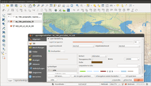
QGIS 2.2 showing the redesigned menus. | |
| Developer(s) | QGIS Development Team |
|---|---|
| Initial release | July 2002 |
| Stable release |
2.18.1 (Las Palmas)[1]
/ October 21, 2016 |
| Repository |
github |
| Written in | C++, Python, Qt |
| Platform | Windows, Linux, Mac OS X, Android(beta) |
| Available in | Multilingual |
| Type | Geographic information system |
| License | GNU GPL |
| Website |
qgis |
QGIS (previously known as Quantum GIS) is a cross-platform free and open-source desktop geographic information system (GIS) application that provides data viewing, editing, and analysis.[2]
Functionality
Similar to other software GIS systems, QGIS allows users to create maps with many layers using different map projections. Maps can be assembled in different formats and for different uses.[2] QGIS allows maps to be composed of raster or vector layers. Typical for this kind of software, the vector data is stored as either point, line, or polygon-feature. Different kinds of raster images are supported, and the software can georeference images.
Advanced functions
QGIS integrates with other open-source GIS packages, including PostGIS, GRASS GIS, and MapServer to give users extensive functionality.[3] Plugins written in Python or C++ extend QGIS's capabilities. Plugins can geocode using the Google Geocoding API, perform geoprocessing using fTools, which are similar to the standard tools found in ArcGIS, and interface with PostgreSQL/PostGIS, SpatiaLite and MySQL databases.
Development
Gary Sherman began development of Quantum GIS in early 2002, and it became an incubator project of the Open Source Geospatial Foundation in 2007.[4] Version 1.0 was released in January 2009.[5]
Written in C++, QGIS makes extensive use of the Qt library.[3] QGIS allows integration of plugins developed using either C++ or Python. In addition to Qt, required dependencies of QGIS include GEOS and SQLite. GDAL, GRASS GIS, PostGIS, and PostgreSQL are also recommended, as they provide access to additional data formats.[6]
QGIS runs on multiple operating systems including Mac OS X, Linux, UNIX, and Microsoft Windows. For Mac users, the advantage of QGIS over GRASS GIS is that it does not require the X11 windowing system in order to run, and the interface is much cleaner and faster. QGIS can also be used as a graphical user interface to GRASS. QGIS has a small file size compared to commercial GIS's and requires less RAM and processing power; hence it can be used on older hardware or running simultaneously with other applications where CPU power may be limited.
QGIS is maintained by volunteer developers who regularly release updates and bug fixes. As of 2012, developers have translated QGIS into 48 languages and the application is used internationally in academic and professional environments.
Release history
| Version | Codename | Release date | Significant changes |
|---|---|---|---|
| 0.0.1-alpha | July 2002 | Import and view data from PostGIS[7] | |
| 0.0.3-alpha | 10 August 2002 | Added support for shapefiles and other vector formats.[7] | |
| 0.0.4-alpha | 15 August 2002 | Improvements in layers handling, colorize layers, and view properties in a dialog box.[7] | |
| 0.0.5-alpha | 5 October 2002 | Bug fixes and improved stability, ability to set line widths, and improved zoom in/out functionality.[7] | |
| 0.0.6 | 24 November 2002 | Improvements to PostGIS connections, layer identify function added, and ability to view and sort attribute tables.[7] | |
| 0.0.7 | 30 November 2002 | ||
| 0.0.8 | 11 December 2002 | ||
| 0.0.9 | 25 January 2003 | ||
| 0.0.10 | 13 May 2003 | ||
| 0.0.11 | 10 June 2003 | ||
| 0.0.12 | 10 June 2003 | ||
| 0.0.13 | 8 December 2003 | ||
| 0.1pre1 | 14 February 2004 | Added support for raster data; single, continuous, and graduated shading for vector data; ability to create buffers, implemented as a PostGIS plugin.[8][9] | |
| 0.1 | Moroz | 25 February 2004 | |
| 0.2 | Pumpkin | 26 April 2004 | |
| 0.3 | Madison | 28 May 2004 | |
| 0.4 | Baby | 4 July 2004 | |
| 0.5 | Bandit | 5 October 2004 | |
| 0.6 | Simon | 19 December 2004 | |
| 0.7 | Seamus | ||
| 0.7.3 | 11 October 2005 | ||
| 0.8 | 7 January 2007 | ||
| 0.8.1 | Titan | 15 June 2007 | |
| 0.9.0 | 26 October 2007 | ||
| 0.9.1 | Ganymede | 6 January 2008 | |
| 0.10 | Io | 3 May 2008 | |
| 0.11 | Metis | 21 July 2008 | |
| 1.0 | Kore | 5 January 2009 | |
| 1.1 | Pan | 12 May 2009 | |
| 1.2 | Daphnis | 1 September 2009 | |
| 1.3 | Mimas | 20 September 2009 | |
| 1.4 | Enceladus | 10 January 2010 | |
| 1.5 | Tethys | 29 July 2010 | |
| 1.6 | Copiapó | 27 November 2010 | |
| 1.7 | Wrocław | 19 June 2011 | |
| 1.8 | Lisboa | 21 June 2012 | "Mojibake" in Japanese environment. |
| 2.0 | Dufour | 8 September 2013 | New vector API, integration of SEXTANTE geoprocessor, symbology and labeling overhaul. |
| 2.2 | Valmiera | 22 February 2014 | [10][11] |
| 2.4 | Chugiak | 27 June 2014 | 2.4.0 changelog |
| 2.6 | Brighton | 1 November 2014 | 2.6.0/ changelog |
| 2.8 | Wien | 20 February 2015 | |
| 2.10 | Pisa | 26 June 2015 | |
| 2.12 | Lyon | 23 October 2015 | |
| 2.14 LTR | Essen | 29 February 2016 | |
| 2.16 | Nødebo | 8 July 2016 | |
| 2.18 | Las Palmas | 2016-10-21 | Last release in the 2.x series! |
| 3.0 | ? | end of Q1 of 2017 | 2016-01-17: Plan for QGIS 3.0: based upon Qt5 (Qt 5.6 LTS as released on 16 March 2016?) and PyQt5 and Python 3 (KDE_Frameworks 5.25 requires at least Qt 5.5) |
| Old version Older version, still supported Latest version Future release | |||
Licensing
As a free software application under the GNU GPL, QGIS can be freely modified to perform different or more specialized tasks. Two examples are the QGIS Browser and QGIS Server applications, which use the same code for data access and rendering, but present different front-end interfaces. There are also numerous plug-ins available which expand the software's core functionality.
Data formats
QGIS supports dxf, shapefiles, coverages, and personal geodatabases. MapInfo, PostGIS, and a number of other formats.[12] Web services, including Web Map Service and Web Feature Service, are also supported to allow use of data from external sources.[3]
Adoption
A number of public and private organizations have adopted QGIS. Among others, these are the Austrian state Vorarlberg, and the Swiss Cantons Canton of Glarus and Canton of Solothurn.[13]
Mobile version

A mobile version of QGIS is currently being developed for Android.[14] This version is optimized for touch, multitouch or stylus input. Geolocation of the mobile device can be used to create GIS features at the users current position.
References
- ↑ http://changelog.qgis.org/en/qgis/version/2.18.0/
- 1 2 "QGIS Official Website". QGIS. Retrieved 16 October 2013.
- 1 2 3 Cavallini, Paolo (August 2007). "Free GIS desktop and analyses: QuantumGIS, the easy way". The Global Geospatial Magazine.
- ↑ OSGeo (February 2008). "OSGeo Annual Report 2007".
- ↑ Tim Sutton (January 23, 2009). "Announcing the release of QGIS 1.0 'Kore'". Retrieved 2009-01-26.
- ↑ "Project details for Quantum GIS - Quantum GIS 0.9.0". Freshmeat. Retrieved 2008-12-31.
- 1 2 3 4 5 "QGIS Change Log". Open Source Geospatial Foundation. 2004-03-09. Retrieved 2008-12-13.
- ↑ "README for QGIS version 0.1pre1 'Moroz'". Open Source Geospatial Foundation. Retrieved 2008-12-31.
- ↑ "Quantum GIS 0.1pre1 (Development)". Freshmeat News. Freshmeat. 2004-02-14. Retrieved 2008-12-31.
- ↑ "QGIS Development - Road Map". Retrieved 4 February 2014.
- ↑ Fischer, Jürgen E. "Announcing the release of QGIS 2.2". OSGeo.org. Retrieved 22 February 2014.
- ↑ Gray, James (2008-03-26). "Getting Started With Quantum GIS". Linux Journal.
- ↑ "QuantumGIS (QGIS) – freie GIS-Software". Land Vorarlberg. Retrieved 12 October 2013.
- ↑ "QGIS for Android". Retrieved 25 September 2014.
External links
| Wikimedia Commons has media related to QGIS. |
- Official website
- QGIS Blog
- QGIS Podcast
- QGIS Blogposts
- QGIS - Map Showcase (Flickr)
- QGIS - Screenshots (Flickr)
| Software Compilation | |||||||||||||||||||||||||||||||||||||||||||||||||
|---|---|---|---|---|---|---|---|---|---|---|---|---|---|---|---|---|---|---|---|---|---|---|---|---|---|---|---|---|---|---|---|---|---|---|---|---|---|---|---|---|---|---|---|---|---|---|---|---|---|
| KDE Core Applications |
| ||||||||||||||||||||||||||||||||||||||||||||||||
| Platform |
| ||||||||||||||||||||||||||||||||||||||||||||||||
| Packages | |||||||||||||||||||||||||||||||||||||||||||||||||
| Community | |||||||||||||||||||||||||||||||||||||||||||||||||
| People | |||||||||||||||||||||||||||||||||||||||||||||||||
| |||||||||||||||||||||||||||||||||||||||||||||||||