Put-in-Bay, Ohio
| Put-in-Bay, Ohio | ||
|---|---|---|
| Village | ||
|
View from atop the observation deck of the Perry Memorial, looking down into the village's downtown area and DeRiveria Park (wooded area to the right) | ||
| ||
 Location of Put-in-Bay, Ohio | ||
 Location of Put-in-Bay in Ottawa County | ||
| Coordinates: 41°39′11″N 82°49′3″W / 41.65306°N 82.81750°WCoordinates: 41°39′11″N 82°49′3″W / 41.65306°N 82.81750°W | ||
| Country | United States | |
| State | Ohio | |
| County | Ottawa | |
| Township | Put-in-Bay | |
| Government | ||
| • Mayor | Judith A. Berry | |
| Area[1] | ||
| • Total | 0.63 sq mi (1.63 km2) | |
| • Land | 0.45 sq mi (1.17 km2) | |
| • Water | 0.18 sq mi (0.47 km2) | |
| Elevation | 595 ft (181 m) | |
| Population (2010)[2] | ||
| • Total | 138 | |
| • Estimate (2014[3]) | 138 | |
| • Density | 306.7/sq mi (118.4/km2) | |
| Time zone | EST (UTC-5) | |
| • Summer (DST) | EDT (UTC-4) | |
| Area code(s) | 419 | |
| Website | http://villageofpib.com/ | |


Put-in-Bay is a village located on South Bass Island in Put-in-Bay Township, Ottawa County, Ohio, United States. The population was 138 at the 2010 census. The bay played a significant role in the War of 1812 as the location of the squadron of U.S. naval commander Oliver Hazard Perry, who sailed from the port on September 10, 1813 to engage a British squadron just north of the island in the Battle of Lake Erie. The village is a popular summer resort and recreational destination. Ferry and airline services connect the community with Catawba Island, Kelleys Island, Port Clinton, and Sandusky, Ohio.
Geography
Put-in-Bay is located 15 miles (24 km) northwest of Sandusky, at 41°39′11″N 82°49′3″W / 41.65306°N 82.81750°W (41.653006, -82.817620).[5]
According to the United States Census Bureau, the village has a total area of 0.63 square miles (1.63 km2), of which 0.45 square miles (1.17 km2) is land and 0.18 square miles (0.47 km2) is water.[1]
History of name
The name "Put-in-Bay" originally only referred to the bay itself. In the latter-1700s, the schooners sailing on Lake Erie would "put in" to this bay, to wait out bad weather on Lake Erie. (Many of the unfamiliar sailors used the slang phonetic term, puddin' (or pudding) bay,[6] resulting in later local-historians' attempt to attribute various explanations for the term "pudding bay", which, in reality, had no meaning, but was simply a slang phonetic variant of "Put-in-Bay".)
In 1820 and 1830, the island was under the jurisdiction of Huron County, Ohio; but later joined to Ottawa County, Ohio. It was after 1830 when Put-in-Bay Township was finally established. The island was only very sparsely inhabited and there was no actual village here prior to the creation of Put-in-Bay Township.[7] The first known Caucasian resident on the island was Alexander Ewen, who had about 1000 hogs roaming the island in 1810.[8]
Demographics
| Historical population | |||
|---|---|---|---|
| Census | Pop. | %± | |
| 1880 | 381 | — | |
| 1890 | 282 | −26.0% | |
| 1900 | 317 | 12.4% | |
| 1910 | 259 | −18.3% | |
| 1920 | 216 | −16.6% | |
| 1930 | 226 | 4.6% | |
| 1940 | 202 | −10.6% | |
| 1950 | 191 | −5.4% | |
| 1960 | 357 | 86.9% | |
| 1970 | 135 | −62.2% | |
| 1980 | 146 | 8.1% | |
| 1990 | 141 | −3.4% | |
| 2000 | 128 | −9.2% | |
| 2010 | 138 | 7.8% | |
| Est. 2015 | 136 | [9] | −1.4% |
2010 census
As of the census[2] of 2010, there were 138 people, 70 households, and 43 families residing in the village. The population density was 306.7 inhabitants per square mile (118.4/km2). There were 263 housing units at an average density of 584.4 per square mile (225.6/km2). The racial makeup of the village was 100.0% White.
There were 70 households of which 17.1% had children under the age of 18 living with them, 52.9% were married couples living together, 4.3% had a female householder with no husband present, 4.3% had a male householder with no wife present, and 38.6% were non-families. 32.9% of all households were made up of individuals and 10% had someone living alone who was 65 years of age or older. The average household size was 1.94 and the average family size was 2.44.
The median age in the village was 54.7 years. 15.2% of residents were under the age of 18; 2.2% were between the ages of 18 and 24; 15.1% were from 25 to 44; 38.4% were from 45 to 64; and 29% were 65 years of age or older. The gender makeup of the village was 52.9% male and 47.1% female.
2000 census
| Largest ancestries (2000) | Percent |
|---|---|
| German | 54.4% |
| Ireland | 18.8% |
| Italian | 11.4% |
| Hungarian | 6.7% |
| Russian | 5.4% |
| Polish | 4.7% |
| Scottish | 4.7% |
As of the census[11] of 2000, there were 128 people, 67 households, and 36 families residing in the village. The population density was 279.2 persons per square mile (107.4/km²). There were 179 housing units at an average density of 390.5 per square mile (150.2/km²). The racial makeup of the village was 99.22% White and 0.78% from two or more races.
There were 67 households out of which 16.4% had children under the age of 18 living with them, 49.3% were married couples living together, 4.5% had a female householder with no husband present, and 44.8% were non-families. 41.8% of all households were made up of individuals and 6.0% had someone living alone who was 65 years of age or older. The average household size was 1.91 and the average family size was 2.59.
In the village the population was spread out with 15.6% under the age of 18, 4.7% from 18 to 24, 25.8% from 25 to 44, 38.3% from 45 to 64, and 15.6% who were 65 years of age or older. The median age was 47 years. For every 100 females there were 124.6 males. For every 100 females age 18 and over, there were 116.0 males.
The median income for a household in the village was $52,917, and the median income for a family was $80,000. Males had a median income of $47,083 versus $38,750 for females. The per capita income for the village was $35,301. None of the population was below the poverty line.
Education
The village is home to Put-in-Bay High School. Aside from South Bass Island, Put-In-Bay Local School District covers the Lake Erie Islands of Buckeye Island, Gibraltar Island, Green Island, Mouse Island, Rattlesnake Island, and Starve Island, even though most of these islands are uninhabited.[12]
Climate
| Climate data for Put-in-Bay | |||||||||||||
|---|---|---|---|---|---|---|---|---|---|---|---|---|---|
| Month | Jan | Feb | Mar | Apr | May | Jun | Jul | Aug | Sep | Oct | Nov | Dec | Year |
| Record high °F (°C) | 66 (19) |
70 (21) |
81 (27) |
89 (32) |
92 (33) |
104 (40) |
104 (40) |
103 (39) |
97 (36) |
91 (33) |
79 (26) |
68 (20) |
104 (40) |
| Average high °F (°C) | 31.9 (−0.1) |
34.2 (1.2) |
43.1 (6.2) |
55.3 (12.9) |
66.2 (19) |
76.1 (24.5) |
80.8 (27.1) |
79.6 (26.4) |
72.8 (22.7) |
60.6 (15.9) |
48.9 (9.4) |
36.0 (2.2) |
57.2 (14) |
| Daily mean °F (°C) | 25.8 (−3.4) |
28.0 (−2.2) |
36.1 (2.3) |
47.7 (8.7) |
59.1 (15.1) |
69.2 (20.7) |
74.1 (23.4) |
73.1 (22.8) |
66.3 (19.1) |
54.1 (12.3) |
43.1 (6.2) |
30.9 (−0.6) |
50.7 (10.4) |
| Average low °F (°C) | 19.6 (−6.9) |
21.8 (−5.7) |
29.2 (−1.6) |
40.1 (4.5) |
52.0 (11.1) |
62.3 (16.8) |
67.4 (19.7) |
66.7 (19.3) |
59.7 (15.4) |
47.6 (8.7) |
37.3 (2.9) |
25.9 (−3.4) |
44.2 (6.8) |
| Record low °F (°C) | −18 (−28) |
−19 (−28) |
−2 (−19) |
13 (−11) |
30 (−1) |
40 (4) |
41 (5) |
50 (10) |
37 (3) |
24 (−4) |
6 (−14) |
−14 (−26) |
−19 (−28) |
| Average precipitation inches (mm) | 1.91 (48.5) |
1.68 (42.7) |
2.42 (61.5) |
3.03 (77) |
3.72 (94.5) |
3.23 (82) |
3.45 (87.6) |
3.29 (83.6) |
2.95 (74.9) |
2.67 (67.8) |
2.65 (67.3) |
2.19 (55.6) |
33.19 (843) |
| Average snowfall inches (cm) | 6.4 (16.3) |
5.2 (13.2) |
2.9 (7.4) |
0.4 (1) |
0.0 (0) |
0.0 (0) |
0.0 (0) |
0.0 (0) |
0.0 (0) |
0.0 (0) |
0.6 (1.5) |
4.5 (11.4) |
19.9 (50.5) |
| Average precipitation days (≥ 0.01 in) | 9.7 | 8.5 | 9.9 | 11.2 | 11.0 | 9.2 | 8.2 | 8.0 | 8.2 | 8.5 | 9.6 | 9.9 | 113.9 |
| Source #1: NOAA (normals 1981-2010)[13] | |||||||||||||
| Source #2: Weatherbase [14] | |||||||||||||
Transportation
Ohio state routes
Airport
- Put-in-Bay Airport offers a single, unlit, paved 2870-foot runway in addition to a helipad.[15]
- North Bass Island Airport located on North Bass Island, offers a 1,804 ft (550 m) (549.9 m) paved airstrip.[16]
Tourism
For most of its history, the island's primary industry has been tourism and continues to be today. The tourist season runs roughly between April and October. The most common methods of transportation to and from the island are via ferry boat, propeller-driven aircraft and private boat.
One of the world's largest hotels, the Hotel Victory, opened its 625 rooms to the public in 1892. The four-story hotel featured a one-thousand-seat dining room. However, on August 14, 1919, the giant hotel burned to the ground. Today only parts of the foundations can be seen at the state campground.[17]
Put-in-Bay is the site of Perry's Victory and International Peace Memorial commemorating Commodore Oliver Hazard Perry's September 10, 1813 naval victory over British ships in the War of 1812. Construction of the monument began in 1912 and it opened to the public on June 13, 1915. It is 352 feet (107 m) tall and made up of 78 layers of pink granite, topped with an eleven ton (10 metric ton) bronze urn. Its height makes it the highest open-air observatory operated by the U.S. National Park Service. The remains of six naval officers, three British and three Americans, were interred beneath the floor of the monument's rotunda.
Other historical sites include:
- Stonehenge Estate – An estate with 19th-century buildings that are listed on the National Register of Historic Places.
- Perry's Cave – Cave discovered by Native Americans. Perry sent men here during the War of 1812 (Battle of Lake Erie). Has an underground lake from which Perry's men obtained drinking water, after previously drinking from the bacteria filled Lake Erie water and getting sick. The water in the cave was clean and thus by drinking it, his men returned to health in order to win the battle.
- Heineman's winery and Crystal Cave – the world's largest geode.
- Lake Erie Islands Historical Society – 6,000 square foot (560 m²) museum that houses artifacts, memorabilia and genealogical data pertinent to the Lake Erie Islands.
There are under 150 full-time (South Bass Island) residents, most of whom remain on the island over the winter. Supplies and perishables are flown to the island during the winter months along with the mail, parcels and bank employees who staff the island's only bank (for one day a week) until the spring. The island has a single school that is used for grades kindergarten through 12 and serves the educational requirements of Middle Bass and North Bass islands. These students arrive by plane, boat or ATV across the frozen lake depending on the season and weather.
Put-in-Bay has one grocery store, one hardware store, one school - which houses the one lending library branch - one gas station, a post office, one bank and two cemeteries. It has one seasonal franchise restaurant, Subway. There is no cinema. The island does not have a hospital, but does have an Emergency Medical Service that can use a Life Flight helicopter to transport critically ill patients to mainland medical facilities.
In 1952–1959, as well as 1963, the island held road races around a 3-mile (4.8 km) course. In 2011, the Put-in-Bay Road Races Reunion returned to the island. The temporary road course set up at the Put-in-Bay Airport during the 2011 event was a key step in pointing the way to the return of real vintage sports car racing to the island for 2012.
The Boy Scouts of America hold an annual camporee at the base of Perry's Monument.
Gallery


See also
References
- 1 2 "US Gazetteer files 2010". United States Census Bureau. Retrieved 2013-01-06.
- 1 2 "American FactFinder". United States Census Bureau. Retrieved 2013-01-06.
- ↑ "Population Estimates". United States Census Bureau. Retrieved 2015-12-12.
- ↑ Lossing, Benson (1868). The Pictorial Field-Book of the War of 1812. Harper & Brothers, Publishers. p. 517.
- ↑ "US Gazetteer files: 2010, 2000, and 1990". United States Census Bureau. 2011-02-12. Retrieved 2011-04-23.
- ↑ Weld, Isaac; Travels through the states of North America; publ. 1800.
- ↑ 1820 and 1830 United States Federal Census, for Danbury Twp. Huron County, Ohio.
- ↑ letter from Charles Barnum to Z. Wildman, 1810; Zalmon Wildman papers, at the Ohio Historical Society (and copy held by R.B. Hayes library, Fremont, Oh.)
- ↑ "Annual Estimates of the Resident Population for Incorporated Places: April 1, 2010 to July 1, 2015". Retrieved July 2, 2016.
- ↑ "Census of Population and Housing". Census.gov. Retrieved June 4, 2015.
- ↑ "American FactFinder". United States Census Bureau. Retrieved 2008-01-31.
- ↑ http://www.ottawacountyauditor.org/Map.aspx Ottawa County Auditor, School District Basemap. Retrieved May 28, 2014.
- ↑ "Station Name: Put-in-Bay, Ohio". National Oceanic and Atmospheric Administration. Retrieved March 3, 2013.
- ↑ "Weatherbase: Historical Weather for Put-in-Bay, Ohio". Weatherbase. Retrieved 8 May 2012.
- ↑ Airport Data Dot Com accessed 20 June 2012
- ↑ "North Bass Island". FAA. Retrieved 3 April 2013.
- ↑ Volgenau, Gerry (2005). Islands : Great Lakes stories. Ann Arbor, Michigan: Ann Arbor Media Group LLC. pp. 23–29. ISBN 1-58726-128-6.
External links
| Wikimedia Commons has media related to Put-in-Bay, Ohio. |
| Wikivoyage has a travel guide for Put-in-Bay. |
- Official website
- Chamber of Commerce & Visitors Bureau
- Lake Erie Islands Historical Society
- Put-In-Bay at DMOZ
Municipalities and communities of Ottawa County, Ohio, United States | ||
|---|---|---|
| City | 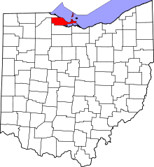 | |
| Villages | ||
| Townships | ||
| CDPs | ||
| Unincorporated communities | ||
| Footnotes | ‡This populated place also has portions in an adjacent county or counties | |