Punta Rassa, Florida
| Punta Rassa, Florida | |
|---|---|
| CDP | |
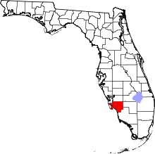
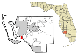 Location in Lee County and the state of Florida | |
| Coordinates: 26°31′N 82°0′W / 26.517°N 82.000°WCoordinates: 26°31′N 82°0′W / 26.517°N 82.000°W | |
| Country |
|
| State |
|
| County | Lee |
| Area | |
| • Total | 4.5 sq mi (11.6 km2) |
| • Land | 2.4 sq mi (6.1 km2) |
| • Water | 2.1 sq mi (5.5 km2) |
| Elevation | 3 ft (1 m) |
| Population (2010) | |
| • Total | 1,750 |
| • Density | 384.7/sq mi (149.2/km2) |
| Time zone | Eastern (EST) (UTC-5) |
| • Summer (DST) | EDT (UTC-4) |
| FIPS code | 12-59250[1] |
| GNIS feature ID | 0289383[2] |
Punta Rassa is a census-designated place (CDP) in Lee County, Florida, United States. The population was 1,750 at the 2010 census. It is part of the Cape Coral–Fort Myers Metropolitan Statistical Area.
Geography
Punta Rassa is located at 26°31′N 82°0′W / 26.517°N 82.000°W (26.5104, -81.9988).[3]
According to the United States Census Bureau, the CDP has a total area of 4.5 square miles (12 km2), of which 2.4 square miles (6.2 km2) is land and 2.1 square miles (5.4 km2) (47.66%) is water.
History
The location was named "Punta Rasca" (Spanish for "smooth or flat point" and later corrupted to "Punta Rassa") by the Spanish Conquistadors in the mid-16th century, who unloaded cattle in the area.
Punta Rassa was a thriving cattle shipping town in the 1800s. Florida cattle would be loaded at the port onto ships destined for Cuba. It was one of the home bases for the "King of the Cracker Cowboys" Jake Summerlin, who by the time he was 40 was one of the wealthiest of the Florida cattle barons. The town of Punta Rassa was lined with wooden buildings, including a hotel and several bars, which were frequented by the many merchants and cattle sellers.
Between 1835 and 1865, Punta Rassa was a site of many Indian skirmishes during the Seminole Indian Wars. As a result, Fort Dulany was built there in 1838, as an army supply depot. A hurricane destroyed Fort Dulany in October 1841, and the military was forced to look for a site less exposed to storms from the Gulf of Mexico. As a result of the search, Fort Harvie was built on the grounds that now comprise downtown Fort Myers. Fort Dulany was rebuilt and later used again during the Civil War when Punta Rassa again became a thriving southwest Florida port.
At the end of the Civil War, the area was abandoned. In 1866, the International Ocean Cable Company, of Newark, New Jersey (later becoming merged into Western Union), took over the fort and port of Punta Rassa and made it the southernmost point of its cabling system. The company also controlled the shipping rights, pens and the dock. For the use of these facilities, the company usually charged 15 cents a head of cattle. Punta Rassa was the telegraph office that first learned of the sinking of the U.S.S. Maine in Cuba in 1898.
In 1880s, the area became known as a great sport fishing area and was frequented by the wealthy, who came in search of the prized tarpon sport fish. Soon, however, visitors relocated to Boca Grande, 70 miles north of Punta Rassa by land after the Charlotte Harbor and Northern Railway was completed to that destination. Although the distance seems great, these areas are only separated by approximately 25 miles of water.
A railroad line was built towards Punta Rassa in the early 1920s by the Seaboard Air Line Railroad as part of an effort by Seaboard president S. Davies Warfield to reestablish a deepwater port at Punta Rassa. The 8-mile line branched off the Seaboard's main line, which ran along the west bank of the Ten Mile Canal, in South Fort Myers near where Six Mile Cypress Parkway crosses the canal. It ran through where Lakes Park currently sits, and then roughly paralleled what is now Summerlin Road, terminating just east of Punta Rassa at Truckland. Due to their financial state, the Seaboard Air Line Railroad discontinued all operations in the Fort Myers area in 1952. Despite never fully reaching Punta Rassa, the abandoned line is still referred to as Seaboard’s Punta Rassa Branch.[4] An FPL transmission line currently sits on a portion of the Punta Rassa Branch's former right of way just south of Summerlin Road.
The area figured prominently in the 1984 historical novel A Land Remembered, by Patrick D. Smith.
Demographics
As of the census[1] of 2000, there were 1,731 people, 1,015 households, and 481 families residing in the CDP. The population density was 734.8 people per square mile (283.2/km²). There were 1,372 housing units at an average density of 582.4/sq mi (224.5/km²). The racial makeup of the CDP was 99.25% White, 0.35% African American, 0.12% Native American, 0.17% Asian, 0.06% from other races, and 0.06% from two or more races. Hispanic or Latino of any race were 0.23% of the population.
There were 1,015 households out of which 1.5% had children under the age of 18 living with them, 46.7% were married couples living together, 0.5% had a female householder with no husband present, and 52.6% were non-families. 52.0% of all households were made up of individuals and 48.7% had someone living alone who was 65 years of age or older. The average household size was 1.53 and the average family size was 2.09.
In the CDP the population was spread out with 1.5% under the age of 18, 0.5% from 18 to 24, 2.8% from 25 to 44, 12.8% from 45 to 64, and 82.5% who were 65 years of age or older. The median age was 80 years. For every 100 females there were 63.9 males. For every 100 females age 18 and over, there were 64.3 males.
The median income for a household in the CDP was $44,583, and the median income for a family was $66,912. Males had a median income of $73,333 versus $19,583 for females. The per capita income for the CDP was $39,048. None of the families and 1.9% of the population was living below the poverty line, including no under eighteens and 1.3% of those over 64.
References
- 1 2 "American FactFinder". United States Census Bureau. Retrieved 2008-01-31.
- ↑ "US Board on Geographic Names". United States Geological Survey. 2007-10-25. Retrieved 2008-01-31.
- ↑ "US Gazetteer files: 2010, 2000, and 1990". United States Census Bureau. 2011-02-12. Retrieved 2011-04-23.
- ↑ Turner, Gregg M. (December 1, 1999). Railroads of Southwest Florida. Images of America. Arcadia Publishing.
External links
- "Beach Cowmen – A Slice of Local Lore'" by Keri Hendry, a story in the April, 2008 Island Sand Paper
- History of Punta Rassa
- 2005, January 2005, "Sea Stories, Novelist Robert N. Macomber on Florida's waterways," by Robert N. Macomber, Gulfshore Life magazine