Pulau Brani
| Pulau Brani | |
|---|---|
| Name transcription(s) | |
| • Chinese | 布拉尼岛 |
| • Pinyin | Bùlānídǎo |
| • Malay | Pulau Brani |
|
Pulau Brani lies to the right of the Keppel Harbour, as seen in this view from Sentosa's Tiger Sky Tower | |
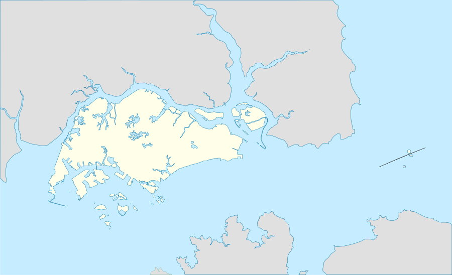 Pulau Brani Location of Pulau Brani within Singapore | |
| Coordinates: 1°15′36″N 103°50′00″E / 1.26000°N 103.83333°ECoordinates: 1°15′36″N 103°50′00″E / 1.26000°N 103.83333°E | |
| Country |
|

Pulau Brani is an island located off the southern coast of Singapore, near Keppel Harbour. The island is situated between the main island of Singapore and the resort island of Sentosa, and is linked to the mainland via Brani Terminal Avenue. The area of Pulau Brani is 1.22 square kilometres (0.47 square miles).
Etymology
Pulau Brani means "Island of the Brave" in Malay (berani means "brave") or "Home of the Warriors". In an 1828 sketch of the island of Singapore, the island is referred to as Po. Ayer Brani.
There are at least three Malay legends and stories pertaining to the island's name. One story propounds that the island got its name because it was the burial ground of old warrior pirates. Another view refers to the island as Pulau Ayer Brani, as recorded in John Turnbull Thomson's 1949 chart, because a stream of fresh water was said to come up from the coastal sea bed or beach, which persisted despite the flow of sea water. The third story has it that there is a well on top of the island, with water of potent qualities. A tank formed of natural rock on the Tanjong Pagar side of the island contained the overflow of water from this well and was used by people for bathing.
Pulau Brani is known as san chu shek tui min in Cantonese, meaning "opposite the new tin smelting" due to a tin smelting plant located on the island in the first half of the twentieth century. The Cantonese also refer to it as cha tin ma thau tui min, meaning "opposite Jardine's jetty".
History
Initially, Pulau Brani only had Malay fishing villages along the coast, such as Telok Saga and Kampong Selat Sengkir. In 1845, G.A. Prinsep proposed building a patent ship at Telok Saga which is on the north side of the island. In 1846, Jacob Chinis published plans for the construction of a dry dock on the same side. One of the great coin divers in the 1930s was Wak Melau who stayed at Telok Saga. His father came from Sumatra but he had stayed all his life at Telok Saga as a coin diver and fisherman.
Interest in Pulau Brani as a military base was already evident before 1822, with the completion of a chart based on a survey of the island and its coast in that year by Captain Franklin, the Quarter Master in the General Surveyor's Department. By March 1889, the island was made into a navy and military fort, following the decision to transfer forts to the islands south of the new harbour at Keppel Harbour. In line with the above, the Commissariat and the Ordnance Department were moved to Pulau Brani.
In 1890, the Straits Trading Company opened a tin smelting plant on Pulau Brani. In February 1942, the plant was destroyed in view of the British surrender of Singapore to the Japanese. However, with the ending of the Japanese Occupation in 1945, the plant was restored and smelting resumed. In 1965, the Straits Trading Company's lease expired and the company soon moved out.
The British army had their maritime (water transport) base here, first with the RASC and then the RCT. Many families lived in the married quarters on the island. Primary children attended the British army school located near Buller Jetty, as did the children from army families on Blakang Mati (now Sentosa). Secondary age children had to go to the mainland by ferry, attending the Alexandra Schools at Gillman Barracks, then after 1964 either Bourne (in the Gillman buildings) or the brand new St John's Comprehensive in what is now the United World College in Dover Road.
Pulau Brani was selected to house a naval base in early 1971 for the then Singapore Maritime Command (now Republic of Singapore Navy). In those days, there were some settlements along the island's coast. In addition, there were the Pulau Brani Sports Club, the Pulau Brani Community Club and two primary schools - Tai Chong and Telok Saga.
In September 1971, work for the development of the naval base commenced, and villagers living on the island were resettled to mainland Singapore. Land reclamation works by the Port of Singapore Authority (PSA) commenced in April 1972. The PSA also carried out the removal of reef, dredging, and widening of Selat Sengkir (the channel between Pulau Brani and Sentosa) in February 1973.
The new naval base, then known as the Singapore Maritime Command Naval Base, was officially opened by former Prime Minister Lee Kuan Yew on 26 January 1974. The base was subsequently renamed Brani Naval Base.
Subsequently, part of the naval base was redeveloped to build Brani Container Terminal. On 12 October 2000, the rest of the base was officially closed when its facilities were moved to Changi Naval Base. The vacant facilities were taken over by the Singapore Police Force's Police Coast Guard for its new headquarters.

References
- Victor R Savage, Brenda S A Yeoh (2003), Toponymics - A Study of Singapore Street Names, Eastern Universities Press, ISBN 981-210-205-1