Pulai River
| Pulai River (Sungai Pulai) | |
| River | |
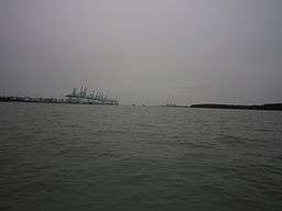 Mouth of Pulai River | |
| Country | Malaysia |
|---|---|
| State | Johor |
| Mouth | |
| - location | Tebrau Straits |
| - elevation | 0 m (0 ft) |
| - coordinates | 1°20′3″N 103°32′58″E / 1.33417°N 103.54944°ECoordinates: 1°20′3″N 103°32′58″E / 1.33417°N 103.54944°E |
| Length | 22 km (14 mi) |
Pulai River (Malay: Sungai Pulai) is a river in Johor, Malaysia.[1] It runs from Mount Pulai until Tanjung Pelepas, draining into the Tebrau Straits. At its mouth lies the single largest seagrass bed in Malaysia[2] which extents all the way to Pulau Merambong. Sungai Pulai is also a Mangrove Forest Reserve.[3] The site is under intensive studies to help managing the vast mangrove ecosystem, with assistant from UTM, and UKM, in line with the Integrated Management Plan for the sustainable use of mangroves in Johore.[4]
Sungai Pulai is also one of Ramsar site, one of the few locations all over the world recognized for its ‘Wetlands of International Importance".[5] Ecotours is being under taken to educate the public and as a part of promoting the ongoing conservation efforts at Sungai Pulai seagrass bed area.
See also
| Wikimedia Commons has media related to Pulai River. |
References
- ↑ Malaysian Nature Society Johor Blog.
- ↑ Mapping of Seagrass Along Sungai Pulai, Johor, Malaysia
- ↑ Remote Sensing for Mapping RAMSAR Heritage Site at Sungai Pulai Mangrove Forest Reserve, Johor, Malaysia
- ↑ Mapping of Seagrass Along Sungai Pulai, Johor, Malaysia.
- ↑ Seagrass bed exploration & mangrove tour, Sungai Pulai Johor