Pucón
| Pucón | ||||||
|---|---|---|---|---|---|---|
| City and Commune | ||||||
|
View of Pucón along Lincoyán street and Villarrica Lake | ||||||
| ||||||
| Coordinates: 39°16′36″S 71°58′28″W / 39.27667°S 71.97444°WCoordinates: 39°16′36″S 71°58′28″W / 39.27667°S 71.97444°W | ||||||
| Country | Chile | |||||
| Region | Araucanía | |||||
| Province | Cautín | |||||
| Foundation | February 27, 1883 | |||||
| Government[1][2] | ||||||
| • Type | Municipality | |||||
| • Alcalde | Carlos Barra Matamala | |||||
| Area[3] | ||||||
| • City and Commune | 1,248.5 km2 (482.0 sq mi) | |||||
| Elevation | 227 m (745 ft) | |||||
| Population (2012 Census)[3] | ||||||
| • City and Commune | 22,081 | |||||
| • Density | 18/km2 (46/sq mi) | |||||
| • Urban | 13,837 | |||||
| • Rural | 7,270 | |||||
| Sex[3] | ||||||
| • Men | 10,705 | |||||
| • Women | 10,402 | |||||
| Time zone | CLT (UTC−4) | |||||
| • Summer (DST) | CLST (UTC−3) | |||||
| Area code(s) | country 56 + city 45 | |||||
| Website |
www | |||||


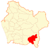
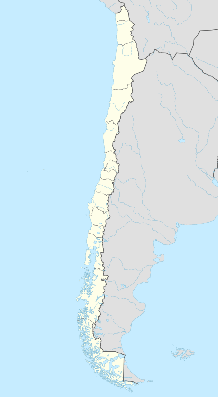
Pucón (Mapudungun: "entrance to the cordillera") is a Chilean city and commune administered by the municipality of Pucón. It is located in the Province of Cautín, Araucanía Region, 100 km to the southeast of Temuco and 780 km to the south of Santiago. It is on the eastern shore of Lake Villarrica, and Villarrica volcano is located roughly 17 km to the south.
Pucón's location by a lake and volcano, along with its relatively stable climate, especially in summer,[4] make it a popular destination for tourists. It offers a variety of sports and adventure/recreational activities for tourists, including water skiing, snow skiing, backpacking, white water rafting and kayaking, horse back riding, natural hot springs, zip line rides, skydiving and guided ascents of Villarrica volcano.
History
Pucón was established in 1883 as a fort in the aftermath of the Occupation of Araucanía when the Chilean state subdued the native population of Araucanía Region. It was a strategically advantageous spot because of its location at entrance of the Trancura Valley, where the Argentinean army had once pursued a group of Mapuches through Mamuil Malal Pass during the Conquest of the Desert.
The first hotel in Pucón was the Gudenschwager, established in 1923, but it was in 1934 with the establishment of Gran Hotel Pucón that tourism became a popular activity in the area. In 1940 the first road between Villarrica and Pucón was built and in the 1970s the road to Caburgua Lake was finished.
Demographics
According to the 2002 census carried out by the Chilean National Statistics Institute, Pucón spans an area of 1,248.5 km2 (482 sq mi) and has 21,107 inhabitants (10,705 men and 10,402 women). Of these, 13,837 (65.6%) lived in urban areas and 7,270 (34.4%) in rural areas. The population grew by 47% (6,751 persons) between the 1992 and 2002 censuses.[3]
Tourism

Pucón is a major centre of adventure tourism in Chile, attracting national and foreigner visitors alike. Due to its striking natural surroundings which include volcanoes, lakes, waterfalls, nature reserves and hot springs, Pucón attracts tourism all year round. During the summer, popular tourist activities include hiking, rafting, horseback riding, bird watching, fishing, canopy trails, and canyoning. In winter and spring, it is possible to go skiing or snowboarding on the slopes of Villarrica volcano or visit one of the several thermal baths scattered around the nearby Valdivian temperate rain forest. These activities are easily arranged from the city itself, which harbours several tourist offices and travel agencies. Despite its relatively small urban area, accommodation infrastructure in Pucón is well developed, ranging from backpacker hostels to luxury hotels. Chilean and international cuisine can be found in one of the several city restaurants. More recently, Pucón has become a major destination for second home investments and amenity migration.[5]

Tourist attractions
- Playa Blanca (“White Beach”)
Located on the shores of Caburga Lake, Playa Blanca is a quieter alternative to the crowded Pucón beach. It is a small beach with clear water and light coloured sands, surrounded by trees and a small Myrtle wood, which provide useful shelter from the sun.
- Volcanoes
The most well-known is Villarrica (volcano), but other volcanoes tourists can visit include Mocho-Choshuenco, Quetrupillán and Lanín. The 2,840 meter high Villarrica is part of the Ring of Fire that lie around the basin of the Pacific Ocean. It is an active volcano with more than 82 eruptions since 1558; the most recent of which occurred on March 3, 2015. Despite this, it is possible to climb it throughout the year, if weather and volcanic activity permit. During winter, the summit is completely covered by snow, and offers views of at least seven of the surrounding lakes.
- El Cañi
El Cañi,[6] meaning “sight that transforms”, is a private protected area of 500 hectares belonging to a non-profit organization. It contains hiking trails through ancient Araucarias, Lengas (Lenga Beech), Coigues, old volcanic craters and lagoons. It is administered by a group of young farmers who offer an “eco” alternative to tourism. The park is home to foxes, pumas, pudús (a small kind of deer), wild ducks and condors, among many other species. A view point located at 1,550 meters altitude provides views of four nearby volcanoes: Villarrica, Quetrupillán, Lanín and Llaima.
- National parks:
There are many national parks in the area, including: Villarrica National Park, Huerquehue National Park and Villarrica National Reserve.
- Volcanic caves
Pucón’s volcanic caves were formed by volcanic lava that flowed under glacier formations. Tourists can visit one of these caves and walk 400 metres underground with a specialist guide who can explain the process of formation.
- Lakes
Some of the main lakes near Pucón are: Villarrica, Caburgua and Tinquilco, with opportunities to practice watersports or to simply relax on their beaches.
- Rivers
The main river is the Trancura, known for its white water. It is popular for practicing watersports like kayaking and rafting. There are different levels of difficulty on the river, from easy family rides through Level III rapids to more difficult rides through Level V rapids.
- Spas in Pucón:
There are several hot springs and spas in the commune of Pucón and the surrounding area, including: Palguín, Rio Blanco, Huife, Quimey-Co and Los Pozones. The nearby commune of Curarrehue also contains popular spas, including: Menetúe, San Luis, Trancura, Panqui and Ancamil.

Administration
As a commune, Pucón is a third-level administrative division of Chile administered by a municipal council, headed by an alcalde who is directly elected every four years. The 2012-2016 alcalde is Carlos Barra Matamala (RN).[1][2]
Within the electoral divisions of Chile, Pucón is represented in the Chamber of Deputies by René Manuel García (RN) and Fernando Meza (PRSD) as part of the 52nd electoral district, (together with Cunco, Curarrehue, Villarrica, Loncoche, Gorbea and Toltén). The commune is represented in the Senate by José Garcia Ruminot (RN) and Eugenio Tuma Zedan (PPD) as part of the 15th senatorial constituency (Araucanía-South).
Education
Previously the area had a German school, Deutsche Schule Pucón.[7]
See also
- Villarrica Lake
- Villarrica (volcano)
- Quetrupillán Volcano
- Lanín and Llaima Volcanos
Sister cities
 Lake Oswego, Oregon, United States
References
- 1 2 "Asociación Chilena de Municipalidades" (in Spanish). Retrieved 23 February 2011.
- 1 2 "Municipality of Pucón" (in Spanish). Retrieved 23 February 2011.
- 1 2 3 4 "National Statistics Institute" (in Spanish). Retrieved 13 December 2010.
- ↑ Welcome to Pucón Revista Letra Media. Retrieved 24 August 2013.
- ↑ Borsdorf, A., Hidalgo, R., Zunino, H. (2012): Amenity Migration: a comparative study of the Italian Alps and the Chilean Andes. Journal of Sustainability Education 3, pp. 1-10 PDF.
- ↑ Hike El Cañi near Pucón, Chile for great views of the region www.thisischile.cl Thursday, February 21, 2013, retrieved 29 August 2013
- ↑ "Deutscher Bundestag 4. Wahlperiode Drucksache IV/3672" (Archive). Bundestag (West Germany). 23 June 1965. Retrieved on 12 March 2016. p. 22/51.
External links
 Pucón travel guide from Wikivoyage
- (English) (Spanish) Pucon, Chile - Online Travel guide. Web and Mobile. PuconChile.com
- (Spanish) Municipality of Pucón
- (English) (Spanish) Tourism info, history and webcams. PuconOnline.cl
