Pu'u Kukui
| Pu'u Kukui | |
|---|---|
|
Pu'u Kukui as seen from East Maui | |
| Highest point | |
| Elevation | 5,788 ft (1,764 m) [1] |
| Prominence | 5,668 ft (1,728 m) [1] |
| Listing | |
| Coordinates | 20°53′26″N 156°35′11″W / 20.89056°N 156.58639°WCoordinates: 20°53′26″N 156°35′11″W / 20.89056°N 156.58639°W [1] |
| Geography | |
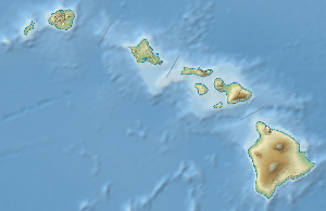 Pu'u Kukui Hawaii | |
| Location | Maui, Hawaiʻi, U.S. |
| Parent range | Hawaiian Islands |
| Topo map | USGS Lahaina |
| Geology | |
| Age of rock | <1.3 Mega-annum |
| Mountain type | Eroded shield volcano |
| Volcanic arc/belt | Hawaiian–Emperor seamount chain |
| Climbing | |
| Easiest route | Hike |

Puʻu Kukui is a mountain peak in Hawaiʻi. It is the highest peak of Mauna Kahalawai (the West Maui Mountains). The 1,764-metre (5,787 ft) summit rises above the Puʻu Kukui Watershed Management Area, an 8,661-acre (35.05 km2) private nature preserve maintained by the Maui Land & Pineapple Company. The peak was formed by a volcano whose caldera eroded into what is now Īʻao Valley.
Puʻu Kukui is one of the wettest spots on Earth[2] and the second wettest in the state after Mount Waiʻaleʻale,[3] receiving an average of 386.5 inches (9,820 mm) of rain a year.[4] Rainwater unable to drain away flows into a bog. The soil is dense, deep, and acidic.[5]
Puʻu Kukui is home to many endemic plants, insects, and birds, including the greensword (Argyroxiphium grayanum), a distinctive bog variety of ʻōhiʻa lehua (Metrosideros polymorpha var. pseudorugosa)[6] and many lobelioid species. Due to the mountain peak's extreme climate and peat soil, many species, such as the ʻōhiʻa, are represented as dwarfs. Access to the area is restricted to researchers and conservationists.
See also
- List of mountain peaks of the United States
- List of Ultras of Oceania
- List of Ultras of the United States
- Hawaii hotspot
- Evolution of Hawaiian volcanoes
- Hawaiian–Emperor seamount chain
References
- 1 2 3 "Puu Kukui, Hawaii". Peakbagger.com. 2004-11-01. Retrieved 2008-04-06.
- ↑ Juvik, Sonia P. (1998). Atlas of Hawaii. University of Hawaii Press. p. 14. ISBN 978-0-8248-2125-8.
- ↑ "July 2008 Precipitation Summary". National Weather Service Forecast Office Honolulu, HI. National Oceanic and Atmospheric Administration. 2008-09-04. Archived from the original on October 2, 2008. Retrieved 2009-02-20.
The USGS gage on Puu Kukui lived up to expectation as the second wettest spot in the state by having the second highest total of 26.67 inches (79 percent of normal) below only Mount Waialeale’s 30.30 inches.
- ↑ "NOAA Hawaiʻi rain gauge summary". Pacific Islands Water Science Center. United States Geological Survey. Retrieved 2009-02-20.
- ↑ Wianecki, Shannon (March 2007). "Rooted in Mystery". Maui Nō Ka ʻOi Magazine. 11 (2).
- ↑ Percy, Diana M.; Adam M. Garver; Warren L. Wagner; Helen F. James; Clifford W. Cunningham; Scott E. Miller; Robert C. Fleischer (2008). "Progressive island colonization and ancient origin of Hawaiian Metrosideros (Myrtaceae)" (PDF). Proceedings of the Royal Society B. 275 (1642): 1484. doi:10.1098/rspb.2008.0191. PMC 2602662
 . PMID 18426752.
External links
Honolulu (capital) | ||
| Topics | ||
| Society | ||
| Main Islands | ||
| Northwestern Islands | ||
| Communities | ||
| Counties | ||
| Sovereignty Movement | ||