Przemsza
| Przemsza | |
|---|---|
 Three Emperors' Corner | |
| Country | Poland |
| Basin | |
| Main source |
Three Emperors' Corner, Mysłowice 50°13′46″N 19°09′26″E / 50.22944°N 19.15722°E |
| River mouth |
Vistula at Gorzów 50°3′58″N 19°14′0″E / 50.06611°N 19.23333°ECoordinates: 50°3′58″N 19°14′0″E / 50.06611°N 19.23333°E |
| Basin size | 2,121 km2 (819 sq mi) |
| Physical characteristics | |
| Length | 24 km (15 mi) |
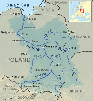
Przemsza (German: Przemsa) is a river in the south of Poland, a tributary of the Vistula. According to one theory, it originates at the confluence of the Black (Polish: Czarna) Przemsza and White (Biała) Przemsza, between the cities of Mysłowice and Jaworzno. For about 24 km (15 mi) it flows southwards to its Vistula mouth at Czarnuchowice (a district of Bierun). Another theory stipulates that it has the length of 88 kilometers, and begins at the source of the Black Przemsza.
It is one of the most polluted rivers of Poland. It carries industrial waste from Upper Silesian and Zagłębie Dąbrowskie Coal Basin, and its water is regarded as dead. Furthermore, due to high level of pollution, the Przemsza does not freeze in winter. Among cities located along the Przemsza are Dąbrowa Górnicza, Mysłowice, Jaworzno, Chełmek, and Jezor, a district of Sosnowiec.
The Przemsza has been used for water transport since mid-18th century. By mid-19th century, it emerged as one of the most important waterways of the region. Special kind of flat-bottomed, large rowboats, called galar, was used for transport of goods along the Przemsza to the Vistula. One galar took up to 70 tons of coal or stone from quarries at Jelen or Dzieckowice. In June 1926, Piast Mine from Lędziny began mass water transport of its coal, using a specially constructed port, located at the village of Chelm Maly. Other mines followed Piast, opening their own loading facilities. By 1937, there were eight such facilities along the Przemsza. Government of the Second Polish Republic had far-reaching plans about the river. A river port at Niwka (a district of Sosnowiec) was to be built, a canal Mysłowice - Spytkowice - Kraków, and a waterway to the Baltic Sea. The outbreak of World War Two terminated these plans
Since the 12th century, the river formed eastern border of the Silesian Duchy of Racibórz with Lesser Poland. From 1846 until 1918, on the so-called Three Emperors' Corner, at the confluence of Black and White Przemsza marked the tripoint of Kingdom of Prussia, Austrian Empire and Russian Empire. Nowadays the lower Przemsza forms the border between Silesian Voivodeship in the west and Lesser Poland Voivodeship in the east.
White and Black Przemsza
The White Przemsza is 63,9 kilometers long, and begins in a bog near Wolbrom. It flows towards the southwest, in a wide valley. The Upper White Przemsza has very clean water, which changes in the village of Klucze. Among others, the White Przemsza flows through the Błędów Desert. The Black Przemsza is 64,2 kilometers long, and its source is in Bzow, which is a district of Zawiercie since 1977. In its upper course, the water of the river is very clean, but its quality gets worse in Przeczyce, where a reservoir was built in 1963.
Both rivers were named after the color of the water. In the past, the Black Przemsza’s bed near Bedzin was made of shallow deposits of coal. At the same time the White Przemsza flowed through limestone hills in the area of Olkusz, so its bottom was white.
Sources
| Wikimedia Commons has media related to Przemsza. |
Tributaries of the Vistula River | ||
|---|---|---|
| Forming rivers |
|  |
| Main tributaries of the left bank | ||
| Main tributaries of the right bank |
| |
| Distributary | ||