Prunelli-di-Fiumorbo
| Prunelli-di-Fiumorbo | ||
|---|---|---|
|
The tower of the FORTEF (Forces et Terres du Fium'orbu) of Migliacciaru, housing a clock and a siren to inform workers of the time, in Prunelli-di-Fiumorbo | ||
| ||
 Prunelli-di-Fiumorbo | ||
|
Location within Corsica region 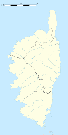 Prunelli-di-Fiumorbo | ||
| Coordinates: 42°00′41″N 9°19′31″E / 42.0114°N 9.3253°ECoordinates: 42°00′41″N 9°19′31″E / 42.0114°N 9.3253°E | ||
| Country | France | |
| Region | Corsica | |
| Department | Haute-Corse | |
| Arrondissement | Corte | |
| Canton | Prunelli-di-Fiumorbo | |
| Intercommunality | Fium'orbo | |
| Government | ||
| • Mayor (2008–2014) | Pierre Siméon de Buochberg | |
| Area1 | 37.41 km2 (14.44 sq mi) | |
| Population (2008)2 | 3,203 | |
| • Density | 86/km2 (220/sq mi) | |
| Time zone | CET (UTC+1) | |
| • Summer (DST) | CEST (UTC+2) | |
| INSEE/Postal code | 2B251 / 20243 | |
| Elevation |
0–580 m (0–1,903 ft) (avg. 580 m or 1,900 ft) | |
|
1 French Land Register data, which excludes lakes, ponds, glaciers > 1 km² (0.386 sq mi or 247 acres) and river estuaries. 2 Population without double counting: residents of multiple communes (e.g., students and military personnel) only counted once. | ||


Prunelli-di-Fiumorbo is a commune in the Haute-Corse department of France on the island of Corsica.
Population
| Historical population | ||
|---|---|---|
| Year | Pop. | ±% |
| 1800 | 325 | — |
| 1806 | 475 | +46.2% |
| 1821 | 264 | −44.4% |
| 1831 | 480 | +81.8% |
| 1836 | 536 | +11.7% |
| 1841 | 600 | +11.9% |
| 1846 | 690 | +15.0% |
| 1851 | 867 | +25.7% |
| 1856 | 1,049 | +21.0% |
| 1861 | 918 | −12.5% |
| 1866 | 871 | −5.1% |
| 1872 | 740 | −15.0% |
| 1876 | 824 | +11.4% |
| 1881 | 965 | +17.1% |
| 1886 | 1,202 | +24.6% |
| 1891 | 1,120 | −6.8% |
| 1896 | 1,076 | −3.9% |
| 1901 | 1,197 | +11.2% |
| 1906 | 1,194 | −0.3% |
| 1911 | 1,088 | −8.9% |
| 1921 | 1,021 | −6.2% |
| 1926 | 1,117 | +9.4% |
| 1931 | 1,160 | +3.8% |
| 1936 | 1,329 | +14.6% |
| 1946 | 1,107 | −16.7% |
| 1954 | 1,172 | +5.9% |
| 1962 | 1,186 | +1.2% |
| 1968 | 1,536 | +29.5% |
| 1975 | 1,608 | +4.7% |
| 1982 | 2,339 | +45.5% |
| 1990 | 2,647 | +13.2% |
| 1999 | 2,745 | +3.7% |
| 2008 | 3,203 | +16.7% |
See also
References
| Wikimedia Commons has media related to Prunelli-di-Fiumorbo. |
This article is issued from Wikipedia - version of the 2/8/2015. The text is available under the Creative Commons Attribution/Share Alike but additional terms may apply for the media files.