Parkway (St. John's)
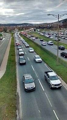
The Parkway is a major arterial road in the city of St. John's, Newfoundland and Labrador. It consists of three distinct roads that form a single through route: Columbus Drive, Prince Philip Drive, and Macdonald Drive. A four-lane limited-access road with a speed limit of 70 km/h along most of its length, the parkway begins at an intersection with Pitts Memorial Drive in the city's west end and terminates at Logy Bay Road in the east end.
Segments
Columbus Drive runs in a general south-to-north direction from Pitts Memorial Drive to Thorburn Road. It passes Bowring Park, the Village Mall, the edge of the west end residential area, and the Avalon Mall. Also known as the Crosstown Arterial, Columbus Drive was constructed in order to improve traffic circulation in the city by linking Kenmount Road and Prince Philip Drive with Topsail Road and Pitts Memorial Drive. Built on land purchased by the city in 1970, the road was opened in December 1981.[1]
Prince Philip Drive, constructed in the late 1960s, runs in an east-west direction from Thorburn Road to Portugal Cove Road. Passing through Pippy Park, Prince Philip Drive provides access to several significant institutions: the Health Sciences Centre and Janeway Children's Hospital,[2] the CBC's St. John's studios, the main Memorial University of Newfoundland campus,[3] the St. John's Arts and Culture Centre,[4][5] the Confederation Building, and the College of the North Atlantic.[6]
Macdonald Drive runs in an east-west direction from Portugal Cove Road to Logy Bay Road. Unlike Columbus Drive and Prince Philip Drive, Macdonald Drive is not a limited-access road and is intersected by several residential side streets.
Safety
In 2006, seven of the ten most dangerous intersections in the city of St. John's were located on the Parkway. In order of severity, these were:[7]
- Allandale Road at Prince Philip Drive (ranking 3)
- Columbus Drive at Old Pennywell Road (ranking 4)
- Prince Philip Drive at Thorburn Road (ranking 5)
- Columbus Drive at Topsail Road (ranking 6)
- Columbus Drive at Mundy Pond Road (ranking 7)
- Prince Philip Drive-Macdonald Drive at Portugal Cove Road (ranking 9)
- Prince Philip Drive at Clinch-Westerland (ranking 10)
In 2013, five of the ten most dangerous intersections in the city of St. John's were located on the Parkway. In order of severity, these were:[8]
- Columbus Drive at Topsail Road (ranking 2)
- Allandale Road at Prince Philip Drive (ranking 5)
- Prince Philip Drive at Thorburn Road (ranking 6)
- Blackmarsh Road at Columbus Drive (ranking 8)
- Macdonald Drive at Torbay Road (ranking 9)
Intersections
The following roads intersect with the Parkway. Macdonald Drive is also intersected by several residential side streets, which are not listed in the table.
| Segment | Intersecting Road |
|---|---|
| Columbus Drive | Pitts Memorial Drive |
| Columbus Drive | Bay Bulls Road (to Waterford Bridge Road) |
| Columbus Drive | Topsail Road |
| Columbus Drive | Canada Drive |
| Columbus Drive | Captain Whelan Drive / Hogan Street |
| Columbus Drive | Blackmarsh Road |
| Columbus Drive | Mundy Pond Road |
| Columbus Drive | Empire Avenue (two separate non-signalized T-intersections) |
| Columbus Drive | Old Pennywell Road (to Empire Avenue) |
| Columbus Drive | Wishingwell Road (to Freshwater Road) |
| Prince Philip Drive | Thorburn Road (to Freshwater Road and Kenmount Road) |
| Prince Philip Drive | Wicklow Street |
| Prince Philip Drive | Clinch Crescent (west) |
| Prince Philip Drive | University Avenue |
| Prince Philip Drive | Clinch Crescent (east) / Westerland Road (Memorial University of Newfoundland) |
| Prince Philip Drive | Morrissey Road / Livyer's Loop (Memorial University of Newfoundland) |
| Prince Philip Drive | Allandale Road (Memorial University of Newfoundland) |
| Prince Philip Drive | Confederation Building access |
| Prince Philip Drive | Portugal Cove Road (to airport) |
| Macdonald Drive | Torbay Road (to Torbay) |
| Macdonald Drive | Logy Bay Road (end) |
References
- ↑ "A History of St. John's City Council". Retrieved 2008-02-02.
- ↑ "Janeway Children's Hospital Foundation". Retrieved 2008-09-06.
- ↑ "Memorial University - Campus Maps". Retrieved 2008-09-06.
- ↑ "St. John's Arts and Culture Centre". Archived from the original on 2008-06-16. Retrieved 2008-09-06.
- ↑ "St. John's Arts and Culture Centre - Contact Us". Archived from the original on 2008-06-12. Retrieved 2008-09-06.
- ↑ "Prince Philip Drive Campus CNA". Retrieved 2008-09-06.
- ↑ CBC (2008-02-09). "Where are the most dangerous intersections in St. John's?". CBC News. Archived from the original on 2012-11-03. Retrieved 2014-11-19.
- ↑ Royal Newfoundland Constabulary (2014). 2013 Annual Juristat Report (PDF) (Report). Government of Newfoundland and Labrador. p. 55. Retrieved 2014-11-19.
Coordinates: 47°34′05″N 52°44′39″W / 47.568°N 52.7441°W