Price, Utah
| Price, Utah | |
|---|---|
| City | |
|
Price, Utah | |
 Location in Carbon County and the state of Utah | |
 Location of Utah in the United States | |
| Coordinates: 39°36′0″N 110°48′24″W / 39.60000°N 110.80667°WCoordinates: 39°36′0″N 110°48′24″W / 39.60000°N 110.80667°W | |
| Country | United States |
| State | Utah |
| County | Carbon |
| Settled | 1879 |
| Founded by | Caleb Baldwin Rhoades |
| Named for | Bishop William Price |
| Area | |
| • Total | 5.1 sq mi (13.1 km2) |
| • Land | 5.1 sq mi (13.1 km2) |
| • Water | 0.0 sq mi (0.0 km2) |
| Elevation[1] | 5,627 ft (1,715 m) |
| Population (2010) | |
| • Total | 8,715 |
| • Density | 1,720/sq mi (664.1/km2) |
| Time zone | Mountain (MST) (UTC-7) |
| • Summer (DST) | MDT (UTC-6) |
| ZIP code | 84501 |
| Area code(s) | 435 |
| FIPS code | 49-62030[2] |
| GNIS feature ID | 2411491[1] |
| Website |
www |

Price is a city in Carbon County, Utah, United States. The city is home to Utah State University Eastern, as well as the USU Eastern Prehistoric Museum. Price is located within short distances of both Nine Mile Canyon and the Manti-La Sal National Forest. The city is noted for its history as a mining town and for its Greek Orthodox/Catholic/Mormon split population. The population was 8,715 at the 2010 census.[3] Price is the county seat of, and largest city in, Carbon County.[4]
Geography
Price is located in west-central Carbon County at the northwestern edge of the Colorado Plateau. According to the United States Census Bureau, the city has a total area of 5.1 square miles (13.1 km2), all land.[3] The Price River, a tributary of the Green River, flows southeasterly through the city, and the San Rafael Swell is to the south.
The city is on U.S. Route 6 and U.S. Route 191. US 6 leads 67 miles (108 km) northwest to Spanish Fork on the Interstate 15 corridor, while US 191 leads northeast 54 miles (87 km) to Duchesne. The two highways together run southeast 64 miles (103 km) to the city of Green River and Interstate 70. Utah State Route 10 leads southwest from Price 21 miles (34 km) to Huntington.
Price was one of the communities that was served by the Rio Grande Zephyr passenger train. Today Amtrak's California Zephyr passes once a day each direction with a station about seven miles away in Helper.
Climate
Price is located in an arid climate and features cold winters and relatively moderate summers. The average high in January is 37 °F (3 °C) and it rises to 90 °F (32 °C) in July. The low in January averages just 13 °F (-11 °C), and even in summer the dry climate keeps the nights cool, with an average of just 58 °F (14 °C). The all-time record high is 110 °F (43 °C), which was set on August 3, 1918, while the all-time low is -31 °F (-35 °C), set on December 26, 1924. Price lies in the rain shadow of mountains of central Utah and precipitation averages only 9.24 inches (235mm) annually. Late summer and early fall are the wettest times of year due to the Gulf of California monsoon that brings scattered thunderstorms to the region. The city also sees frequent snow during winter and early spring.[5][6]
This climatic region is typified by large seasonal temperature differences, with warm to hot (and often humid) summers and cold (sometimes severely cold) winters. According to the Köppen Climate Classification system, Price has a humid continental climate, abbreviated "Dfb" on climate maps.[7]
Demographics
| Historical population | |||
|---|---|---|---|
| Census | Pop. | %± | |
| 1890 | 209 | — | |
| 1900 | 539 | 157.9% | |
| 1910 | 1,021 | 89.4% | |
| 1920 | 2,777 | 172.0% | |
| 1930 | 4,084 | 47.1% | |
| 1940 | 5,214 | 27.7% | |
| 1950 | 6,010 | 15.3% | |
| 1960 | 6,802 | 13.2% | |
| 1970 | 6,218 | −8.6% | |
| 1980 | 9,086 | 46.1% | |
| 1990 | 8,712 | −4.1% | |
| 2000 | 8,402 | −3.6% | |
| 2010 | 8,715 | 3.7% | |
| Est. 2015 | 8,378 | [8] | −3.9% |
As of the census[2] of 2000, there were 8,402 people, 3,045 households, and 2,085 families residing in the city. The population density was 1,979.7 people per square mile (765.1/km²). There were 3,311 housing units at an average density of 780.2 per square mile (301.5/km²). The racial makeup of the city was 90.70% White, 0.26% African American, 1.37% Native American, 0.56% Asian, 0.04% Pacific Islander, 4.25% from other races, and 2.82% from two or more races. Hispanic or Latino of any race were 10.08% of the population.
There were 3,045 households out of which 34.4% had children under the age of 18 living with them, 53.2% were married couples living together, 11.5% had a female householder with no husband present, and 31.5% were non-families. 27.4% of all households were made up of individuals and 12.2% had someone living alone who was 65 years of age or older. The average household size was 2.60 and the average family size was 3.19.
In the city the population was spread out with 27.6% under the age of 18, 15.9% from 18 to 24, 22.5% from 25 to 44, 19.9% from 45 to 64, and 14.1% who were 65 years of age or older. The median age was 32 years. For every 100 females there were 91.7 males. For every 100 females age 18 and over, there were 88.3 males.
The median income for a household in the city was $31,687, and the median income for a family was $39,429. Males had a median income of $37,476 versus $21,081 for females. The per capita income for the city was $14,313. About 11.4% of families and 15.0% of the population were below the poverty line, including 16.3% of those under age 18 and 11.1% of those age 65 or over.
Education

There are two public elementary schools in Price (Creekview and Castle Heights); one middle school (Mont Harmon); one high school (Carbon); and one alternative high school (Lighthouse). It is also the location of the charter Pinnacle Canyon Academy, which serves grades K-12, as well as the Castle Valley Center for disabled children. Some children located in the Gordon Creek area attend Sally Mauro Elementary in Helper.
Price is the location of Utah State University Eastern, which has an enrollment of approximately 2,700.
Notable people
- Harold Arceneaux, professional basketball player who gained national attention during his collegiate career at Weber State University; played two seasons at the College of Eastern Utah in Price
- Dean and Lynn Fausett, painters of the American West
- John D. Fitzgerald, author known for his The Great Brain series of books for children
- Herman Franks, former catcher, coach, manager, general manager and scout in Major League Baseball
- Dave Lauriski, head of the Mine Safety and Health Administration from 2001 to 2004
- J. Bracken Lee, mayor of Price from 1935 to 1947, governor of Utah from 1949 to 1957, mayor of Salt Lake City from 1960 to 1971
- Cassandra Lynn, model, Playboy Playmate, born in Price
- Erik Pears, NFL offensive lineman
- Jean Westwood, first female chair of the Democratic National Committee; worked on several presidential campaigns
- Scott Woodward, molecular geneticist noted for his work with the discovery of the first genetic marker for cystic fibrosis, as well as with ancient mummy, mammoth, and dinosaur DNA
See also
| Wikimedia Commons has media related to Price, Utah. |
- Cleveland Lloyd Dinosaur Quarry
- Helper, Utah
- KCBU
- National Register of Historic Places listings in Carbon County, Utah
References
- 1 2 U.S. Geological Survey Geographic Names Information System: Price
- 1 2 "American FactFinder". United States Census Bureau. Retrieved 2008-01-31.
- 1 2 "Geographic Identifiers: 2010 Census Summary File 1 (G001): Price city, Utah". U.S. Census Bureau, American Factfinder. Retrieved August 10, 2015.
- ↑ "Find a County". National Association of Counties. Retrieved 2011-06-07.
- ↑ Utah Climate Summaries - Price Warehouses
- ↑ Utah Climate Summaries - Price game farm
- ↑ Climate Summary for Price, Utah
- ↑ "Annual Estimates of the Resident Population for Incorporated Places: April 1, 2010 to July 1, 2015". Retrieved July 2, 2016.
- ↑ "Census of Population and Housing". Census.gov. Retrieved June 4, 2015.
External links
| Wikimedia Commons has media related to Price, Utah. |
 |
Scofield | Helper | Duchesne | |
| Fairview Mount Pleasant |
|
East Carbon-Sunnyside | ||
| ||||
| | ||||
| Spring City | Huntington, Cleveland, Elmo | Wellington, East Carbon-Sunnyside |
Municipalities and communities of Carbon County, Utah, United States | ||
|---|---|---|
| Cities | 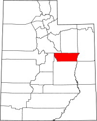 | |
| Town | ||
| CDPs | ||
| Indian reservation | ||
| Ghost towns | ||
| Footnotes | ‡This populated place also has portions in an adjacent county or counties | |