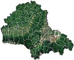
Prejmer
| Prejmer | ||
|---|---|---|
| Commune | ||
|
| ||
| ||
 | ||
 Prejmer | ||
| Coordinates: 45°43′N 25°46′E / 45.717°N 25.767°E | ||
| Country |
| |
| County | Braşov County | |
| Population (2011)[1] | 8,114 | |
| Time zone | EET (UTC+2) | |
| • Summer (DST) | EEST (UTC+3) | |


Prejmer (German: Tartlau; Hungarian: Prázsmár) is a commune in Braşov County, Romania. It is composed of three villages: Lunca Câlnicului (Farkasvágó), Prejmer and Stupinii Prejmerului (Rohrau; Méheskert). Located 18 km northeast of Braşov, the Olt River passes through the commune.
At the 2011 census, 90.7% of inhabitants were Romanians, 6.3% Roma, 1.9% Hungarians and 0.8% Germans.
History
The Teutonic Knights constructed the fortress Tartlau in 1212–1213 as part of their colonization of the Burzenland region. The town of Prejmer near the castle had begun development by 1225, and was the eastern-most settlement of the Transylvanian Saxons. Prejmer was repeatedly invaded throughout the Middle Ages by various groups, including the Mongols, Tatars, Hungarians, Ottoman Turks, Cossacks, and Moldavians. However, the castle was only captured once, by Gabriel Báthory in 1611. Most of Prejmer's German population fled the commune during World War II.
Prejmer is noted for its fortified church, one of the best preserved of its kind in Eastern Europe. Between 1962–1970, the Romanian government carefully restored it to its present condition; the restoration work was done under the direction of architect Mariana Angelescu and engineer Alexandru Dobriceanu. The church is modeled after churches of Jerusalem, as well as built in the style of Late Gothic churches from the Rhineland. In the 15th century, it was surrounded by a wall 12m high, forming a quadrilateral with rounded corners. The wall was reinforced by four horseshoe-shaped towers, two of which have since disappeared. The entrance—a vaulted gallery—is protected by a barbican and flanked by a lateral wall. The defensive structure is strengthened by embrasures and bartizans, while the covered way is surrounded by a parapet. The granaries and rooms that accommodated the villagers are arranged on four levels above the cellars.
Natives
- Leonard Oprea, Romanian writer
Gallery
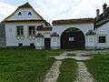 Typical house in Prejmer
.jpg) Painting on the walls of Prejmer Citadel
Painting on the walls of Prejmer Citadel Fortified church
.JPG) Entrance to the fortified church
Entrance to the fortified church
See also
References
- ↑ Romanian census data, 2011; retrieved on March 17, 2012
- Evaluations of cultural properties, at the UNESCO World Heritage Convention, Marrakesh, Morocco, November 29–December 4, 1999, pp. 177–182
External links
| Wikimedia Commons has media related to Prejmer. |
- History of Tartlau (Prejmer) (German)
- Aerial picture of Prejmer Fortress (German)
- Pictures of cultural highlights in Prejmer
- "Biserica Sfânta Cruce" (Romanian)
- Fortified church in Prejmer
- "Video Fortified Church Prejmer" (English)
Coordinates: 45°43′N 25°46′E / 45.717°N 25.767°E