Potterville, Michigan
| Potterville, Michigan | |
|---|---|
| City | |
 Location of Potterville, Michigan | |
| Coordinates: 42°37′39″N 84°44′31″W / 42.62750°N 84.74194°W | |
| Country | United States |
| State | Michigan |
| County | Eaton |
| Government | |
| • Mayor | Jeff Bussard |
| Area[1] | |
| • Total | 1.82 sq mi (4.71 km2) |
| • Land | 1.68 sq mi (4.35 km2) |
| • Water | 0.14 sq mi (0.36 km2) |
| Elevation | 899 ft (274 m) |
| Population (2010)[2] | |
| • Total | 2,617 |
| • Estimate (2012[3]) | 2,614 |
| • Density | 1,557.7/sq mi (601.4/km2) |
| Time zone | Eastern (EST) (UTC-5) |
| • Summer (DST) | EDT (UTC-4) |
| ZIP code | 48876 |
| Area code(s) | 517 |
| FIPS code | 26-66100[4] |
| GNIS feature ID | 0635356[5] |
| Website | http://www.pottervillemi.org/ |
Potterville is a city in Eaton County in the U.S. state of Michigan. The population was 2,617 at the 2010 census.
History
Potterville is named after Linus Potter, who settled his family in the area in November, 1844. Linus was elected supervisor of Benton Township in 1846. In 1830, Linus and his wife Diantha came from Cayuga County, New York, by way of the Erie Canal, to Buffalo and then by way of Lake Erie steamboat to Detroit. From there, Linus and Diantha walked to Plymouth, Michigan, a journey of about thirty miles, before walking on to Saline. The pair carried their three-year-old son, George, and their infant daughter, Louisa.[6]
Historical Calamities
On July 6, 1994, a lightning strike at Fox Park injured 22 beach-goers. The lightning struck the water and "walked up the beach."[7]
A rare Michigan earthquake on September 2, 1994, had its epicenter just east of the city. The shock had a body wave magnitude of 3.5 and a maximum Mercalli intensity of V (Moderate). It could be felt through most of Mid-Michigan.[8]
The city experienced a massive train derailment of 35 Canadian National railroad cars over Memorial Day weekend 2002. Due to leaking propane from the cars, the entire city was evacuated.[9] The cause of the derailment was found to have been a faulty rail.
A second Canadian National train derailment occurred in May 2006, though no evacuation was necessary. The cause of this derailment was found to be a failed wheel bearing on the 82nd car.[10]
January 30, 2010 at 11:30 pm a fire occurred in downtown Potterville burning two antique shops, a book store, Masonic Lodge, a dog grooming shop, and two apartments. This fire destroyed historic buildings that were 100 years old. No one was seriously hurt in the fire. Fire fighters from Benton Township, Windsor Township, Delta Township, Charlotte, and Eaton Rapids were initially involved in battling the blaze. When it was found that the city's water system could not keep up with the draw from fighting the inferno, tanker trucks from each of the above departments as well as several other departments in Eaton County were called to assist. It took nearly twelve hours to extinguish the blaze. The fire then rekindled on February 1, 2010 and was again extinguished.
Geography
According to the United States Census Bureau, the city has a total area of 1.82 square miles (4.71 km2), of which 1.68 square miles (4.35 km2) is land and 0.14 square miles (0.36 km2) is water.[1]
Demographics
| Historical population | |||
|---|---|---|---|
| Census | Pop. | %± | |
| 1880 | 471 | — | |
| 1890 | 505 | 7.2% | |
| 1900 | 495 | −2.0% | |
| 1910 | 430 | −13.1% | |
| 1920 | 330 | −23.3% | |
| 1930 | 492 | 49.1% | |
| 1940 | 547 | 11.2% | |
| 1950 | 624 | 14.1% | |
| 1960 | 1,028 | 64.7% | |
| 1970 | 1,280 | 24.5% | |
| 1980 | 1,502 | 17.3% | |
| 1990 | 1,523 | 1.4% | |
| 2000 | 2,168 | 42.4% | |
| 2010 | 2,617 | 20.7% | |
| Est. 2015 | 2,618 | [11] | 0.0% |
2010 Census
As of the census[2] of 2010, there were 2,617 people, 952 households, and 702 families residing in the city. The population density was 1,557.7 inhabitants per square mile (601.4/km2). There were 1,112 housing units at an average density of 661.9 per square mile (255.6/km2). The racial makeup of the city was 94.2% White, 1.3% African American, 0.6% Native American, 0.5% Asian, 0.6% from other races, and 2.6% from two or more races. Hispanic or Latino of any race were 5.7% of the population.
There were 952 households of which 45.4% had children under the age of 18 living with them, 51.2% were married couples living together, 16.8% had a female householder with no husband present, 5.8% had a male householder with no wife present, and 26.3% were non-families. 21.6% of all households were made up of individuals and 4.9% had someone living alone who was 65 years of age or older. The average household size was 2.75 and the average family size was 3.16.
The median age in the city was 32.4 years. 31.2% of residents were under the age of 18; 8.3% were between the ages of 18 and 24; 30% were from 25 to 44; 23.5% were from 45 to 64; and 7.1% were 65 years of age or older. The gender makeup of the city was 48.6% male and 51.4% female.
2000 Census
As of the census[4] of 2000, there were 2,168 people, 802 households, and 572 families residing in the city. The population density was 1,178.3 inhabitants per square mile (454.9/km2). There were 892 housing units at an average density of 484.8/sq mi (187.2/km2). The racial makeup of the city was 95.48% White, 0.23% African American, 0.42% Native American, 0.42% Asian, 1.48% from other races, and 1.98% from two or more races. Hispanic or Latino of any race were 4.01% of the population.
There were 802 households out of which 44.0% had children under the age of 18 living with them, 50.4% were married couples living together, 17.3% had a female householder with no husband present, and 28.6% were non-families. 22.9% of all households were made up of individuals and 4.9% had someone living alone who was 65 years of age or older. The average household size was 2.70 and the average family size was 3.18.
In the city the population was spread out with 33.7% under the age of 18, 9.0% from 18 to 24, 33.9% from 25 to 44, 18.1% from 45 to 64, and 5.3% who were 65 years of age or older. The median age was 29 years. For every 100 females there were 92.5 males. For every 100 females age 18 and over, there were 87.5 males.
The median income for a household in the city was $42,292, and the median income for a family was $48,182. Males had a median income of $33,988 versus $26,250 for females. The per capita income for the city was $17,880. About 3.5% of families and 5.9% of the population were below the poverty line, including 5.0% of those under age 18 and 6.0% of those age 65 or over.
Education
Potterville public schools are located on one campus, just east of M-100. The district mascot is the Vikings, with school colors of maroon and gold. This campus includes an elementary, middle, and high school (including sport facilities). Also sharing this campus is the administration and preschool building.
Public safety
The City of Potterville Police Department provides law enforcement services to Potterville with three full-time officers, one part-time officer, and a full-time chief. Fire services are provided by the Potterville City "Fire Dept". which utilizes paid-on-call "fire fighters" which took effect on December 7, 2013 when the city decided to dissolve the contract with Benton Township for fire/EMS coverage.
Notable people
- Joe Davis, sports announcer; attended Potterville High School
References
- 1 2 "US Gazetteer files 2010". United States Census Bureau. Retrieved 2012-11-25.
- 1 2 "American FactFinder". United States Census Bureau. Retrieved 2012-11-25.
- ↑ "Population Estimates". United States Census Bureau. Retrieved 2013-06-03.
- 1 2 "American FactFinder". United States Census Bureau. Retrieved 2008-01-31.
- ↑ "US Board on Geographic Names". United States Geological Survey. 2007-10-25. Retrieved 2008-01-31.
- ↑ Wright, Ruth L. The History of Potterville, Michigan, 1869-1976. Potterville: Al Dymond Color Service, 1977.
- ↑ https://news.google.com/newspapers?nid=2457&dat=19940707&id=exozAAAAIBAJ&sjid=TDgHAAAAIBAJ&pg=5584,1797605
- ↑ USGS. "M3.5 - Michigan". United States Geological Survey.
- ↑
- ↑
- ↑ "Annual Estimates of the Resident Population for Incorporated Places: April 1, 2010 to July 1, 2015". Retrieved July 2, 2016.
- ↑ "Census of Population and Housing". Census.gov. Retrieved June 4, 2015.
External links
Municipalities and communities of Eaton County, Michigan, United States | ||
|---|---|---|
| Cities | 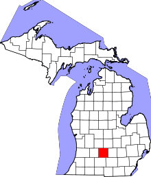 | |
| Villages | ||
| Charter townships | ||
| General law townships | ||
| CDP | ||
| Footnotes | ‡This populated place also has portions in an adjacent county or counties | |
Coordinates: 42°37′45″N 84°44′20″W / 42.62917°N 84.73889°W