Portopalo di Capo Passero
| Portopalo di Capo Passero | |
|---|---|
| Comune | |
| Comune di Portopalo di Capo Passero | |
|
Castle Tafuri | |
 Portopalo di Capo Passero Location of Portopalo di Capo Passero in Italy | |
| Coordinates: 36°41′N 15°8′E / 36.683°N 15.133°ECoordinates: 36°41′N 15°8′E / 36.683°N 15.133°E | |
| Country | Italy |
| Region | Sicily |
| Province / Metropolitan city | Province of Syracuse (SR) |
| Area | |
| • Total | 14.9 km2 (5.8 sq mi) |
| Elevation | 20 m (70 ft) |
| Population (Dec. 2004) | |
| • Total | 3,617 |
| • Density | 240/km2 (630/sq mi) |
| Demonym(s) | Portopalesi |
| Time zone | CET (UTC+1) |
| • Summer (DST) | CEST (UTC+2) |
| Postal code | 96010 |
| Dialing code | 0931 |

Portopalo di Capo Passero (Sicilian: Puortupalu) is a comune (municipality) in the Province of Syracuse, Sicily (Italy). It is about 220 kilometres (140 mi) southeast of Palermo and about 45 kilometres (28 mi) southwest of Syracuse. As of 31 December 2004, it had a population of 3,617 and an area of 14.9 square kilometres (5.8 sq mi).[1]
History
The sea 19 nautical miles off Portopalo was the scene of the worst shipping disaster to hit the Mediterranean since the Second World War.[2] In the early hours of December 26, 1996, a fishing vessel F174 carrying more than 300 South Asian migrants sank off the coast of Sicily and 283 of them drowned.
The catastrophe happened when the Yohan a merchant ship carrying the migrants from Greece approached the Sicilian Coast and nearly three hundred people were transferred from the freighter to a fishing boat that measured 18 by 4 metres (59 by 13 ft). During the operation the two vessels collided and the fishing vessel sank
Some of their bodies remain trapped in the ship’s wreck, 108 metres (354 ft) below the surface. For most of the following years the disaster was considered nothing more than a ghost story. Harbor officials and Fishermen from the port of Portopalo kept silent and the Italian government denied the tragedy ever took place, and refused to accept the testimonies of survivors.
Salvatore Lupo, a local Fisherman began speaking out about the accident in 2001, after he found one of the victims’ identification cards in his fishing net. He then helped a journalist, Giovanni Mario Bellu, working for La Repubblica locate the wreck with an underwater robot equipped with cameras.
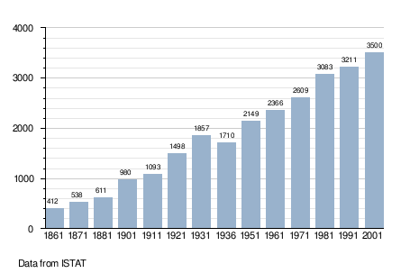
Demographic evolution
Geography
Portopalo di Capo Passero borders the following municipalities: Pachino.
Climate
The Köppen Climate Classification subtype for this climate is "Csa" (Mediterranean Climate).[3]
| Climate data for Portopalo di Capo Passero (Cozzo Spadaro) (1971–2000, extremes 1929–present) | |||||||||||||
|---|---|---|---|---|---|---|---|---|---|---|---|---|---|
| Month | Jan | Feb | Mar | Apr | May | Jun | Jul | Aug | Sep | Oct | Nov | Dec | Year |
| Record high °C (°F) | 20.6 (69.1) |
23.0 (73.4) |
29.4 (84.9) |
31.0 (87.8) |
35.0 (95) |
40.4 (104.7) |
42.0 (107.6) |
39.8 (103.6) |
38.0 (100.4) |
32.2 (90) |
26.8 (80.2) |
22.0 (71.6) |
42.0 (107.6) |
| Average high °C (°F) | 15.3 (59.5) |
15.6 (60.1) |
16.7 (62.1) |
18.8 (65.8) |
22.5 (72.5) |
26.8 (80.2) |
29.8 (85.6) |
30.3 (86.5) |
27.6 (81.7) |
23.7 (74.7) |
19.7 (67.5) |
16.7 (62.1) |
22.0 (71.6) |
| Daily mean °C (°F) | 12.3 (54.1) |
12.4 (54.3) |
13.4 (56.1) |
15.3 (59.5) |
18.9 (66) |
22.9 (73.2) |
25.7 (78.3) |
26.6 (79.9) |
24.2 (75.6) |
20.6 (69.1) |
16.7 (62.1) |
13.7 (56.7) |
18.6 (65.5) |
| Average low °C (°F) | 9.4 (48.9) |
9.2 (48.6) |
10.0 (50) |
11.7 (53.1) |
15.3 (59.5) |
19.0 (66.2) |
21.6 (70.9) |
22.8 (73) |
20.7 (69.3) |
17.5 (63.5) |
13.6 (56.5) |
10.7 (51.3) |
15.1 (59.2) |
| Record low °C (°F) | 0.0 (32) |
0.1 (32.2) |
0.0 (32) |
5.0 (41) |
7.8 (46) |
12.0 (53.6) |
14.0 (57.2) |
16.3 (61.3) |
11.8 (53.2) |
7.6 (45.7) |
3.0 (37.4) |
1.5 (34.7) |
0.0 (32) |
| Average precipitation mm (inches) | 69.9 (2.752) |
50.4 (1.984) |
31.3 (1.232) |
22.1 (0.87) |
15.9 (0.626) |
1.5 (0.059) |
5.4 (0.213) |
8.1 (0.319) |
40.3 (1.587) |
81.7 (3.217) |
68.5 (2.697) |
89.2 (3.512) |
484.3 (19.067) |
| Average precipitation days (≥ 1.0 mm) | 7.6 | 6.3 | 4.9 | 3.9 | 2.2 | 0.4 | 0.3 | 0.6 | 3.3 | 6.4 | 6.8 | 8.2 | 50.9 |
| Average relative humidity (%) | 76 | 75 | 72 | 72 | 71 | 68 | 66 | 69 | 72 | 75 | 75 | 76 | 72 |
| Source #1: Servizio Meteorologico[4][5] | |||||||||||||
| Source #2: NOAA (humidity, 1961–1990)[6] | |||||||||||||
References
- ↑ All demographics and other statistics: Italian statistical institute Istat.
- ↑ Information regarding this incident is taken from a DW article on the incident
- ↑ Climate Summary from Weatherbase.com
- ↑ "Cozzo Spadaro (SR)" (PDF). Atlante climatico. Servizio Meteorologico. Retrieved February 23, 2016.
- ↑ "Cozzo Spadaro: Record mensili dal 1929" (in Italian). Servizio Meteorologico dell’Aeronautica Militare. Retrieved February 23, 2016.
- ↑ "Cozzo Spadaro Climate Normals 1961–1990". National Oceanic and Atmospheric Administration. Retrieved February 23, 2016.
External links
![]() Media related to Portopalo di Capo Passero at Wikimedia Commons
Media related to Portopalo di Capo Passero at Wikimedia Commons