Port St. John, Florida
| Port St. John, Florida | |
|---|---|
| Census-designated place | |
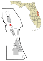 Location in Brevard County and the state of Florida | |
| Coordinates: 28°28′37″N 80°47′19″W / 28.47694°N 80.78861°WCoordinates: 28°28′37″N 80°47′19″W / 28.47694°N 80.78861°W | |
| Country |
|
| State |
|
| County |
|
| Area | |
| • Total | 3.8 sq mi (9.9 km2) |
| • Land | 3.8 sq mi (9.9 km2) |
| • Water | 0 sq mi (0 km2) |
| Elevation | 26 ft (8 m) |
| Population (2010) | |
| • Total | 12,267 |
| • Density | 3,200/sq mi (1,200/km2) |
| Time zone | Eastern (EST) (UTC-5) |
| • Summer (DST) | EDT (UTC-4) |
| FIPS code | 12-58700[1] |
| GNIS feature ID | 1867193[2] |
Port St. John is a census-designated place located between Titusville and Cocoa in Brevard County, Florida. The population was 12,267 at the 2010 United States Census.[3] It is part of the Palm Bay–Melbourne–Titusville Metropolitan Statistical Area.
Geography
Port St. John is located at 28°28′37″N 80°47′19″W / 28.47694°N 80.78861°W (28.477056, -80.788597).[4]
According to the United States Census Bureau, the CDP has a total area of 3.8 square miles (9.8 km2), all of it land.
History
In 2002, a group of five Port St. John residents formed "Port St. John For Tomorrow"[5] (PSJ4T) and tried to incorporate the Port St. John area.[6] Included in PSJ4T's incorporation plans were five separate communities: Delespine, Williams Point, Hardeeville, Frontenac and a part of Sharpes.[7] PSJ4T had not informed[8] these five communities. When the five communities did find out, they expressed disinterest in being included in the incorporation effort.[9] A feasibility study[10] was requested by PSJ4T members.[11] Voters approved the study.[12] The study was funded by Brevard County[13] and performed by the University of Central Florida.[14] The five reviewing committees in Tallahassee said the study was "deeply flawed.".[15] The county allowed the residents of Port St. John and the five communities to vote on becoming a city. Howard Futch[16] and Randy Ball (CS/HB 1071)[17] sponsored the bills in the Senate and House.[18] The incorporation issue was defeated in November 2002, 73% to 27%,[19] including most of the people in the five communities.[20] State statute prevented Port St. John from considering incorporation for ten years.
In 2012, the area received national attention when a mother shot and killed her four teenagers and herself.[21][22]
In January 2013, a brush fire ignited outside of Port St. John. As of January 13, the fire has burned over 1,000 acres of land, as well as closing both lanes of State Route 407.
Demographics
As of the census[1] of 2000, there were 12,112 people, 4,307 households, and 3,264 families residing in the CDP, although the number has grown since. The population density was 3,172.0 people per square mile (1,224.2/km²). There were 4,544 housing units at an average density of 1,190.0/sq mi (459.3/km²). The racial makeup of the CDP was 90.70% White, 5.01% African American, 0.47% Native American, 0.92% Asian, 0.17% Pacific Islander, 0.83% from other races, and 1.91% from two or more races. Hispanic or Latino of any race were 3.28% of the population.
There were 4,307 households out of which 40.2% had children under the age of 18 living with them, 60.1% were married couples living together, 11.4% had a female householder with no husband present, and 24.2% were non-families. 17.7% of all households were made up of individuals and 5.5% had someone living alone who was 65 years of age or older. The average household size was 2.73 and the average family size was 3.09.
In the CDP the population was spread out with 28.1% under the age of 18, 5.6% from 18 to 24, 33.0% from 25 to 44, 22.2% from 45 to 64, and 11.2% who were 65 years of age or older. The median age was 37 years. For every 100 females there were 99.0 males. For every 100 females age 18 and over, there were 96.6 males.
The median income for a household in the CDP was $44,030, and the median income for a family was $47,342. Males had a median income of $35,912 versus $26,184 for females. The per capita income for the CDP was $17,953. About 4.7% of families and 6.6% of the population were below the poverty line, including 7.9% of those under age 18 and 6.0% of those age 65 or over.
According to the 2010 United States Census info, Port Saint John has a total population of 12,267.
Education
Elementary schools
In 2009, Atlantis Elementary was named one of the nation's top 12 schools in terms of character development, school culture and academic achievement. Teaching was termed "absolutely brilliant". It was the only school so cited in Florida. It has been a state A-rated school from 2000-2009. There are 640 students K-6. 45% of the students qualify for free or reduced lunch, a typical indication of poverty. 18% are enrolled in exceptional student classes. 20% of the students are minorities.[26]
Middle and high schools
References
- 1 2 "American FactFinder". United States Census Bureau. Retrieved 2008-01-31.
- ↑ "US Board on Geographic Names". United States Geological Survey. 2007-10-25. Retrieved 2008-01-31.
- ↑ "Profile of General Population and Housing Characteristics: 2010 Demographic Profile Data (DP-1): Port St. John CDP, Florida". U.S. Census Bureau, American Factfinder. Retrieved January 31, 2012.
- ↑ "US Gazetteer files: 2010, 2000, and 1990". United States Census Bureau. 2011-02-12. Retrieved 2011-04-23.
- ↑ Port St John for Tomorrow Incorporation papers
- ↑ Brevard Supervisor of Elections Past Election Results incorporate the Port St. John area.
- ↑
- ↑ Brevard County Commissioner Meeting Minutes from August 27 2002
- ↑ Brevard County Commissioner Meeting Minutes from April 2 2002
- ↑ Feasibility Study
- ↑ Meeting Minutes Regarding Study April 17 2001
- ↑ Voters Approved PSJ Study
- ↑ Meeting Minutes Describing Study
- ↑ Meeting Minutes Regarding UCF Study
- ↑ Truth About PSJ Study
- ↑ Florida Senate Bill 2056 - Brevard Co./Port St. John Charter
- ↑ An act creating the city of Port St. John
- ↑ PSJ Incorporation Bill
- ↑ PSJ Incorporation Election Results
- ↑ most of the people in the five communities (starting on page 133)
- ↑ Timothy Williams, New York Times, May 15, 2012
- ↑ Reuters, May 15, 2012
- ↑ Atlantis Elementary
- ↑ Challenger 7 Elementary
- ↑ Enterprise Elementary
- ↑ Summers, Keyonna (23 December 2010). "Atlantis cited as 'a great school'". Melbourne, Florida: Florida Today. pp. 1B.
External links
| Wikimedia Commons has media related to Port St. John, Florida. |
Municipalities and communities of Brevard County, Florida, United States | ||
|---|---|---|
| Cities | 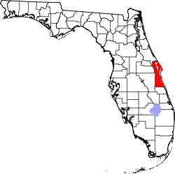 | |
| Towns | ||
| CDPs | ||
| Unincorporated communities | ||