Port-Cartier
| Port-Cartier | |
|---|---|
| City | |
 | |
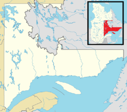 Port-Cartier Location in Côte-Nord region of Quebec. | |
| Coordinates: 50°02′N 66°52′W / 50.033°N 66.867°WCoordinates: 50°02′N 66°52′W / 50.033°N 66.867°W[1] | |
| Country |
|
| Province |
|
| Region | Côte-Nord |
| RCM | Sept-Rivières |
| Settled | 1910s |
| Constituted | February 19, 2003 |
| Government[2] | |
| • Mayor | Violaine Doyle |
| • Federal riding | Manicouagan |
| • Prov. riding | Duplessis |
| Area[2][3] | |
| • Total | 1,353.70 km2 (522.67 sq mi) |
| • Land | 1,101.31 km2 (425.22 sq mi) |
| Population (2011)[3] | |
| • Total | 6,651 |
| • Density | 6.0/km2 (16/sq mi) |
| • Pop 2006-2011 |
|
| • Dwellings | 3,093 |
| Time zone | EST (UTC−5) |
| • Summer (DST) | EDT (UTC−4) |
| Postal code(s) | G5B |
| Area code(s) | 418 and 581 |
| Highways |
|
| Website |
www |
Port-Cartier is a town in the Côte-Nord region of Quebec, Canada. It is located on the north shore of the Saint Lawrence River at the mouth of the Aux-Rochers River, exactly 63 kilometres (39 mi) southwest of Sept-Îles, Quebec.
Port-Cartier had a population of 6,651 at the 2011 Canadian census.[3] It has a land area of 1,101 square kilometres (425 sq mi), ranking 27th in area among all Canadian cities and towns. Besides Port-Cartier itself, the communities of Rivière-Pentecôte (49°47′N 67°10′W / 49.783°N 67.167°W) and Pointe-aux-Anglais are also within its municipal boundaries, all located along Quebec Route 138.
History
In 1915, Colonel Robert R. McCormick, owner of the Chicago Tribune, visited the Rochers River area to evaluate its forest potential. Soon after, a settlement was established on the west side of the mouth of this river, originally called Shelter Bay.[4] The post office opened in 1916, followed by a sawmill in 1918 and a debarking factory of the Ontario Paper Company in 1920. Yet the exhaustion of timber led to the closure of the factory in 1955.[1]
In 1958, the Québec Cartier Mining Company constructed an iron ore processing plant and an artificial sea port near Shelter Bay, for shipping the iron ore mined from deposits at Lake Jeannine near Fermont. Port-Cartier, named after the mining company, was incorporated as a town in 1959 [1] and the next year, Shelter Bay was added to it.[5] The original town of Shelter Bay is now the suburb known as Port-Cartier West.[6] Today, the port handles approximately 18,000,000 tonnes (19,800,000 short tons; 17,700,000 long tons) of cargo per year [4] and ranks third in Quebec in terms of handled tonnage.[1]
Rivière-Pentecôte

In 1875, a mission called Saint-Patrice-de-la-Rivière-Pentecôte was established some 100 km south-west of Sept-Îles at the mouth of the Pentecôte River. This name is attributed to Jacques Cartier who arrived at the place on the day of Pentecost in 1535. In 1884, the "Penticost River" Post Office opened, frenchized to Rivière-Pentecôte in 1933. At the end of the 19th century, it was among the most important industrial centres along the North Shore. In 1972, the Municipality of Rivière-Pentecôte was formed out of unorganized territory.[7]
On February 19, 2003, the Municipality of Rivière-Pentecôte was amalgamated into the Town of Port-Cartier.[7]
Demographics
Population
| Canada census – Port-Cartier community profile | |||
|---|---|---|---|
| 2011 | 2006 | 2001 | |
| Population: | 6,651 (-1.6% from 2006) | 6,758 (+5.1% from 2001) | 6,412 (-9.3% from 1996) |
| Land area: | 1,101.31 km2 (425.22 sq mi) | 1,101.31 km2 (425.22 sq mi) | 292.86 km2 (113.07 sq mi) |
| Population density: | 6.0/km2 (16/sq mi) | 6.1/km2 (16/sq mi) | 21.9/km2 (57/sq mi) |
| Median age: | 43.1 (M: 42.6, F: 43.5) | 41.7 (M: 41.1, F: 42.2) | 38.2 (M: 38.2, F: 38.2) |
| Total private dwellings: | 3,093 | 3,010 | 2,764 |
| Median household income: | $70,897 | $56,801 | $54,488 |
| Notes: Municipality of Rivière-Pentecôte amalgamated into the Town of Port-Cartier on February 19, 2003. – References: 2011[3] 2006[8] 2001[9] | |||
| Historical Census Data - Port-Cartier, Quebec[10] | |||||||||||||||||||||||||||||
|---|---|---|---|---|---|---|---|---|---|---|---|---|---|---|---|---|---|---|---|---|---|---|---|---|---|---|---|---|---|
|
|
| |||||||||||||||||||||||||||
Municipality of Rivière-Pentecôte amalgamated into the Town of Port-Cartier on February 19, 2003. | |||||||||||||||||||||||||||||


Language
Mother tongue:[8]
- English as first language: 1.1%
- French as first language: 97.1%
- English and French as first language: 0%
- Other as first language: 1.8%
See also
References
- 1 2 3 4 "Port-Cartier (ville)" (in French). Commission de toponymie du Québec. Retrieved 2010-07-30.
- 1 2 "Port-Cartier". Répertoire des municipalités (in French). Ministère des Affaires municipales, des Régions et de l'Occupation du territoire. Retrieved 2012-05-07.
- 1 2 3 4 "Port-Cartier census profile". 2011 Census of Population. Statistics Canada. Retrieved 2012-05-07.
- 1 2 Great Lakes St. Lawrence Seaway System : Port Cartier
- ↑ Encyclopedia Americana, Volume 22. Americana Corp. 1965. p. 378.
- ↑ Brookes, Ivan (1974). The lower St. Lawrence: a pictorial history of shipping and industrial development. Freshwater Press. p. 165.
- 1 2 "Rivière-Pentecôte (municipalité)" (in French). Commission de toponymie du Québec. Retrieved 2010-07-30.
- 1 2 "2006 Community Profiles". Canada 2006 Census. Statistics Canada. March 30, 2011. Retrieved 2012-05-07.
- ↑ "2001 Community Profiles". Canada 2001 Census. Statistics Canada. February 17, 2012. Retrieved 2012-05-07.
- ↑ Statistics Canada: 1996, 2001, 2006, 2011 census
External links
| Wikimedia Commons has media related to Port-Cartier. |
- (French) Port-Cartier official website
- Québec Cartier Mining Company
- Government of Canada demographic information
- Encyclopædia Britannica entry
 |
Lac-Walker | Sept-Îles | | |
| Lac-Walker | |
Gulf of Saint Lawrence | ||
| ||||
| | ||||
| Baie-Trinité |
| Cities & Towns | |
|---|---|
| Unorganized Territories | |
| Native reserves (Unassociated with RCM) | |
| |