Pomeroon-Supenaam
| Pomeroon-Supenaam (Region 2) | |
|---|---|
| Administrative Region | |
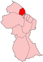 Map of Guyana showing Pomeroon-Supenaam region | |
| Country | Guyana |
| Regional Capital | Anna Regina |
| Area | |
| • Total | 6,195 km2 (2,392 sq mi) |
| Population (2012 census) | |
| • Total | 46,810 |
| • Density | 7.6/km2 (20/sq mi) |
| [1] | |
Pomeroon-Supenaam (Region 2) is a region in Guyana, bordering the Atlantic Ocean to the north, the region of Essequibo Islands-West Demerara to the east, the region of Cuyuni-Mazaruni to the south and the region of Barima-Waini to the west. Pomeroon-Supenaam contains the towns of Anna Regina, Charity, Pickersgill, Spring Garden and Suddie. In 2012, an Official Census by the Government of Guyana listed the population of the Pomeroon-Supenaam Region at 46,810.[2]
There are three lakes on the Essequibo Coast - Capoey, Mainstay and Hot and Cold. Capoey is near Anna Regina. The 3 lakes symbolize three of the standard elements, with earth being represented by the land.
Population
The Government of Guyana has administered three official censuses since the 1980 administrative reforms, in 1980, 1991 and 2002.[3] In 2002, the population of Pomeroon-Supenaam was recorded at 49,253 people.[2] Official census records for the population of the Pomeroon-Supenaam region are as follows:
- 2012 : 46,810
- 2002 : 49,253
- 1991 : 43,455
- 1980 : 42,341
Communities
(including name variants):
- Adventure
- Akawini Mission
- Amazon
- Anna Regina
- Aurora
- Aurora Estate
- Airy Hall
- Abrams Zuil
- Annandale
- Affiance
- Aberdeen
- Andrews
- Bel Alliance
- Bethany
- Bounty Hall
- Better Hope
- Better Success
- Bush Lot
- Cotton Field
- Capoey
- Cullen
- Columbia
- Charity
- Danielstown
- Dartmouth
- Dryshore
- Devonshire Castle
- Dawa
- Durung Bang
- Eurowa
- Fear Not
- Fair Field
- Golden Fleece (Golden Fleece Plantation)
- Good Hope
- Hoff Van Aurich
- Hibernia
- Huis'T Dieren
- Henritta
- Hampton Court
- Issororo
- Johanna Cecilia
- Kabakaburi
- La Union
- Little Alliance
- Land of Plenty
- Lima
- Machabo
- Middlesex
- Maria's Lodge
- Marlborough
- New Road
- Onderneeming
- Pomona
- Paradise
- Perth
- Perseverance
- Queenstown (Queenstown Village)
- Riverstown
- Reliance
- Richmond
- Sparta
- Saint Nicholas (Saint Nicholas Mission)
- Simiri
- Sirikie
- Somerset and Berks
- Suddie
- Wakapau Village
- Supenaam
- Spring Garden
- Taymouth Manor
- Three Friends
- Windsor Castle
- Walton Hall
- Zorg
- Zorg-en-Light
See also
References
- ↑ Macmillan Publishers (2009). "Administrative Regions - 2 and 3". Macmillan Junior Atlas: Guyana. Oxford: Macmillan Caribbean. p. 34. ISBN 9780333934173.
- 1 2 Beaie, Sonkarley Tiatun (19 September 2007). "National Population Trends: Size, Growth and Distribution" (PDF Download). 2002 Population and Housing Census - Guyana National Report. Bureau of Statistics. p. 25. Retrieved 29 August 2012.
- ↑ Beaie, Sonkarley Tiatun (19 September 2007). "Chapter 3: National Redistribution and Internal Migration". 2002 Population and Housing Census - Guyana National Report. Bureau of Statistics. p. 51. Archived from the original (PDF) on 2 September 2012. Retrieved 29 August 2012.
Coordinates: 7°06′28″N 58°52′50″W / 7.10778°N 58.88056°W