Polk, Wisconsin
| Polk, Wisconsin | |
|---|---|
| Town | |
 Location of Polk, Wisconsin | |
| Coordinates: 43°19′18″N 88°14′10″W / 43.32167°N 88.23611°WCoordinates: 43°19′18″N 88°14′10″W / 43.32167°N 88.23611°W | |
| Country | United States |
| State | Wisconsin |
| County | Washington |
| Area | |
| • Total | 32.2 sq mi (83.4 km2) |
| • Land | 31.9 sq mi (82.7 km2) |
| • Water | 0.3 sq mi (0.7 km2) |
| Elevation[1] | 1,122 ft (342 m) |
| Population (2000) | |
| • Total | 3,938 |
| • Density | 123.3/sq mi (47.6/km2) |
| Time zone | Central (CST) (UTC-6) |
| • Summer (DST) | CDT (UTC-5) |
| Area code(s) | 262 |
| FIPS code | 55-63875[2] |
| GNIS feature ID | 1583950[1] |
| Website |
www |
Polk is a town in Washington County, Wisconsin, United States. The population was 3,938 at the 2000 census. The unincorporated communities of Ackerville, Cedar Creek, Cedar Lake, Diefenbach Corners, Mayfield, and Rugby Junction are located in the town. The town derives its name from James K. Polk, 11th U.S. President, who was in office when Wisconsin attained statehood in 1848.
Geography
According to the United States Census Bureau, the town has a total area of 32.2 square miles (83.4 km²), of which, 31.9 square miles (82.7 km²) of it is land and 0.3 square miles (0.7 km²) of it (0.87%) is water.
Demographics
As of the census[2] of 2000, there were 3,938 people, 1,352 households, and 1,139 families residing in the town. The population density was 123.3 people per square mile (47.6/km²). There were 1,430 housing units at an average density of 44.8 per square mile (17.3/km²). The racial makeup of the town was 98.70% White, 0.20% African American, 0.15% Native American, 0.15% Asian, 0.13% Pacific Islander, 0.33% from other races, and 0.33% from two or more races. Hispanic or Latino of any race were 0.91% of the population.
There were 1,352 households out of which 38.3% had children under the age of 18 living with them, 77.2% were married couples living together, 3.6% had a female householder with no husband present, and 15.7% were non-families. 12.6% of all households were made up of individuals and 4.7% had someone living alone who was 65 years of age or older. The average household size was 2.89 and the average family size was 3.16.
In the town the population was spread out with 26.9% under the age of 18, 6.7% from 18 to 24, 28.5% from 25 to 44, 27.5% from 45 to 64, and 10.4% who were 65 years of age or older. The median age was 39 years. For every 100 females there were 105.0 males. For every 100 females age 18 and over, there were 105.6 males.
The median income for a household in the town was $62,933, and the median income for a family was $74,643. Males had a median income of $42,955 versus $33,750 for females. The per capita income for the town was $27,518. About 3.2% of families and 3.5% of the population were below the poverty line, including 2.2% of those under age 18 and 7.9% of those age 65 or over.
Notable people
- Valentine Detling, Wisconsin businessman and legislator, lived in the town of Polk.[3]
- Louis D. Guth, Wisconsin businessman and legislator, was born in the town of Polk.[4]
- James Rolfe, Wisconsin farmer and legislator, lived in the town of Polk.[5]
References
- 1 2 "US Board on Geographic Names". United States Geological Survey. 2007-10-25. Retrieved 2008-01-31.
- 1 2 "American FactFinder". United States Census Bureau. Retrieved 2008-01-31.
- ↑ 'Wisconsin Blue Book 1889,' Biographical Sketch of Valentine Detling, pg. 518
- ↑ 'Wisconsin Blue Book 1899,' Biographical Sketch of Louis D. Guth, pg. 789
- ↑ 'History of Washington and Ozaukee Counties, Wisconsin,' Western Publishing Company: 1881, Biographical Sketch of James Rolfe, pg. 589
External links
Municipalities and communities of Washington County, Wisconsin, United States | ||
|---|---|---|
| Cities | 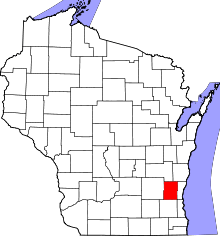 | |
| Villages | ||
| Towns | ||
| CDP | ||
| Unincorporated communities |
| |
| Footnotes | ‡This populated place also has portions in an adjacent county or counties | |