Pointe-Noire
| Pointe-Noire | |
|---|---|
|
Pointe Noire Railway Station | |
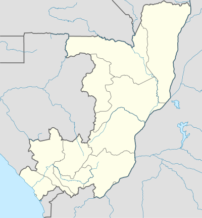 Pointe-Noire Location in the Republic of the Congo | |
| Coordinates: 04°46′43″S 11°51′49″E / 4.77861°S 11.86361°E | |
| Country |
|
| Department | Pointe-Noire Department |
| Commune | Pointe-Noire |
| Founded | 1883 |
| Government | |
| • Mayor | Roland Bouiti-Viaudo (MAR) |
| Area | |
| • Total | 1,144 km2 (442 sq mi) |
| Elevation | 14 m (46 ft) |
| Population (2007[1]) | |
| • Total | 715,334 |
| • Density | 630/km2 (1,600/sq mi) |
| Area code(s) | 242 |
| Website | www.pointenoireinformation.com |

Pointe-Noire (Kongo: Ndindi) is the second largest city in the Republic of the Congo, following the capital of Brazzaville, and an autonomous department since 2004. Before this date it was the capital of the Kouilou region (now a separate department). It is situated on a headland between Pointe-Noire Bay and the Atlantic Ocean. Pointe-Noire is the main commercial centre of the country and has a population of 715,334 (2007),[2] expanding to well over 1 million when the entire metropolitan area is taken into account.
Climate
The climate is tropically hot and humid. September and October experience somewhat less rainfall than the rest of the year.
| Climate data for Pointe-Noire 1982-2012 | |||||||||||||
|---|---|---|---|---|---|---|---|---|---|---|---|---|---|
| Month | Jan | Feb | Mar | Apr | May | Jun | Jul | Aug | Sep | Oct | Nov | Dec | Year |
| Average high °C (°F) | 30.6 (87.1) |
30.9 (87.6) |
31.5 (88.7) |
31.3 (88.3) |
29.7 (85.5) |
27.5 (81.5) |
25.8 (78.4) |
25.7 (78.3) |
26.8 (80.2) |
28.6 (83.5) |
29.3 (84.7) |
29.7 (85.5) |
28.95 (84.11) |
| Daily mean °C (°F) | 27.5 (81.5) |
27.6 (81.7) |
27.9 (82.2) |
27.7 (81.9) |
26.8 (80.2) |
24.4 (75.9) |
22.9 (73.2) |
23.1 (73.6) |
24.3 (75.7) |
26.2 (79.2) |
26.8 (80.2) |
26.9 (80.4) |
26.0 (78.8) |
| Average low °C (°F) | 24.3 (75.7) |
24.3 (75.7) |
24.4 (75.9) |
24.2 (75.6) |
23.8 (74.8) |
21.4 (70.5) |
20.0 (68) |
20.4 (68.7) |
21.8 (71.2) |
23.8 (74.8) |
24.1 (75.4) |
24.0 (75.2) |
23.04 (73.46) |
| Average precipitation mm (inches) | 151.8 (5.976) |
183.6 (7.228) |
154.0 (6.063) |
92.7 (3.65) |
45.7 (1.799) |
2.2 (0.087) |
1.7 (0.067) |
5.7 (0.224) |
17.1 (0.673) |
96.6 (3.803) |
126.1 (4.965) |
153.9 (6.059) |
1,031.1 (40.594) |
| Source: Normales et records pour la période 2000-2016 à Pointe-Noire ,[3] | |||||||||||||
Administration
Pointe-Noire is a commune divided into six urban districts (arrondissements):
- Patrice Emery Lumumba district, the oldest area. It is the administrative and commercial centre.
- Mvou-Mvou
- Tié-Tié
- Loandjili district
- Mongo-Pokou district
- Ngoyo district
History
The name Pointe Noire (Black Point) originated with Portuguese navigators who saw a block of black rocks on the headland in 1484. From then on, Pointe Noire, called Ponta Negra, became a maritime point of reference, and then a small fishing village starting in 1883, after the French signed a treaty with local people, the Loangos.
In 1910, French Equatorial Africa (Afrique équatoriale française, AEF) was created, and French companies were allowed to exploit the Middle Congo (modern-day Congo Brazzaville). It soon became necessary to build a railroad that would connect Brazzaville, the terminus of the river navigation on the Congo River and the Ubangui River, with the Atlantic coast. As rapids make it impossible to navigate on the Congo River past Brazzaville, and the coastal railroad terminus site had to allow for the construction of a deep-sea port, authorities chose the site of Ponta Negra instead of Libreville as originally envisaged. Construction of the Congo-Ocean Railway began in 1921, and led to the foundation of Pointe-Noire on 22 May 1922.
In 1927, drinking water became available in the city, which had about 3,000 inhabitants. The airport was built in 1932. In 1934, Governor Raphael Antonetti inaugurated the Congo-Ocean Railway. The first hospital was built in 1936. That same year, Bank of West Africa (BAO) opened its first branch in the city. In 1942, the Pointe-Noire Harbour welcomed its first ship, and made the city the AEF's seaport.
In 1950, Pointe-Noire had 20,000 inhabitants, and became the capital of the Middle Congo, while Brazzaville was the capital city of the AEF. In 1957, the Middle-Congo became the Republic of Congo, although it was still not independent. Incidents which occurred during 1958 legislative elections led the leaders of the Democratic Union for the Defence of African Interests (Union démocratique pour la défense des interets africains, UDDIA) to transfer the capital to Brazzaville, since Pointe-Noire was under the influence of the political opposition.
Pointe-Noire continued growing, and was the most modern city in 1960, when Congo gained independence. Then, the oil discovery around 1980 re-attracted people and Elf Aquitaine factories. The population doubled by 1982, and reached 360,000 in 1994.
Civil wars in 1997 and 1999 caused an influx of refugees from the surrounding provinces (Lékoumou, Niari, Bouenza, Pool) towards Pointe-Noire, causing the population to climb to over 1 million inhabitants.
Recently the Government has proposed the development of a new bulk resource port to be constructed at Point Indienne, 30 km to the north of the Port of Pointe-Noire. A meeting was held on 18 December 2012 with a collective of 10 Congo government ministries and invited mining companies to discuss future development opportunities.
Economy
Pointe-Noire is the essential centre of the oil industry of the Republic of Congo, one of the main oil producers in Central Africa. Congolese oil has been largely exploited by the French company Elf Aquitaine since its discovery around 1980.
Pointe-Noire is also known for its fishing industry, which is often at odds with the oil development.[4]
Formerly, Pointe-Noire was home to a potash exploitation which led to the construction of a wharf, currently closed to the public.
Education
Lycée Français Charlemagne, a French international school for primary and secondary school children, is in Pointe-Noire.
The city is home to the École supérieure de Technologie du Littoral (technology) the École supérieure de commerce et de gestion (business), Institut UCAC-ICAM (engineering) and the Centre d’éducation, de formation et d’apprentissage en mécanique auto (automotive engineering).[5] The Higher Institute of Technology of Central Africa has a campus in the city. There are also several other institutions of higher education in the city.[6]
Transport
Pointe-Noire is home to Agostinho Neto Airport which as of May 2015 had direct flights to Abidjan, Addis Ababa, Brazzaville, Casablanca, Cotonou, Douala, Kinshasa–N'Djili, Libreville, Lomé, Malabo, Paris–Charles de Gaulle, Port-Gentil, and Johannesburg–O. R. Tambo and was second busiest airport in the country. Pointe-Noire is also the terminus of the Congo-Ocean Railway, the railway station being a notable building. As of 2014 the railway was operating the La Gazelle train service every other day to Brazzaville and intermediate destinations.[7]
Thanks to its rapid growth, the city now includes Tié-Tié Railway Station and Ngondji Railway Station, the next railway stations after the Pointe Noire terminus.
Pointe-Noire has a taxi-bus network that runs throughout the entire city.
On 22 June 2010 a train departing from Pointe-Noire derailed resulting in the deaths of at least 50 passengers.[8] The railway was built by the French between 1921 and 1934 during the French colonial rule in Congo, thousands of people died while building the railway.[8]
Rankings
In the Mercer (consulting firm) Quality of Living Survey of 215 cities; Pointe Noire is ranked 209 in 2009. The rank for 2008 was 210.
International relations
Twin towns – Sister cities
Pointe-Noire is twinned with:
 Le Havre, France[9][10]
 New Orleans, Louisiana, USA
See also
References
- ↑ "Estimation at World Gazetteer". Archived from the original on 5 January 2013.
- ↑ Administrator. "Population des Départements". Retrieved 24 May 2016.
- ↑ "Normales et records pour la période 2000-2016 à Pointe-Noire". Infoclimat. Retrieved 2014-01-13.
- ↑ Tati, Gabriel (2004). "Sharing Public Space in Pointe-Noire, Congo-Brazzaville: Immigrant Fishermen and a Multinational Oil Company". In Hansen, Karen Tranberg. Reconsidering informality: perspectives from urban Africa. Nordic Africa Institute, 2004. p. 235. ISBN 91-7106-518-0.
- ↑ News of Bolloré Africa Logistics, Partnering schools in Congo Brazzaville: Congo Terminal commits to sandwich course education schemes.,Congo Brazzaville. 07 August 2014 , http://www.bollore-africa-logistics.com/en/media/news/partenariats-entreprise-ecoles-congo-brazzaville.html
- ↑ Tikdem Technologies. "Higher education, universities, institutes, campuses in Pointe-Noire, Pointe-Noire". PagesClaires.com. Retrieved 24 May 2016.
- ↑ 2014 Timetable, Lonely Planet, https://www.lonelyplanet.com/thorntree/forums/africa/congo/la-gazelle-train-brazzaville-to-pointe-noire
- 1 2 "Scores dead in Congo train crash". Retrieved 24 May 2016.
- ↑ Florence, Jeanne. "Le Havre - Les villes jumelées" [Le Havre - Twin towns] (in French). Retrieved 2013-08-07.
- ↑ "Le Havre - Les villes jumelées" [Le Havre - Twin towns]. City of Le Havre (in French). Archived from the original on 2013-07-29. Retrieved 2013-08-07. External link in
|work=(help)
External links
| Wikivoyage has a travel guide for Pointe-Noire. |
| Wikimedia Commons has media related to Pointe-Noire. |
- Decalo S., Thompson V. & Adloff R. 1984. Historical dictionary of Congo Pg 244-245. USA: The Scarecrow Press, Inc.
- MSN Map - elevation = 1m
Coordinates: 04°48′S 11°51′E / 4.800°S 11.850°E