Point Hope Airport
| Point Hope Airport | |||||||||||
|---|---|---|---|---|---|---|---|---|---|---|---|
 | |||||||||||
| IATA: PHO – ICAO: PAPO – FAA LID: PHO | |||||||||||
| Summary | |||||||||||
| Airport type | Public | ||||||||||
| Owner | State of Alaska DOT&PF - Northern Region | ||||||||||
| Serves | Point Hope, Alaska | ||||||||||
| Elevation AMSL | 12 ft / 4 m | ||||||||||
| Coordinates | 68°20′56″N 166°47′58″W / 68.34889°N 166.79944°W | ||||||||||
| Map | |||||||||||
 PAPO Location of Point Hope Airport | |||||||||||
| Runways | |||||||||||
| |||||||||||
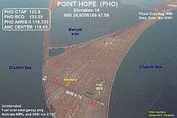
Point Hope Airport (IATA: PHO, ICAO: PAPO, FAA LID: PHO) is a state-owned public-use airport located two miles (3 km) southwest of the central business district of Point Hope, a city in the North Slope Borough of the U.S. state of Alaska. Point Hope is located in the Lisburne Peninsula, on the Chukchi Sea coast. The airport covers an area of 22 acres (8.9 ha) and contains one asphalt paved runway designated 1/19 which measures 4,000 x 75 ft (1,219 x 23 m).[1]
As per Federal Aviation Administration records, the airport had 4,580 commercial passenger boardings (enplanements) in calendar year 2005 and 4,900 enplanements (4,359 scheduled and 541 unscheduled) in 2006.[2] According to the FAA's National Plan of Integrated Airport Systems for 2007–2011, it is classified as commercial service - non-primary because it has between 2,500 and 10,000 passenger boardings per year.[3]
Airlines and destinations
| Airlines | Destinations |
|---|---|
| Bering Air | Cape Lisburne, Kotzebue[4] |
| Ravn Alaska | Kivalina, Kotzebue, Point Lay |
References
- 1 2 FAA Airport Master Record for PHO (Form 5010 PDF), effective 2008-04-10
- ↑ FAA Passenger Boarding Data: 2005 and 2006
- ↑ FAA National Plan of Integrated Airport Systems: 2007-2011
- ↑ Bering Air: Kotzebue Flight Schedule (PDF). Retrieved 2008-05-22.
External links
- FAA Alaska airport diagram (GIF)
- FAA Terminal Procedures for PHO, effective December 8, 2016
- Resources for this airport:
- FAA airport information for PHO
- AirNav airport information for PAPO
- ASN accident history for PHO
- FlightAware airport information and live flight tracker
- NOAA/NWS latest weather observations for PAPO
- SkyVector aeronautical chart for PHO