Point Fortin
| Point Fortin | |
|---|---|
| Borough | |
| Motto: Aspire to Achieve | |
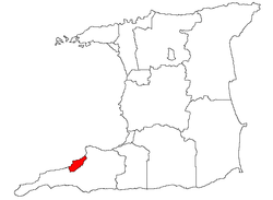 Location of Point Fortin | |
| Coordinates: 10°10′N 61°40′W / 10.167°N 61.667°WCoordinates: 10°10′N 61°40′W / 10.167°N 61.667°W | |
| Country | Trinidad and Tobago |
| Jurisdiction | Borough of Point Fortin |
| Government | |
| • Mayor | Clyde Paul |
| • Governing body | Point Fortin Borough Corporation |
| • Deputy Mayor | Janelle St. Hillaire |
| • Chief Executive Officer | Donnamay Taylor |
| Area | |
| • Total | 9.22 sq mi (23.88 km2) |
| Population (2000) | |
| • Total | 23,000 |
| • Density | 2,000/sq mi (800/km2) |
| Time zone | Atlantic (UTC-4) |
| Website | pointfortinborough.com |
|
| |
Point Fortin, the smallest Borough in Trinidad and Tobago,(also the first Republic Borough of Trinidad and Tobago) is located in southwestern Trinidad, about 32 km (20 mi) southwest of San Fernando. After the discovery of petroleum in the area in 1906 the town grew into a major oil-producing centre. The town grew with the oil industry between the 1940s and 1980s, culminating in its elevation to borough status in 1980. After the end of the oil boom Point Fortin was hit hard by economic recession in the 1980s and the closure of its oil refinery. Construction of a Liquefied Natural Gas plant by Atlantic LNG boosted the economy.
History and Development
At the beginning of the 20th century (before the discovery of oil), Point Fortin was an agricultural community with three distinct and separately owned cocoa and coconut estates.
These estates were sparsely populated. Employment was provided for a small number of workers who depended on the estates for their living accommodation as well as their food and other supplies. Travel in and out of Point Fortin was by coastal steamers as there was no road into or out of the area. The inhabited area was located along the seacoast.
In 1907, the Trinidad Oilfields moved into Point Fortin on an expedition for the exploration of oil and sank its first oil well on the La Fortunee Estates. That company turned out to be the only one that survived successfully, although there had been several similar expeditions by other oil companies.
The company later changed its name to the United British Oilfields of Trinidad then became Shell Trinidad Limited. In 1974 it was acquired by the Government and named TRINTOC or the Trinidad and Tobago Oil Company, today known as Petrotrin.
The change from an agricultural to an oil based economy made a significant impact in Point Fortin. There was rapid development in the construction of dwelling houses, plant, pipelines and oil tanks in the area. Point Fortin was booming and labour, particularly skilled labour for the new technology, was scarce and posed a major problem. Trinidadians did not seem to be attracted to the area.
Although people migrated from all over the country, the population in 1931 was less than 500. There were very few houses, no schools, and recreational and other facilities. As a result, Trinidadians who went to work in Point Fortin never took their families with them.
However, this changed when the company realised that in order to attract and retain workers, they needed to develop the area. This encouraged families to settle in the area, and coupled with a growth in the commercial sector, brought about such facilities as a post office, police station as well as other governmental agencies and banks.
In the 1960s the town began to see a decline due to massive retrenchment. The Government tried to revive the economic activity and eventually succeeded in establishing the Dunlop Tyre Factory. However the economic revival was only achieved in the early 1970s as a result of the Oil boom and the acquisition of Shell Trinidad Limited by the government. Point Fortin's Mayor is His Worship Alderman Clyde Paul. Point Fortin is ruled by the People's National Movement. The MP for Point Fortin is Edmund Dillon.
Notable natives
Culture
- Fay-Ann Lyons Alvarez – Soca Artiste
- Barnet Henry (The Preacher) – Calypsonian
- Wayne T – Soca artist / Calypsonian
- Iwer George – Soca artist / Calypsonian
- Austin Lyons (Superblue) – Calypsonian / Soca artist
- Kelvin Pope (The Mighty Duke) – Calypsonian
- Morel Peters (Luta) – Calypsonian
- Western Rawlins (Cro Cro) – Calypsonian
- Naya George – Soca Artiste
Sports
Trinidad and Tobago National Football
- Reynold Carrington
- Atiba Charles
- Avery John
- Kenwyne Jones
- Sherwin Julien
- Keyeno Thomas
- Aubrey David
- Warren Archibald
- Leo Brewster
- Wilfred Cave
- Steve David
- Leroy de Leon
- Anthony Douglas
- Watty Douglas
- Rawlins "Cax" Baptiste
- Keith "Salem" Douglas
- Randy Samuel - Canadian footballer
Track and field
- Anthony "Sugars" Monroe
- Maxine McMillan
Trinidad and Tobago Cricket
- Lionel Mc Cree
- Richard Gabriel
- Richard Daniel
Trinidad and Tobago Basketball
- Victor "Voot" O'Garro
- Gerard Joseph
- Larry "Engine" Belfon
Public Service
- Lionel Blake - First Mayor
- Victor Chin Kit - Past Mayor
- Arthur Joseph - Deal or No Deal (US game show) Winner
- Cyril Rogers-Longest serving MP
- Francis Bertrand-Longest serving Mayor(Boro Day Pioneer)
Others
- Manchand Teeluck - Professional Wrestler Ring of Honor and New Japan Pro Wrestling
- Kailash Seemegona - Color Commentator Ring of Honor and New Japan Pro Wrestling
- Keston Jones - Special Effects Assistant (Ash vs Evil Dead)
- Andreus Sookram - Adult Pornographic Actor Brazzers
- Blake Ramires - Radio Co-Host Pirate Radio Podcast (US Internet Radio/Podcast Show)
Education
Primary schools
- Point Fortin Roman Catholic Primary School
- Point Fortin S.D.A Primary School
Secondary schools
- Point Fortin East Secondary School (formally known as PFC)
- Point Fortin West Secondary School (formally known as the Junior Secondary)
- Holy Name Convent'
Other Educational/Training Institutions
- Manchand Teeluck's Squared Circle Grappling Academy - Professional Wrestling Academy
- Lu-Wong Dance Academy
- Com Sa Choi - Asian Culinary Institute
- Club Malibu - Pole Dancing Academy
Electoral Districts
- Egypt Village
- Techier/Guapo Village
- Mahaica/New Lands Village
- Cap-De-Ville/Fanny Village
- New Village
- Hollywood Village
References
- Anthony, Michael (2001). Historical Dictionary of Trinidad and Tobago. Scarecrow Press, Inc. Lanham, Md., and London. ISBN 0-8108-3173-2.
Local Government in Trinidad and Tobago | ||
|---|---|---|
| Regional corporations |  | |
| Boroughs and cities | ||
| Other bodies | ||
| Counties (historic) | ||