Pohakuloa Training Area
| Pōhakuloa Training Area | |
|---|---|
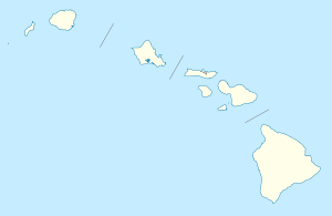
| Island of Hawaiʻi, Hawaiʻi | |
|
The main gate at the Pōhakuloa Training Area. | |
 Pōhakuloa Training Area | |
| Coordinates | 19°45′22″N 155°32′49″W / 19.756°N 155.547°W |
| Type | Training facility |
| Site information | |
| Owner | United States Army |
| Controlled by | United States |
| Site history | |
| Built | 1955 |
| In use | Yes |
| Garrison information | |
| Current commander |
Lt. Col. Christopher Marquez [1] |

Pōhakuloa Training Area (PTA) is located on the island of Hawaiʻi in the high plateau between Mauna Loa, Mauna Kea and the Hualālai volcanic mountains. It includes a small military airstrip known as Bradshaw Army Airfield.
Description
The area of 108,863 acres (440.55 km2) is the largest United States Department of Defense installation in the state of Hawaii, or anywhere in the Pacific. The region was used for live fire exercises in 1943 during World War II when Camp Tarawa temporarily held troops on Parker Ranch.[2] About 91,000 acres (37,000 ha) were leased from Richard Smart, owner of the ranch. At that time it was called the Waikoloa Maneuver Area, and located northwest of current base, south of Waimea. In September 1946 the land used for the old maneuver area and camp was returned to the ranch, and a smaller Lalamilo Firing Range used until 1953. Since coastal areas were developed into tourist resorts, military areas were moved inland to more remote locations.[3]
Location
The name of the current facility comes from puʻu pōhaku loa, which means "long rocky cinder cone" in the Hawaiian Language, although like many other Hawaiian names, the same name has been used for other places on the island.[4] Pōhakuloa Training Area lies in a high plateau between lower slopes of Mauna Kea to approximately 6,800 feet (2,100 m) in elevation and to about 9,000 feet (2,700 m) on Mauna Loa. The training area is about midway between Hilo, on the east coast and the Army landing site at Kawaihae Harbor.[5] It is used by both the U.S. Army and Marine Corps.
The only road access is via the Saddle Road (Hawaii Route 200), which is paralleled by a tank trail. Heavy equipment is either flown into Hilo, or else shipped via barge to Kawaihae Harbor, about 40 miles (64 km) away on the Saddle Road. Because of this remoteness, the area is used mostly for short training sessions.
Facilities
The barracks for about 2,000 troops were constructed in April 1955 from prefabricated buildings used in World War II. The support area includes 600 acres (240 ha) of logistic and administrative facilities. In July 2006 an additional 24,000 acres (9,700 ha) were purchased from Parker Ranch in an area known as Keʻāmuku,[6] which means "cut-off lava" in Hawaiian, from to the 19th century lava flows through the area.[7][8] Located at 19°50′24″N 155°43′1″W / 19.84000°N 155.71694°W,[9] the realignment of the Saddle Road is planned to bypass the Ke‘āmuku addition.[10] PTA has a 51,000-acre (21,000 ha) impact area used for bombing and gunnery practice, refurbished in March 2009 to allow helicopter training.[11] There are approximately 32,000 acres (130 km2) of land level enough for large maneuvers, more than twice the area available on Oʻahu. Its remoteness allows a wide range of weapons to be used. The 25th Infantry Division and 3rd Marine Regiment often use the base for four to six-week training periods.[12]
Environmental problems
Weapons such as the Davy Crockett nuclear rifle with dummy warheads and depleted Uranium have been used at PTA.[13]
After initial denials, an investigation concluded the spotting rounds used in the 1960s. Measurements detected radiation, but reportedly not above life-threatening levels.[14][15]

Two Native Hawaiians were suing the Department of Land and Natural Resources, saying the state has breached its duty to protect ceded lands at the Pohakuloa Training Area.[16]
Bradshaw Army Airfield
The airstrip was constructed at the area in 1956. The runway is only 3,700 feet (1,100 m) long, which only accommodates small aircraft. Fog often restricts helicopters, which can also fly in from the larger bases on Oʻahu.
Environment
Vegetation varies from sparse grassland and low shrubs to open māmane forest. Despite the volcanic terrain, some of the areas contain protected wildlife. Within the borders of the training area, ten different endangered species can be found. These include the native Hawaiian mint honohono (Haplostachys haplostachya) and the shrub 'kio'ele (Kadua coriacea). This area has more endangered species than any other US Army installation.[17] The northeastern portion of the site near Mauna Kea provides habitat for the endangered bird Palila (Loxioides bailleui), for example.
Several archaeological sites have been found in the training area, including the Bobcat Trail Habitation Cave, listed in the National Register of Historic Places.[18] To reduce fire danger and damage from feral goats, areas were fenced.
See also
- Hawaii World War II Army Airfields
References
- ↑ "Pohakuloa Training Area". U.S. Army. May 21, 2016.
- ↑ Andrew M. Beavers (December 19, 2000). "Analysis of Fire History and Management Concerns at Pohakuloa Training Area" (PDF). Colorado State University. Retrieved August 27, 2010.
- ↑ "Phase II Former Waikoloa Maneuver Area and Nansay Sites Engineering Evaluation/Cost Analysis" (PDF). US Army Corps of Engineers. July 1, 2002. Retrieved August 27, 2010.
- ↑ "Lookup of pohakuloa". Hawaiian place names web site. 2004. Retrieved August 27, 2010.
- ↑ Pahakuloa Training Area page at Marine Corps Base Hawaii web site
- ↑ "U.S. Army Acquires Keamuku Parcel". Parker Ranch Foundation. Retrieved August 27, 2010.
- ↑ Lloyd J. Soehren (2004). "lookup of Keamuku". on Hawaiian place names. Ulukau, the Hawaiian Electronic Library. Retrieved August 25, 2010.
- ↑ U.S. Geological Survey Geographic Names Information System: Ke‘āmuku Lava Flow
- ↑ U.S. Geological Survey Geographic Names Information System: Ke‘āmuku
- ↑ US Department of Transportation; Hawaii Department of Transportation. Supplemental Environmental Impact Statement (PDF). Retrieved August 26, 2010.
- ↑ "25th CAB improves Pōhakuloa Training Area" press release on U.S. Army web site, March 2009
- ↑ Gregg K. Kakesako (May 13, 2001). "Big Isle site is base for heavy Army training Pohakuloa Training Area allows for large-scale training that the Army cannot do on Oahu". Honolulu Star-Bulletin. Retrieved August 30, 2010.
- ↑ William Cole (14 May 2007). "Doubts remain about depleted uranium". Honolulu Star-Bulletin. Retrieved August 30, 2010.
- ↑ Erin Miller (September 1, 2010). "Military says DU at PTA likely harmless: Army reports 'no likely adverse impacts' from spotting rounds". West Hawaii Today. Retrieved September 2, 2010.
- ↑ Cabrera Services (2010-06-22). "FINAL POHAKULOA TRAINING AREA FIRING RANGE BASELINE HUMAN HEALTH RISK ASSESSMENT FOR RESIDUAL DEPLETED URANIUM" (PDF). Wheeler Army Airfield, Oahu, HI, USA: U.S. Army Garrison-Hawaii. Retrieved 2013-03-02. External link in
|publisher=(help) - ↑ Nancy Cook (December 12, 201). "Hawaiians sue over PTA munitions". West Hawaii today. Oahu Publications, Inc. Retrieved 31 December 2014. Check date values in:
|date=(help) - ↑ Pohakuloa Training Area on GlobalSecurity.Org web site
- ↑ "Historic Sites Review of a Proposed Mauna Loa Trail System" by Thomas S. Dye, March 25, 2005, on Nature Conservancy web site
External links
| Wikimedia Commons has media related to Pohakuloa Training Area. |