Pleasant Plains, Staten Island
Pleasant Plains is a neighborhood located on Staten Island, one of the five boroughs of New York City, New York, the most populous city in the United States. It is bordered by Woodrow to the north, the Lower New York Bay to the south, Richmond Valley to the west, and Prince's Bay to the east. The neighborhood is represented in the New York City Council by Joe Borelli.

Situated on the island's South Shore, Pleasant Plains has a population of 5,000 according to the 2000 census. It was named by officials of the Staten Island Railroad Corporation, the original owners of what is now known as the MTA Staten Island Railway. When the railroad line was extended to Tottenville in 1860, a station crossing Amboy Road approximately two miles north of Tottenville was named Pleasant Plains. Eventually, the name "Pleasant Plains" was applied to the community which soon sprung up around the station.
History
In 1882, a 120-acre (0.49 km2) farm southeast of the railroad station was purchased from the Bennett family by the Reverend John Christopher Drumgoole founder of the Mission of the Immaculate Virgin. He started the mission in Manhattan in 1871 originally to aid homeless newsboys. Subsequent parcels were added for a combined area of 400 acres (1.6 km2). The formal name became The Mission of The Immaculate Virgin at Mount Loretto but was and still is referred to solely as "Mt. Loretto". An orphanage for boys and a working farm was established on the site. At one time it was the largest farm in New York State. In 1888 Father Drumgooles successor began construction on St. Elizabeth's Building, a six story Georgian Style building to be used as a girls' orphanage with a capacity of 350 children. It was destroyed by fire in Mar. 2000 as a result of arson. The building had been abandoned and neglected for a number of years.[1]
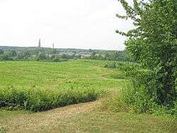
A 194-acre (0.79 km2) parcel of land south of Hylan Blvd. was sold to The State of New York. The park named, "The Mount Loretto Unique Area" is maintained by the New York State Dept. of Environmental Conservation. The state park adjoins Lemon Creek Park, which is partially in Pleasant Plains. The Pleasant Plains' portion includes a fishing pier at the foot of Sharrotts Ave.
The park contains 85 ft (26 m). high red clay bluffs overlooking Prince’s Bay, part Outer New York Harbor,they are part of the terminal moraine the southern terminous of the Wisconsin Glacier which receded 10,000 yrs. ago.[2] They are the tallest ocean-facing bluffs in New York State. On the highest section of these bluffs The Prince's Bay Lighthouse was built in 1864. The lighthouse has attached living quarters.[3]
In 1978, 126 acres (510,000 m²) on the north side of the property were converted into the Cemetery of the Resurrection by the church's Archdiocese of New York, which needed to open a new cemetery on Staten Island as most of the burial plots at the island's existing Catholic cemeteries had already been used.
In 1973, the Church of St. Joachim and St. Anne was destroyed by fire. The exterior of this church was used in the baptism scene from The Godfather the year before.
In 2004 a 12-acre (49,000 m²) tract at the northeastern corner of the mission's property, which had been the site of a convent maintained by the Handmaids of the Most Pure Heart of Mary, a Franciscan order of nuns, was sold to residential developers for US$19 million, despite steadfast opposition from local conservation activists. Part of the mission property became the Mount Loretto Unique Area.[4]
The commercial core of this community centers around the intersection of Bloomingdale Road, Amboy Road and Pleasant Plains Avenue. Like many of the South Shore's old commercial cores, it is experiencing a mild, yet noticeable rebirth.
Transportation
Pleasant Plains is served by the Staten Island Railway station of the same name near Amboy Road/Bloomingdale Road.
It is served by the S55 bus on Amboy Road and Bloomingdale Road. It is also served by numerous express buses to and from Manhattan. The X17 and X22 serve Amboy Road and Bloomingdale Road. The X22A serves Amboy Road and Drumgoogle Road.[5]
Education
The New York City Department of Education operates public schools.
The main campus of South Richmond High School, a special education school, is in Pleasant Plains.[6]
See also
References
- ↑ Mission of the Immaculate Virgin at Mt Loretto
- ↑ / Geology of Staten Island, College of Staten Island
- ↑ / Lighthouse Friends. Com
- ↑ Staff writer (n.d.). "Mt. Loretto Unique Area". New York State Department of Environmental Conservation. Retrieved 2009-08-08.
- ↑ "Staten Island Bus Map January 2013" (PDF). Metropolitan Transportation Authority. January 2013. Retrieved February 16, 2013.
- ↑ Fioravante, Janice. "If You're Thinking of Living In/Charleston, Staten Island; Neighborhood That Grew From a Clay Pit." The New York Times. June 2, 2002. Retrieved on September 20, 2012.
External links
Coordinates: 40°31′26″N 74°12′56″W / 40.52389°N 74.21556°W