Plön (district)
| Plön | ||
|---|---|---|
| District | ||
| ||
 | ||
| Country |
| |
| State | Schleswig-Holstein | |
| Capital | Plön | |
| Government | ||
| • District admin. | Dr. Volkram Gebel | |
| Area | ||
| • Total | 1,082.71 km2 (418.04 sq mi) | |
| Population (31 December 2015)[1] | ||
| • Total | 128,304 | |
| • Density | 120/km2 (310/sq mi) | |
| Time zone | CET (UTC+1) | |
| • Summer (DST) | CEST (UTC+2) | |
| Vehicle registration | PLÖ | |
| Website | kreis-ploen.de | |
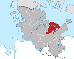
Plön (German pronunciation: [ˈpløːn]) is a district in Schleswig-Holstein, Germany. It is bounded by (from the east and clockwise) the districts of Ostholstein and Segeberg, the city of Neumünster, the district of Rendsburg-Eckernförde, the city of Kiel and the Baltic Sea.
History
The district was established by the Prussian administration in 1867. In 1932 it was enlarged with parts of the dissolved district of Bordesholm. During the 20th century some municipalities left the district due to incorporation into the city of Kiel.
Geography
The inland part of this small district is covered with lakes. The Großer Plöner See ("Great Plön Lake", 29 km²) and the Selenter See ("Lake Selent", 22 km²) are the largest lakes in Schleswig-Holstein. The lakeland and the adjoining parts of the neighbouring district Ostholstein constitute the region called Holstein Switzerland, since this is a very hilly countryside. However, the highest hill (Bungsberg) has only 168 m. North of the lakeland there is the Probstei, a region on the coast of the Baltic Sea.
Coat of arms
 Coat of arms |
The coat of arms displays:
|
Towns and municipalities
| Independent towns | and municipalities |
|---|---|
| Ämter | ||
|---|---|---|
|
|
|
| 1seat of the Amt; 2town | ||
Map of municipalities and Ämter

References
External links
![]() Media related to Kreis Plön at Wikimedia Commons
Media related to Kreis Plön at Wikimedia Commons
- Official website (German)
| Urban districts | |
|---|---|
| Rural districts | |
Coordinates: 54°15′N 10°25′E / 54.25°N 10.42°E