Pixie Mountain
| Pixie Mountain | |
|---|---|
 Grandfather Mountain (left) and Pixie Mountain (right) | |
| Highest point | |
| Elevation | 4,058 ft (1,237 m) [1] |
| Coordinates | 36°03′42″N 81°52′36″W / 36.06167°N 81.87667°WCoordinates: 36°03′42″N 81°52′36″W / 36.06167°N 81.87667°W [1] |
| Geography | |
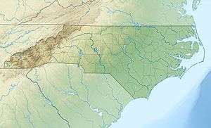 Pixie Mountain Location in North Carolina | |
| Location | Avery County, North Carolina, U.S. |
| Parent range | Blue Ridge Mountains |
| Topo map | USGS Newland |
Pixie Mountain is a mountain in the North Carolina High Country, in the community of Linville. Its elevation reaches 4,058 feet (1,237 m). The mountain is adjacent to the Linville River.
The Linville Bypass (NC Hwy 181) goes around Pixie Mountain on its western side; while the majority of the Linville community is on its East and North. However, most people are blissfully unaware of the mountain's name since no signs and maps mention it.
References
- 1 2 "Pixie Mountain". Geographic Names Information System. United States Geological Survey. Retrieved 2009-12-29.
This article is issued from Wikipedia - version of the 12/6/2015. The text is available under the Creative Commons Attribution/Share Alike but additional terms may apply for the media files.