Pisang
| Pisang पिसाङ | |
|---|---|
| Village development committee | |
|
Pisang | |
 Pisang Location in Nepal | |
| Coordinates: 28°37′00″N 84°09′00″E / 28.61673°N 84.14991°ECoordinates: 28°37′00″N 84°09′00″E / 28.61673°N 84.14991°E | |
| Country |
|
| Zone | Gandaki |
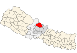
| District | Manang |
| Elevation | 3,250 m (10,660 ft) |
| Population (2001) | |
| • Total | 707 |
| Time zone | Nepal Time (UTC+5:45) |


Buddhist temple in Pisang
Pisang is a village development committee in Manang District in the Gandaki Zone of northern Nepal. At the time of the 2001 Nepal census it had a population of 707 people living in 142 individual households.[1] Pisang consists of two parts divided by the Marsyangdi river: Lower Pisang (3200 m) and Upper Pisang (3300 m). There is a Buddhist temple in Upper Pisang.
References
- ↑ "National Report 2001" (PDF). Central Bureau of Statistics, Government of Nepal.
Headquarter: Chame | ||
 | ||
This article is issued from Wikipedia - version of the 9/10/2014. The text is available under the Creative Commons Attribution/Share Alike but additional terms may apply for the media files.