Piraeus–Patras railway

The railway from Piraeus to Patras was a 230-kilometre long metre gauge railway line in Greece, that connected the port of Piraeus with Patras in the Peloponnese peninsula, via Athens and Corinth. It was opened between 1884 and 1887. Formerly one of the main lines of the Greek railway network, it has now largely fallen into disuse. It has partly been replaced by a new standard gauge line to Kiato, opened in 2005. The 13 km section between Piraeus and Agioi Anargyroi, a northern suburb of Athens, has been removed since.
Main stations
The main stations on the Piraeus–Patras railway were:
- Piraeus station
- Athens Peloponnese station
- Corinth railway station (old)
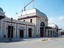
- Patras station
Services
Since 2009, services have ceased on most of the Piraeus–Patras railway. The only remaining passenger service is the Proastiakos commuter rail service Agios Vasileios–Patras–Agios Andreas.[2]