Pinnacle Mountain State Park
Coordinates: 34°50′32″N 92°29′07″W / 34.84220°N 92.48525°W
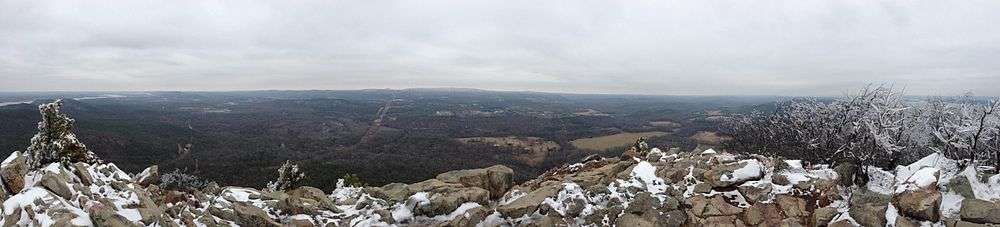
Pinnacle Mountain State Park is located just over a mile from the northwest edge of Little Rock, AR, in the foothills of the Ouachita Mountains. The primary natural feature of the 2,000 acre park is Pinnacle Mountain with an elevation 1,011 feet (308 m). It rises over 750 feet (230 m) above the nearby Arkansas River, which sits at about 250 feet (76 m) above mean sea level.


Hiking
A number of hiking trails are in the park. Two of the most popular trails ascend to the summit of Pinnacle Mountain: The West Summit Trail is one of the most heavily used trails in Arkansas, while the East Summit Trail ascends even more steeply up several rock scrambles. The 3.5 mile Base Trail loops completely around the base of Pinnacle Mountain and connects the East and West Summit Trailhead areas. Two interpretive trails are the Arkansas Trail through the Arkansas Arboretum and the Kingfisher Trail next to the Little Maumelle River. The 223-mile (359 km) Ouachita National Recreation Trail has its eastern terminus in the park, sharing a trail head with the East Summit Trail near the visitor's center. The Rocky Valley Trail also starts near the park visitor's center and forms a two mile loop. The East Quarry Trail spurs off the Rocky Valley Trail midway through the loop to climb in elevation along the east end of the park, providing views of Pinnacle Mountain and the Arkansas River.
Camping
Although camping is not allowed inside the park itself, campsites are available at Maumelle Park, which is 3.8 miles away from Pinnacle Mountain. This is an Army Corps of Engineers facility with water and electrical hookups, a boatramp, and tables with grills.[1] Camping is also allowed at designated sites on the Ouachita Trail. Nance Mountain Shelter is located at mile marker 189.5, approximately 23.5 miles from the eastern terminus of the Ouachita Trail. There is no water or electricity at the Nance Mountain Shelter. Parking is available at the East Summit Trail parking lot.