Pine Brook, Morris County, New Jersey
| Pine Brook, New Jersey | |
|---|---|
| Unincorporated community | |
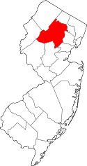
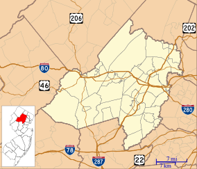 Pine Brook, New Jersey  Pine Brook, New Jersey  Pine Brook, New Jersey Pine Brook's location in Morris County (Inset: Morris County in New Jersey) | |
| Coordinates: 40°51′37″N 74°20′26″W / 40.86028°N 74.34056°WCoordinates: 40°51′37″N 74°20′26″W / 40.86028°N 74.34056°W | |
| Country |
|
| State |
|
| County | Morris |
| Township | Montville |
| Elevation | 197 ft (60 m) |
| ZIP code | 07058 |
| GNIS feature ID | 0879292[1] |
Pine Brook (sometimes spelled Pinebrook) is an unincorporated community located within Montville Township in Morris County, New Jersey, United States.[2] The area is served as United States Postal Service ZIP Code 07058.
History
Pine Brook was first settled by Dutch farmers in the early 1700s. On April 11, 1867 the New Jersey Legislature formally united and chartered the three sections of White Hall, Montville and Pine Brook into the present day Township of Montville from territory set off from Pequannock Township.
Pine Brook is located along a road (the western terminus of today's "Bloomfield Avenue" where it becomes U.S. Route 46) connecting the port city of Newark with the farms, foundries & mines of western New Jersey, it was a waystation for passing trade in its early days. A farming community, Pine Brook produced dairy products in addition to fruits and vegetables, and for many years there existed a large business in cider making and distilling of Cider Brandy in nearby Cider Mills. With its close proximity to Morristown, during the Revolutionary War both British and American forces traveled through the area.
"Pine Brook, being nearly surrounded by the Rockaway and Passaic Rivers, consists of what is called the Pine Brook flats, and is a level tract with soil of sandy loam free from stone, which, when properly cultivated, is productive. This part of the township of Montville is about thirteen miles from Newark, with which it is connected by a good road, which for three-quarters of the distance consists of a Telford pavement. The soil consists mainly of loam on clay bottom, and is generally productive in grass, grain, vegetables and fruit. The farmers engaged largely in the production of milk to supply the Newark market, and considerable quantities of butter, eggs, poultry, pork, beef, hay and straw were produced for market. For some years, considerable attention was given to planting choice fruit trees, and some reaped the benefits in apples and pears, which generally yielded a good return. The land in this township is chiefly rolling." (Hon. John Kanouse - 1881)
WAY STATION - "From the description of property in old deeds, it appears that between 1800 and 1810 an attempt was made to name the cluster of three or four houses at Pine Brook, where George D. Mead keeps a store, "Union Village", but as a village failed to grow up, the name was dropped and has been forgotten. At this point, a tavern was kept over eighty years and for many years it did a legitimate and profitable business in the accommodations of "Sussex Teams", as they were called, which in large numbers used to pass this way toward Newark with loads of flour, feed, grain, butter, pork, and other produce from Sussex, Warren, and the upper parts of Morris county." (Hon. John Kanouse - 1881)
Geography
Pine Brook is located at the southern end of the Hook Mountain Range and surrounded by the Pine Brook Flats; a fertile flood plain created by the surrounding Rockaway River and Passaic River. It is bounded north by Montville and Towaco (aka White Hall), east by the Passaic River across from Fairfield (Old Horse Neck) and West Caldwell, south by the Rockaway River across from East Hanover Township and west by the Rockaway River across from Parsippany and Lake Hiawatha.
Demographics
As of the 2010 United States Census, the population for ZIP Code Tabulation Area 07058 was 5,372.[3]
Points of interest
A number of dining, shopping and entertainment destinations were located in Pine Brook where Bloomfield Avenue becomes Route 46 and heads gradually uphill into the mountainous New Jersey Skylands Region. These landmarks are no longer with us but were very popular with travelers and locals in the 1960s and 1970s: O'Dowd's Milk Bar & Restaurant, a classic ice cream parlor famous for traditional ice cream cones and sundaes. In the rear of the building was a Bowling Alley, Penny Arcade & Slot Car Racing Track. It was located on Route 46 in Pine Brook and was a popular entertainment destination along with the Pine Brook Par 3 Golf Course & Driving Range which featured Lighted Night Golf; the Pine Brook Auction, a permanent Flea Market featuring live auctions of all kinds of merchandise which burned down on October 7, 1971; the Pine Brook Speedway, which operated from July 1962 until October, 1989, Legendary in New Jersey Auto Racing History for its Midget Car Racing and drawing racing fans from around the tri-state area; and the Pine Brook Kiddie Karnival located next to Wetson's Hamburger Stand, a favorite destination of young children throughout the area in the 1960s and 1970s. Rich's HobbyTowne, a classic hobby shop located in an old red church on the side of a mountain. Rich's Hobbytowne was known as "the place to go" for model rocketeers and hobby enthusiasts of any age or interest.
References
- ↑ "Pine Brook". Geographic Names Information System. United States Geological Survey. Retrieved 2012-09-24.
- ↑ Locality Search, State of New Jersey. Accessed June 9, 2016.
- ↑ DP-1 Profile of General Population and Housing Characteristics: 2010 - 2010 Demographic Profile Data for ZCTA 07058, United States Census Bureau. Accessed May 4, 2015.