Pimenta Bueno
| Pimenta Bueno | |
|---|---|
| Municipality | |
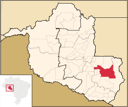 Location in Rondônia state | |
 Pimenta Bueno Location in Brazil | |
| Coordinates: 11°40′21″S 61°11′37″W / 11.67250°S 61.19361°WCoordinates: 11°40′21″S 61°11′37″W / 11.67250°S 61.19361°W | |
| Country |
|
| Region | North Region |
| State | Rondônia |
| Area | |
| • Total | 6,241 km2 (2,410 sq mi) |
| Population (2015) | |
| • Total | 37,512 |
| • Density | 6.0/km2 (16/sq mi) |
| Time zone | BRT-1 (UTC-4) |
Pimenta Bueno is a municipality located in the Brazilian state of Rondônia. Its population was 37,512 (2015) and its area is 6,241 km².[1]
The municipality contained the 27,860 hectares (68,800 acres) Rio Roosevelt State Forest, created in 1990 and cancelled in 2010.[2]
References
- ↑ IBGE -
- ↑
- João Aparecido Cahulla (31 May 2010), Mensagem no 090 de 31 de Maio de 2010 (PDF) (in Portuguese), retrieved 2016-11-01
Capital: Porto Velho | ||
| Alvorada d'Oeste |  | |
| Ariquemes | ||
| Cacoal | ||
| Colorado do Oeste | ||
| Guajara-Mirim | ||
| Ji-Parana | ||
| Porto Velho | ||
| Vilhena | ||
This article is issued from Wikipedia - version of the 11/1/2016. The text is available under the Creative Commons Attribution/Share Alike but additional terms may apply for the media files.