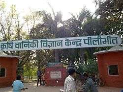
Pilibhit
| Pilibhit पीलीभीत پیلی بھیت | |
|---|---|
| City | |
 Pilibhit Location in Uttar Pradesh, India | |
| Coordinates: 28°38′59″N 79°52′21″E / 28.6497°N 79.8724°ECoordinates: 28°38′59″N 79°52′21″E / 28.6497°N 79.8724°E | |
| Country |
|
| State | Uttar Pradesh |
| Region | Rohilkhand |
| Division | Bareilly |
| District | Pilibhit |
| Ward | 52 wards |
| Settled | Late 15th century |
| Founded by | Hafiz Rahmat Khan |
| Government | |
| • Body | Pilibhit Nagar Palika Parisad |
| • Chairman | Prabhat Jaiswal |
| • MP | Maneka Sanjay Gandhi |
| • MLA | Riyaz Ahmad |
| Area | |
| • Total | 47 km2 (18 sq mi) |
| Elevation | 172 m (564 ft) |
| Population (2011)[1] | |
| • Total | 127,988 |
| • Density | 559/km2 (1,450/sq mi) |
| Time zone | IST (UTC+5:30) |
| PIN | 262001 |
| Telephone code | 05882 |
| ISO 3166 code | IN-UP-PB |
| Vehicle registration | UP-26 |
| Coastline | 0 kilometres (0 mi) |
| Sex ratio | 889 ♂/♀ |
| Literacy | 63.58% |
| Civic agency | Pilibhit Nagar Palika Parisad |
| Distance from Delhi | 274 kilometres (170 mi) NW (land) |
| Distance from Lucknow | 270 kilometres (170 mi) SE (land) |
| Governing body |
Government of UP Government of India |
| Climate | HS-TH (Köppen) |
| Precipitation | 780 millimetres (31 in) |
| Avg. annual temperature | 25.5 °C (77.9 °F) |
| Avg. summer temperature | 36.8 °C (98.2 °F) |
| Avg. winter temperature | 14.5 °C (58.1 °F) |
| Website |
www |
| The word 'Pilibhit' means "A Wall of Yellow Mud" | |
Pilibhit (Hindi: पीलीभीत) is a city and a municipal board in the Pilibhit district in the Indian state of Uttar Pradesh. Pilibhit is the north-easternmost district of Bareilly division, situated in the Rohilkhand region of the sub-Himalayan Plateau belt next to foothills of Sivalik Range on the boundary of Nepal, known for the origin of river Gomati and one of the most forest-rich areas in North India. According to the Imperial Gazetteer of India, vol. 20, page 144, issued by the Government of India, Pilibhit was once known as Hafizabad, derived from the name of the great Rohella leader of the area Hafiz Rahmat Khan, but eventually it took its present name from a nearby village.[2] Pilibhit was also known as Bansuri Nagari - the land of flutes, for making and exporting roughly 95 per cent of India's flutes.[3]
According to a report issued by the Government of India, Pilibhit is one of the Minority Concentrated Areas in India on the basis of the 2001 census data on population, socio-economic indicators and basic amenities indicators.[4] Though separated only by a short distance from the outer ranges of the Himalayas, Pilibhit consists entirely of a level plain, containing depressions but no hills and is intersected by several streams.[5] Pilibhit is one of the forest rich areas of Uttar Pradesh, which has very high tourism potential. The almost 54 km-long Indo-Nepal international border makes Pilibhit a highly sensitive for security purposes.[6] According to an estimate by the Government of India, Pilibhit has 45.23% of its population living under the poverty line.[7] Increasing population and unemployment is a cause of worry in the area, and many non-governmental organisations (NGOs) and government-run organizations have initiated projects to provide employment, but human resources are yet to be exploited in full. The city came third-bottom in terms of hygiene and sanitation in a Government ranking list of 423 towns and cities in India.[8]
Pilibhit has been geographic and political cynosure as it is the only forest area amid the 22 districts and the only district that has an international border in Harit Pradesh, which is proposed to be carved out of Uttar Pradesh.
Pilibhit was in news at national level because of a few man killer sub-adult tigers, which has caused fear in the whole area in and around the forest. By August 2010, the cat had killed and partially eaten eight people.[9]
Geography
Pilibhit lies between the parallels of 28°64' and 29°53' north latitude and the meridians of 79°57' and 81°37' east longitude covering an area of 68.76 km2. The north side of Pilibhit is bordered by Udham Singh Nagar of Uttarakhand state and by the territory of Nepal. Shahjahanpur lies on the south side Pilibhit. The east of Pilibhit is flanked for a short distance by Lakhimpur Kheri and the remaining distance is swathed by the Shahjahanpur. The western limit touches the limits of Bareilly.
According to the Central Statistical Organisation, the district Pilibhit had an area of 3504 km2 on 1 September 2007, occupying 46th position in the state and the total area of the Pilibhit city is 68.76 km2. Pilibhit city, with 2365.11 people per square kilometer, is more densely populated that the rest of district, which has 469.51 people per km2.
The area has diverse features, and topographically may be divided into several distinct tracts. In the north and north-west, the tract is a continuation of the Terai. The southern portion of the Bisalpur tehsil is similar in most respect to the adjacent tract of Bareilly and Shahjahanpur. The eastern and smaller section approximates rather to undeveloped forest areas of Lakhimpur Kheri, though with the spread of cultivation the dissimilarity between Puranpur and the rest of the area is gradually becoming less marked. There are 1216 villages within Pilibhit's limits, of which 982 are electrified.[10]
The area has more than ten small to medium-sized rivers and nine small to medium-sized water bodies. The origin of river Gomti, Gumti or Gomati (Hindi: गोमती ), which is a tributary of the Ganges River, is from a small lake, Gomat Taal, situated in Madhotanda in the Puranpur tehsil region.[11] Another important river in the region is River Sharda (Hindi: शारदा ), which runs through on the eastern part of the district. Pilibhit city receives water from the river Devhahuti Ganga or Devha (Hindi: देवहुति गंगा or देवहा ) on the north-west side of the city and the River Ghaghara or Khakra (Hindi: घाघरा or खाकरा ) on the north-east side of the city.
Pilibhit city also has a few water bodies in its limits, one being on Tanakpur road in front of Dramond college gate, another being at the Chauraha degree college. Every year during winter, the Chauraha water body attracts thousands of migratory birds. The main source of water in the district is the ground water and the canals. District Pilibhit is swathed by a big net of canals. The district has six main feeders or canals, which run through almost 138 km in the district.

The major part of Pilibhit District is covered by dense forest. Total 784.572 km2 is forest.[12] Till 1978, 63% area of the district was a dense forest, but deforestation has reduced the total forest cover to 22.39% in 2004.[13] The Sharda canal is the main canal of the district, the others being its branches. The total length of canals in the district is 138 km. Apart from the canal system, the district also has a few water bodies, which are being using for agriculture purposes.
National Highway No. 74 runs through the district connecting Haridwar to Bareilly via Kichha, Kashipur and Nagina city. Apart from the National Highway, the district is well connected with Shahjahanpur in south, Lakhimpur Kheri and Indian International Border (IIB) with the Nepal in east, Nanital and town Khatima in north, and the city of Bareilly in the west by roads and railways. There are 1216 Villages in the district Pilibhit in four tehsils and seven blocks.
The district Pilibhit also has several places of religious importance in or around the district. A main gurudwara of the Sikh community is located in Nanakmatta town around 46 km from the city.[14][15]
One of the biggest and the most important temples of the region, Sri Purnagiri Temple, is in the nearby Champawat district of Uttaranchal. Millions of people from around Uttar Pradesh and other parts of Northern India come to this temple, and Pilibhit is one of the halting points for the pilgrims.[16]
Demographics
As of the 2011 India census,[17] District Pilibhit had a population of 2,037,225. Pilibhit district is the 46th most populous Districts of Uttar Pradesh. Pilibhit City has 1,97,455 people. Males constitute 52.94% of the population and females 47.06%. Pilibhit has an average literacy rate of 63.58%, lower than the national average of 74.04%. Male literacy is 73.46%, and female literacy is 52.43%. In Pilibhit, 14.58% of the population is under 6 years of age.[18]
Amongst the locals, one of the historically important community is the Tharu tribe.
- Population Growth Estimation in next 40 years in Pilibhit [19]
| Year | Estimated Population | Growth Percentage |
|---|---|---|
| 2016 | 2,324,679 | 14.11% |
| 2021 | 2,606,639 | 12.13% |
| 2026 | 2,897,195 | 11.15% |
| 2031 | 3,194,536 | 10.26% |
| 2036 | 3,500,206 | 9.57% |
| 2041 | 3,812,915 | 8.93% |
| 2046 | 4,116,798 | 7.97% |
| 2051 | 4,415,205 | 7.25% |
Studies reveal that the poverty level in the district is associated with the social identity, source of livelihood, landless and level of education of the head of household. Education is a crucial instrument for raising income levels of people and moving out of the vicious circle of poverty. A study done by Delhi-based NGO, Nav Bharat Nirman indicates a strong correlation between educational attainment and poverty levels among various social classes in the district. The incidence of poverty is much higher among scheduled castes (SC) and scheduled tribes (ST) households in Pilibhit. Nearly 60 per cent of SC households were below the poverty line in Pilibhit in 1999-2000. However, this proportion came down to 45.23 per cent in 2007-08.[20]
Climate
Pilibhit experiences winter from November to February. It experiences pleasant windy days, clear skies and cool nights from November to the end of February, which makes it the most enjoyable time of the year. The day temperature hovers around 14 °C (57 °F) while night temperature is below 7 °C (45 °F) for most of December and January, often dropping to 3 °C (37 °F) or 4 °C (39 °F). On particularly cold days, wind may appear to be very chilly due to the dryness of air. Rain is very expected in February.[21]
Reported climatic variations:[22]
- The highest temperature recorded in Pilibhit was 48.5 °C (119 °F) on 29 May 1989.
- The lowest temperature recorded in Pilibhit was −1.2 °C (30 °F) on 17 January 1949.
- Pilibhit received snowfall once, in January 1949, which was the coolest year in the Himalayan Plateau region. The temperature reached below zero this year in the region.
| Climate data for Pilibhit, Uttar Pradesh, India | |||||||||||||
|---|---|---|---|---|---|---|---|---|---|---|---|---|---|
| Month | Jan | Feb | Mar | Apr | May | Jun | Jul | Aug | Sep | Oct | Nov | Dec | Year |
| Average high °C | 14 | 19 | 21 | 36 | 40 | 42 | 40 | 36 | 34 | 29 | 20 | 11 | 28.5 |
| Average low °C | 4 | 10 | 13 | 23 | 31 | 34 | 32 | 27 | 24 | 20 | 13 | 6 | 19.8 |
| Average rainfall mm | 8 | 23 | 30 | 46 | 81 | 122 | 132 | 140 | 109 | 30 | 23 | 13 | 757 |
| Average high °F | 57 | 66 | 70 | 97 | 104 | 108 | 104 | 97 | 93 | 84 | 68 | 52 | 83.3 |
| Average low °F | 39 | 50 | 55 | 73 | 88 | 93 | 90 | 81 | 75 | 68 | 55 | 43 | 67.5 |
| Average rainfall inches | 0.3 | 0.9 | 1.2 | 1.8 | 3.2 | 4.8 | 5.2 | 5.5 | 4.3 | 1.2 | 0.9 | 0.5 | 29.8 |
| Source: www.wunderground.com[23] | |||||||||||||
Etymology
The city Pilibhit derived its name from a nearby small village name 'Old Pilibhit', whose existence has been traced to the mid-15th century. This village still exist on the bank of the River Ghaghra or Khakra in the north-east from the city on the way to Nyoria Husainpur town. This village was occupied by the Bhanjara (local community) of the Periya clan, which used to live in the houses made of mud and other raw material available in the forest. This community made a wall or mound of yellow mud around their locality in order to secure their house from wild animals, as that area was a dense forest, so the people used to call the locality as Pili (yellow) and Bhit (wall or mound). According to the Imperial Gazetteer of India, vol. 20, page 144, issued by the Government of India, Pilibhit was once known as Hafizabad on the name of the great Rohella leader of the area, Hafiz Rahmat Khan, but later took its current name from a nearby village.[24] According to a document from the British Library, 'the city Pilibhit' existed in the late 18th century (1770–1780) when Marathas invaded the Rohilkhand region. With this invasion, the Kurmi community came to this region and over time, the city Pilibhit enlarged it boundaries.[25] Another evidence of the city's existence is found in Nepali literature, which mentions a city named as Pilibhit, which provided shelter to the last king of the Shah dynasty, Deepa Shah, who was attacked by the Gorakha king in 1789 AD.[26] The Rohella ruler Hafiz Rahmat Khan, a Pashtun ancestor of Afghans in the area, developed Pilibhit as a city and administrative unit.
History
At the introduction of the British rule, the parganas of Pilibhit, Jahanabad and Bisalpur was formed into separate tehsils. Puranpur was united for this purpose with Khutar. A redistribution of the area was effected in 1824, when the Bisalpur tehsil contained the parganas of Bisalpur and Maurari, which afterward become a single area, Jahanabad was joined with Richha to form tehsil Pareva and Pilibhit with Baheri, the HQ being at Pilibhit. In 1851 Baheri and the other tarai pargana were taken under direct management and in 1863 Richha was attached to the new Baheri tehsil, pargana Jahanabad being assigned to Pilibhit which also received Puranpur on its transfer in 1865. The latter, in 1871, a became subtehsil dependent on Pilibhit. The promotion of Puranpur into a full tehsil occurred in 1879, while Bisalpur throughout remained a separate subdivision. Thus the area is now divided into three tehsils and four parganas. Puranpur and Bisalpur constitute individual tehsils and parganas and the tehsil of Pilibhit comprises the paraganas of Pilibhit and Jahanabad.[27]
Historical facts
It is believed by locals that Pilibhit was ruled by an ancient king named Mayurdhwaj or Moredhwaj or King Venu, a great devotee of lord Krishna and a loyal friend of Arjun. King Venu's name and the geography of his kingdom can be traced in the Hindu epic Mahabharat.[28]

The city Pilibhit was an administrative unit in the Mughal era under Bareilly suba. For security, the Mughal subedar Ali Mohammed Khan constructed four magnificent gates around the administrative building in 1734 AD. These gates were named Barellwi darwaza at the west, Hussaini darwaza at the east, Jahanabadi darwaza at the north and Dakhini darwaza at the south. Because of a lack of proper maintenance, all the gates have been lost; only their ruins remain.[29]
Pilibhit was invaded by the Marathas in 1772 AD. This was the time when the Kurmi Kshatriya community came into this region. The Marathas were the ancestors of the Kurmi Kshatriya community, one of the major communities in the region.[30] The last king of the Shah dynasty of Doti,Nepal, Prithivipati Shah, was sheltered in Pilibhit by the ruler of Rampur suba Faizullah Khan in 1789 AD, after being attacked by the Gorakha king of Nepal.[31]
The freedom fighter Maulana Enayetulla, from Pilibhit, voluntarily played host to the exiled Queen of Avadh, Begum Hazrat Mahal, who reached Nepal in late 1859.[32][33]
There is a memorial place at Khakra chouki (today's Police Center), where 21 freedom fighters were hanged on 14 January 1909, on the day of Makar Sankranti, who refused to follow British government's order and rebelled against them. In respect for these 21 martyrs, a rock (named All Martyrs) was underpinned in the compound of the police center.
Transportation
Rail transportation
Pilibhit junction railway station is on the Bareilly-Lakhimpur railway line. The station is under the administrative control of the North Eastern Railways. Computerized reservation facility is provided. Going south-west, Bhojipura junction railway station is the main station next to Pilibhit. The nearest main station to the west is Puranpur railway station.[34]

Three express trains come here from Lucknow: Lucknow-Agra express (5313), Nainital Express (5308) and Rohilkhand Express (5310). Two express trains come from Agra: Agra-Gonda express (5316) and Agra-Lucknow (5314) Express. From Delhi one has to reach first nearby district Bareilly by bus or train before reaching Pilibhit by a bus or meter gauge train.[35]
Pilibhit expected to be connected by broad gauge to Lucknow through Bareilly-Lakhimpur railway line by the end of 2016.[36]
- Station Code: PBE
- Enquiry about arrival and departure of trains: +91-5882-255804
Road transportation
National Highway 74 passes through Pilibhit. Regular buses connect Pilibhit to Bareilly at the frequency of every ½ hr. Direct buses are also available from Delhi, Lucknow, Haridwar, Rishikesh, Kanpur, Rupaidhiya, Agra and Tanakpur, etc.
- Enquiry about arrival and departure of buses: +91-5882-255670
Air transportation
| Nearest Airport | Symbol | Distance (In miles) |
|---|---|---|
| New Delhi | DEL | 142.453 |
| Lucknow | LKO | 136.967 |
| Agra | AGR | 138.348 |
| Gwalior | GWL | 187.85 |
Places of interest

Dargah-e-Shahji Miyan (Hindi: शाहजी मियां की दरगाह)

In the northern side of the city of Pilibhit a dargha of qutebe Pilibhit Hazrat Kibla Haji Shah Ji Mohammad Sher Mian Sahib Rahmat Ullah Aleh is situated. People travel from other states and countries to take the blessing of Hazrat Shah ji mian. It is also said that by offering a Chadar at the dargah is fruitful to the people. The dargar has become place of social harmony as people of various religions come here to offer their faith.[38]
Sports
The Lalit Hari Sugar Factory Stadium is Pilibhit's only cricket stadium. It is located in the Shri Lalit Hari sugar mill compound, and used to be known as Lalit Hari Stadium. This stadium was established in 1931 on Tanakpur road, at the railway station end. The home team for this stadium is Uttar Pradesh. It has matting type of pitch. This stadium had hosted a few Ranji trophy cricket matches in the early 1980s.
The Gandhi Sports Stadium in the Bareilly zone covers 85 acres (local measurement) of area in the middle of the city. It has various facilities for athletics, football, volleyball, hockey and some indoor sports. A swimming pool is proposed to be constructed in the stadium. In the same compound one multipurpose auditorium is available. This stadium is the only sports facility available for public uses.
Various educational institutions have their own facilities, including: DGIC ground, St. Aloysius ground, Rama college ground, and SVM college ground. The city hasn't produced any big sports celebrities, but city teams have won a few state level competitions on various events.[39]
Economy
The main crop in the district is sugarcane and there is a sugar factory in the city.[40] According to an article published in Hindustan Times, by a 1991 estimate, 95% of India's flutes were manufectured in Pilibhit.[41] The craftmen were used to source its bamboo from Barak Valley in Assam. Earlier, there was an unbroken narrow-gauge line running from Silchar, in Assam, via Bihar, and into Pilibhit. On this line, 60-strong bundles of bamboo, each stalk 10 ft long, used to make their way to Pilibhit, but around 15 years ago, sections of that line were removed. Now, the bamboo has to travel on narrow gauge from Silchar to Jiribum, then shift onto a broad-gauge line to travel to Bareilly, the nearest big town, and then reloaded onto narrow gauge to come into Pilibhit.[42]
Politics
Lok Sabha Constituency
Vidhan Sabha constituencies
Notable people
- Varun Gandhi, Member of Parliament
- Maneka Gandhi, Member of Parliament
- Mohan Swarup, Member of Parliament
Culture
Festivals
Religious practices are as much an integral part of everyday life and a very public affair as they are in the rest of India. Therefore, not surprisingly, many festivals are religious in origin although several of them are celebrated irrespective of caste and creed. Among the most important Hindu festivals are Diwali, Holi and Vijayadashami, Mahashivaratri, Ram Navmi, Basant Panchami, Sri Krishna Janamastmi and Raksha Bandhan,which are also observed by Jains and Sikhs. Eid al-Milad, Eid ul-Fitr, Bakr-Id and Moharram are Muslim religious festivals. Mahavir Jayanti is celebrated by Jains, Buddha Jayanti by Buddhists, Guru Nanak Jayanti by Sikhs and Good Friday, Christmas by the Christians.[43]
Communication and media
Pilibhit has one local Radio Station (Akashwani) at 100.1 MHz but it also receives Bareilly's FM signals of following Radio providers:
| Service Provider | Frequency |
|---|---|
| All India Radio | 100.4 MHz |
| Big FM | 92.7 MHz |
| Radio Mantra | 91.9 MHz |
- Print media
The Hindi daily news papers include Dainik Jagran, Amar Ujala, and The Hindustan. Prominent English dailies like The Times of India, The Hindustan Times and Indian Express have fewer readers. Among lesser known Hindi papers are Swatantra Bharat, Rashtriya Sahara, and Jansatta. The Hindi newspapers Dainik Jagran and Amar Ujala have their offices in the city.
Civic administration
The Pilibhit Nagar Palika Parishad (PNPP) is the largest municipal board in the Pilibhit District, in charge of the civic and infrastructural assets of the city of Pilibhit. This municipal board was established in 1865.[44]
See also
References
- ↑ "Census of India Search details". censusindia.gov.in. Retrieved 10 May 2015.
- ↑ "Pilibhit as Hafizabad". Government of India. Retrieved 2009-05-12.
- ↑ "Pilibhit as Bansuri Nagari". The Indian Express. Retrieved 2010-01-24.
- ↑ "Minority Concentrated Districts". Government of India. Retrieved 2007-12-19.
- ↑ "The Physical Aspects". Government of India. Retrieved 2009-10-04.
- ↑ "Indo Nepal International Border". The Dainik Jagram, Hindi News Paper. Retrieved 2009-04-25.
- ↑ "Population under poverty line". A N Sinha Institute of Social Studies. Archived from the original on 16 December 2013. Retrieved 2007-07-21.
- ↑ Government of India, National Urban Sanitation Policy
- ↑ "Man Eating Tiger". Time Of India, English News Paper. 2010-08-28. Retrieved 2010-08-29.
- ↑ "Electrified Villages in Pilibhit". Uttar Pradesh Power Corporation Limited. Retrieved 2010-01-24.
- ↑ Dikshit, Rajeev (2006-08-25). "Gomati goes missing". The Times of India. Retrieved 2006-08-25.
- ↑ "Forest in Pilibhit". District Administration. Retrieved 2006-12-03.
- ↑ "Pilibhit Wildlife". SEVAK group, India. Retrieved 2007-04-23.
- ↑ "Historic Gurdwara". Punjab Heritage. Retrieved 2008-12-09.
- ↑ "Nanak Matta Sahib". Uttarakhand Tourism. Retrieved 2006-09-12.
- ↑ "Purnagiri Temple". Uttarakhand Tourism. Retrieved 2007-11-16.
- ↑ "Population of Pilibhit" (PDF). National Register of Indian Citizens. Retrieved 2011-05-07.
- ↑ "The Literacy rate in 2011" (PDF). Government of India. Retrieved 2011-05-07.
- ↑ "Population Growth Estimation in next 40 years in Pilibhit" (PDF). International Water Management Institute (IWMI). Retrieved 2011-05-07.
- ↑ "Population Under Poverty Line". A N Sinha Institute of Social Studies. Archived from the original on 16 December 2013. Retrieved 2007-07-21.
- ↑ "Annual Weather Pilibhit". Weather Underground. Retrieved 2006-10-22.
- ↑ "Climatic Variations in Pilibhit". Indian Meteorological Department. Archived from the original on 20 March 2005. Retrieved 2005-03-21.
- ↑ "Pilibhit weather". Weather Underground. Retrieved 2008-02-04.
- ↑ "Pilibhit known as Hafizabad before 1763". Government of India. Retrieved 2009-05-12.
- ↑ "History of Banjaras". Prof Motiraj Rathod. Retrieved 2008-07-15.
- ↑ "Advanced History of Nepal". T.R. Vaidya Publications. Retrieved 2005-01-20.
- ↑ "History of Pilibhit". District Administration. Retrieved 2006-09-29.
- ↑ "Kingdom of King Venu". Government of India. Retrieved 2009-05-12.
- ↑ "Ruin of Pilibhit". Brill's Indological Library, Leiden: E.J. Brill. Retrieved 2007-11-10.
- ↑ "History of Kurmi community". reallifelog. Retrieved 2007-10-14.
- ↑ "History of Nepal". T.R.Vaidya Publications. Retrieved 2008-01-31.
- ↑ "History of Oudh". Najma Nasreen. Retrieved 2008-02-12.
- ↑ "History of Oudh and Pilibhit". Meerza Kaukab Qudr. Retrieved 2008-02-12.
- ↑ "Railway Station Pilibhit". IRFCA.org. Retrieved 2008-12-31.
- ↑ "Indian Railways". Railways of India. Retrieved 2007-11-08.
- ↑ "Indian Railways meter gauge". Railways of India. Archived from the original on 3 November 2007. Retrieved 2007-11-08.
- ↑ "British Library Painintg". British Liberary. Retrieved 2007-12-23.
- ↑ "Dargah-e-Shahji Miyan". -e-hind.com. Retrieved 2007-02-27.
- ↑ "Pilibhit city express". cities.expressindia.com. Retrieved 2007-12-28.
- ↑ "Sugar India" (PDF). CDM India. Retrieved 2008-11-23.
- ↑ "Flutes of Pilibhit". The Indian Express News paper. Retrieved 2009-04-22.
- ↑ "History of flute". The Hindustand Times News Paper. Retrieved 2009-04-22.
- ↑ "18 Popular India Festivals". Retrieved 2007-12-23.
- ↑ "Municipal Board Establishment". Government of India. Retrieved 2009-05-12.
Further reading
- P. C. Kanjilal, P (1982). "A Forest Flora for Pilibhit, Oudh, Gorakhpur, and Bundelkhand" (5 ed.). Narendra Pub. House.
- Basil Leonard Clyde Johnson, P (1979). India,: Resources and Development (6 ed.). Heinemann Educational Books. ISBN 0-06-493348-2.
- Govt. of Uttar Pradesh, P (1959). "Uttar Pradesh District Gazetteers" (2 ed.). Govt. of Uttar Pradesh.
- Walter C. Neale, P (1962). "Economic Change in Rural India: Land Tenure and Reform in Uttar Pradesh:1800-1955" (1 ed.). Yale University Press.
- Ira Klein, P (1974). "Population and Agriculture in Northern India, 1872-1921" (1 ed.). Cambridge University Press.
External links
 |
Bareilly | Udham Singh Nagar | |
|
| Bareilly | |
| ||
| ||||
| | ||||
| Shahjahanpur | Shahjahanpur | Lakhimpur Kheri |
Tiger Reserves of India | |
|---|---|
| Assam | |
| Arunachal Pradesh | |
| Andhra Pradesh | |
| Bihar | |
| Chhattisgarh | |
| Jharkhand | |
| Karnataka | |
| Kerala | |
| Madhya Pradesh | |
| Maharashtra | |
| Mizoram | |
| Odisha | |
| Rajasthan |
|
| Tamil Nadu | |
| Telangana | |
| Uttar Pradesh | |
| Uttarakhand | |
| West Bengal | |
| |