Pilar, Bohol
This article is about the municipality of Pilar in Bohol province. For the municipality of Bilar in Bohol province, see Bilar, Bohol. For
Pilar municipality in other provinces, see Pilar § Philippines.
Pilar municipality in other provinces, see Pilar § Philippines.
| Pilar | |
|---|---|
| Municipality | |
|
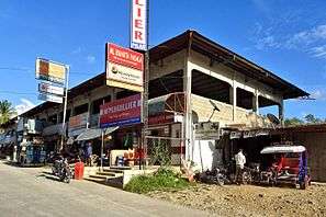
Municipal hall | |
 Map of Bohol with Pilar highlighted | |
.svg.png) Pilar Location within the Philippines | |
| Coordinates: 9°50′N 124°20′E / 9.83°N 124.33°ECoordinates: 9°50′N 124°20′E / 9.83°N 124.33°E | |
| Country | Philippines |
| Region | Central Visayas (Region VII) |
| Province | Bohol |
| District | 3rd district of Bohol |
| Founded | 26 December 1960 |
| Barangay | 21 (see § Barangays) |
| Government [1] | |
| • Type | Sangguniang Bayan |
| • Mayor | Necitas Cubrado (UNA) |
| • Vice mayor | Eugenio Datahan |
| • Town Council |
Members
|
| • Representative | Arthur Yap |
| Area[2] | |
| • Total | 120.39 km2 (46.48 sq mi) |
| Population (2015 census)[3] | |
| • Total | 27,256 |
| • Density | 230/km2 (590/sq mi) |
| • Voter (2016)[4] | 16,152 |
| Time zone | PST (UTC+8) |
| ZIP code | 6321 |
| IDD : area code | +63 (0)38 |
| Income class | 4th class |
| PSGC | 071234000 |

Pilar is a 4th municipal income class municipality in the province of Bohol, Philippines. According to the 2015 census, it has a population of 27,256.[3] In the 2016 election, it had 16,152 registered voters.[4]
History
Pilar was formerly a barrio of Sierra Bullones, known as Lungsodaan. It became a separate municipality on 29 December 1961, by Executive Order No. 460 issued by President Carlos P. Garcia.[5]
Barangays
Pilar comprises 21 barangays:
| PSGC | Barangay | Population | ±% p.a. | ||
|---|---|---|---|---|---|
| 2015[3] | 2010[6] | ||||
| 071234001 | Aurora | 1.6% | 431 | 410 | +0.96% |
| 071234002 | Bagacay | 3.2% | 862 | 890 | −0.61% |
| 071234003 | Bagumbayan | 7.0% | 1,908 | 1,725 | +1.94% |
| 071234004 | Bayong | 5.3% | 1,432 | 1,493 | −0.79% |
| 071234005 | Buenasuerte | 6.9% | 1,894 | 1,918 | −0.24% |
| 071234006 | Cagawasan | 4.0% | 1,079 | 1,086 | −0.12% |
| 071234007 | Cansungay | 3.0% | 820 | 769 | +1.23% |
| 071234008 | Catagda‑an | 5.5% | 1,492 | 1,546 | −0.67% |
| 071234009 | Del Pilar | 3.3% | 898 | 890 | +0.17% |
| 071234010 | Estaca | 10.7% | 2,924 | 2,575 | +2.45% |
| 071234011 | Ilaud | 2.8% | 764 | 929 | −3.65% |
| 071234012 | Inaghuban | 3.9% | 1,062 | 1,235 | −2.83% |
| 071234013 | La Suerte | 2.7% | 726 | 752 | −0.67% |
| 071234014 | Lumbay | 4.4% | 1,212 | 1,161 | +0.82% |
| 071234015 | Lundag | 2.9% | 789 | 735 | +1.36% |
| 071234016 | Pamacsalan | 2.4% | 656 | 666 | −0.29% |
| 071234017 | Poblacion | 10.6% | 2,890 | 2,806 | +0.56% |
| 071234018 | Rizal | 5.2% | 1,425 | 1,282 | +2.03% |
| 071234019 | San Carlos | 2.5% | 679 | 744 | −1.73% |
| 071234020 | San Isidro | 9.2% | 2,506 | 2,411 | +0.74% |
| 071234021 | San Vicente | 3.0% | 807 | 864 | −1.29% |
| Total | 27,256 | 26,887 | +0.26% | ||
Demographics
| Population census of Pilar | |||||||||||||||||||||||||
|---|---|---|---|---|---|---|---|---|---|---|---|---|---|---|---|---|---|---|---|---|---|---|---|---|---|
|
| ||||||||||||||||||||||||
| Source: Philippine Statistics Office[3][6][7] | |||||||||||||||||||||||||
In the 2016 election, it had 16,152 registered voters, meaning that 59% of the population are aged 18 and over.[4]
Gallery
 Public market in Pilar
 Malinao Dam spillway in Pilar
References
- ↑ "Municipality". Quezon City, Philippines: Department of the Interior and Local Government. Retrieved 31 May 2013.
- ↑ "Municipal: Pilar, Bohol". PSGC Interactive. Quezon City, Philippines: Philippine Statistics Authority. Retrieved 8 January 2016.
- 1 2 3 4 "Region VII (CENTRAL VISAYAS)". Census of Population (2015): Total Population by Province, City, Municipality and Barangay (Report). PSA. Retrieved 20 June 2016.
- 1 2 3 "2016 National and Local Elections Statistics". Commission on Elections. 2016.
- ↑ Executive Order No. 460 (1961) of 29 December 1961 CREATING THE MUNICIPALITY OF PILAR IN THE PROVINCE OF BOHOL. Retrieved 7 April 2016.
- 1 2 "Region VII (CENTRAL VISAYAS)". Census of Population and Housing (2010): Total Population by Province, City, Municipality and Barangay (Report). NSO. Retrieved 29 June 2016.
- ↑ "Region VII (CENTRAL VISAYAS)". Census of Population (1995, 2000 and 2007): Total Population by Province, City and Municipality (Report). NSO. Archived from the original on 24 June 2011.
External links
| Wikimedia Commons has media related to Pilar, Bohol. |
 |
Dagohoy | |
Alicia | |
| |
Candijay | |||
| ||||
| | ||||
| Sierra Bullones | |
Guindulman |
This article is issued from Wikipedia - version of the 8/7/2016. The text is available under the Creative Commons Attribution/Share Alike but additional terms may apply for the media files.